
Section 2 – The Draft Masterplan
In Section 2.5 - Relationship with other relevant Plans and Programmes, we acknowledge the plans/programmes referred to in Table 2.1 Relationship with Legislation...
Appendix B - SEA Environmental Report
Closed23 Jun, 2015, 7:00am - 21 Jul, 2015, 6:00pm
SEA Environmental Report (Download SEA Environmental Report)
Table of Contents
List of Abbreviations ............................................................................................... vi
Glossary .................................................................................................................. vii
Section 1 SEA Introduction and Background ..................................................... 1
1.1 Introduction and Terms of Reference ........................................................................... 1
1.2 SEA Definition ............................................................................................................ 1
1.3 SEA Directive and its transposition into Irish Law .......................................................... 1
1.4 Implications for the Masterplan and the Planning Authority ............................................ 1
Section 2 The Draft Masterplan ......................................................................... 3
2.1 Introduction ............................................................................................................... 3
2.2 Draft Masterplan preparation process ........................................................................... 3
2.3 Content and Layout .................................................................................................... 3
2.4 High level Objectives .................................................................................................. 4
2.5 Relationship with other relevant Plans and Programmes ................................................ 5
Section 3 SEA Methodology ............................................................................. 19
3.1 Introduction to the Iterative Approach ........................................................................ 19
3.2 Appropriate Assessment and Integrated Biodiversity Impact Assessment ........................ 20
3.3 Flood Risk Assessment ............................................................................................... 20
3.4 Scoping .................................................................................................................... 20
3.5 Environmental Baseline Data ...................................................................................... 21
3.6 Alternatives .............................................................................................................. 21
3.7 The SEA Environmental Report ................................................................................... 21
3.8 The SEA Statement ................................................................................................... 22
3.9 Difficulties Encountered ............................................................................................. 22
Section 4 Environmental Baseline ................................................................... 24
4.1 Introduction .............................................................................................................. 24
4.2 Likely Evolution of the Environment in the Absence of the Masterplan ............................ 24
4.3 Biodiversity and Flora and Fauna ................................................................................ 26
4.4 Population and Human Health .................................................................................... 33
4.5 Soil ..........................................................................................................................33
4.6 Water ....................................................................................................................... 34
4.7 Air and Climatic Factors ............................................................................................. 38
4.8 Material Assets .......................................................................................................... 41
4.9 Cultural Heritage ....................................................................................................... 42
4.10 Landscape ................................................................................................................ 49
Section 5 Strategic Environmental Objectives ................................................ 52
5.1 Introduction .............................................................................................................. 52
5.2 Biodiversity, Flora and Fauna ...................................................................................... 52
5.3 Population and Human Health .................................................................................... 55
5.4 Soil ..........................................................................................................................56
5.5 Water ....................................................................................................................... 56
5.6 Material Assets .......................................................................................................... 59
5.7 Air and Climatic Factors ............................................................................................. 60
5.8 Cultural Heritage ....................................................................................................... 62
5.9 Landscape ................................................................................................................ 63
Section 6 Description of Alternatives .............................................................. 64
6.1 Introduction .............................................................................................................. 64
6.2 Alternative 1 ............................................................................................................. 64
6.3 Alternative 2 ............................................................................................................. 64
6.4 Alternative 3 ............................................................................................................. 64
6.5 Alternative 4 ............................................................................................................. 65
Section 7 Evaluation of Alternatives ................................................................ 66
7.1 Introduction .............................................................................................................. 66
7.2 Methodology ............................................................................................................. 66
7.3 Cumulative Effects ..................................................................................................... 68
7.4 Detailed Evaluation of Alternatives .............................................................................. 70
Section 8 Evaluation of Draft Masterplan Provisions ...................................... 78
8.1 Overall Findings ........................................................................................................ 78
8.2 Methodology ............................................................................................................. 78
8.3 Appropriate Assessment and Flood Risk Assessment ..................................................... 80
8.4 Potential Adverse Effects and their Determination ........................................................ 80
8.5 Interrelationship between Environmental Components .................................................. 81
8.6 Cumulative Effects ..................................................................................................... 83
8.7 Residual Adverse Effects ............................................................................................ 84
8.8 Detailed Evaluation .................................................................................................... 85
Section 9 Mitigation Measures ......................................................................... 92
9.1 Integration of Environmental Considerations ................................................................ 92
9.2 Strategies contained within the Masterplan .................................................................. 92
9.3 Appropriate Assessment ............................................................................................. 93
9.4 Flood Risk Assessment ............................................................................................... 94
Section 10 Monitoring Measures ..................................................................... 101
10.1 Introduction ............................................................................................................ 101
10.2 Indicators and Targets ............................................................................................. 101
10.3 Sources .................................................................................................................. 101
10.4 Reporting ............................................................................................................... 101
10.5 Thresholds .............................................................................................................. 102
Appendix I Non-Technical Summary……………………………………Separately bound
List of Figures
Figure 3.1 Overview of Masterplan/SEA/AA Processes .................................................................. 19
Figure 4.1 Area subject to both cSAC and SPA designation in the vicinity of the Masterplan area...... 29
Figure 4.2 Natura 2000 sites occurring within 15 km of Masterplan area ........................................ 30
Figure 4.3 pNHAs (and other designated ecological sites) within and adjacent to the City ................ 31
Figure 4.4 Key Green Infrastructure and Rights of Way ................................................................ 32
Figure 4.5 WFD Surface Water Status 2007-2009 ......................................................................... 37
Figure 4.6 WFD Surface Water Status 2010-2012 ......................................................................... 37
Figure 4.7 Archaeological Heritage - Zone of Archaeological Importance ........................................ 45
Figure 4.8 Architectural Heritage - Entries to the Record of Protected Structures ............................ 46
Figure 4.9 Architectural Heritage - Entries to the National Inventory of Architectural Heritage .......... 47
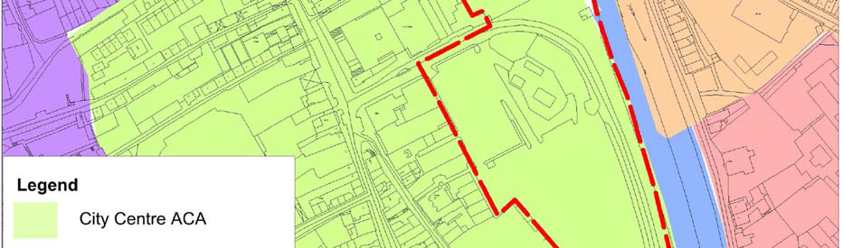
Figure 4.10 Architectural Heritage – Architectural Conservation Areas ............................................ 48
Figure 4.11 Views and Prospects ................................................................................................ 51
Figure 7.1 Final Masterplan Design ............................................................................................. 77
List of Tables
Table 2.1 Relationship with Legislation and Other Plans and Programmes ........................................ 6
Table 3.1 Checklist of Information included in this Environmental Report ....................................... 23
Table 4.1 Natura 2000 sites within 15km of the Masterplan area ................................................... 26
Table 7.1 Strategic Environmental Objectives .............................................................................. 67
Table 7.2 Criteria for appraising the effect of Alternatives on SEOs ................................................ 67
Table 7.3 Potentially Significant Adverse Effects common to all Alternatives ................................... 70
Table 7.4 Evaluation of Alternatives against SEOs ........................................................................ 73
Table 7.5 Significant positive effects facilitated, potentially significant adverse effects, if unmitigated,
and residual non-significant adverse effects ................................................................................ 75
Table 8.1 Criteria for appraising the effect of Masterplan provisions on SEOs ................................. 79
Table 8.2 Strategic Environmental Objectives .............................................................................. 79
Table 8.3 Potentially Significant Adverse Effect, if unmitigated ...................................................... 81
Table 8.4 Presence of Interrelationships between Environmental Components ................................ 82
Table 8.5 Potential Significant Residual Adverse Effects ................................................................ 84
Table 9.1 Selected provisions from the Kilkenny City Development 2014-2020 and potential adverse
effects, if unmitigated ............................................................................................................... 95
Table 10.1 Selected Indicators, Targets and Monitoring Sources ................................................. 103
List of Abbreviations
AA - Appropriate Assessment
CSO - Central Statistics Office
DAHG - Department of Arts, Heritage and the Gaeltacht
DCENR - Department of Communications, Energy and Natural Resources
DEHLG - Department of the Environment, Heritage and Local Government
DECLG - Department of the Environment, Community and Local Government
EIA - Environmental Impact Assessment
EPA - Environmental Protection Agency
EU - European Union
GSI - Geological Survey of Ireland
NHA - Natural Heritage Area
NIAH - National Inventory of Architectural Heritage
RBD - River Basin District
RMP - Record of Monuments and Places
RPS - Record of Protected Structures
RPGs - Regional Planning Guidelines
SAC - Special Area of Conservation
SEA - Strategic Environmental Assessment
SEO - Strategic Environmental Objective
SI No. - Statutory Instrument Number
SPA - Special Protection Area
WFD - Water Framework Directive
Glossary
Appropriate Assessment
The obligation to undertake Appropriate Assessment derives from Article 6(3) and 6(4) of the Habitats Directive 92/43/EEC. AA is a focused and detailed impact assessment of the implications of a strategic action or project, alone and in combination with other strategic actions and projects, on the integrity of a Natura 2000 site in view of its conservation objectives.
Biodiversity and Flora and Fauna
Biodiversity is the variability among living organisms from all sources including inter alia, terrestrial, marine and other aquatic ecosystems and the ecological complexes of which they are a part; this includes diversity within species, between species and of ecosystems’ (United Nations Convention on Biological Diversity 1992). Flora is all of the plants found in a given area. Fauna is all of the animals found in a given area.
Environmental Problems
Annex I of Directive 2001/42/EC of the European Parliament and of the Council of Ministers, of 27th June 2001, on the assessment of the effects of certain Plans and programmes on the environment (the Strategic Environmental Assessment Directive) requires that information is provided on ‘any existing environmental problems which are relevant to the plan or programme’, thus, helping to ensure that the proposed strategic action does not make existing environmental problems worse. Environmental problems arise where there is a conflict between current environmental conditions and ideal targets. If environmental problems are identified at the outset they can help focus attention on important issues and geographical areas where environmental effects of the plan or programme may be likely.
Environmental Vectors
Environmental vectors are environmental components, such as air, water or soil, through which contaminants or pollutants, which have the potential to cause harm, can be transported so that they come into contact with human beings.
Mitigate
To make or become less severe or harsh.
Mitigation Measures
Mitigation measures are measures envisaged to prevent, reduce and, as fully as possible, offset any significant adverse impacts on the environment of implementing a human action, be it a plan, programme or project. Mitigation involves ameliorating significant negative effects. Where there are significant negative effects, consideration should be given in the first instance to preventing such effects or, where this is not possible, to lessening or offsetting those effects. Mitigation measures can be roughly divided into those that: avoid effects; reduce the magnitude or extent, probability and/or severity of effects; repair effects after they have occurred; and compensate for effects, balancing out negative impacts with other positive ones.
Protected Structure
Protected Structure is the term used in the Planning and Development Act and Regulations (as amended) to define a structure included by a planning authority in its Record of Protected Structures. Such a structure shall not be altered or demolished in whole or part without obtaining planning permission or confirmation from the planning authority that the part of the structure to be altered is not protected.
Recorded Monument
A monument included in the list and marked on the map which comprises the Record of Monuments and Places that is set out County by County under Section 12 of the National Monuments (Amendment) Act, 1994 by the Archaeological Survey of Ireland. The definition includes Zones of Archaeological Potential in towns and all other monuments of archaeological interest which have so far been identified. Any works at or in relation to a recorded monument requires two months’ notice to the former Department of the Environment, Heritage and Local Government (now Department of Arts, Heritage and the Gaeltacht) under section 12 of the National Monuments (Amendment) Act, 1994.
Scoping
Scoping is the process of determining what issues are to be addressed, and setting out a methodology in which to address them in a structured manner appropriate to the plan or programme. Scoping is carried out in consultation with appropriate environmental authorities.
Strategic Actions
Strategic actions include: Policies/Strategies, which may be considered as inspiration and guidance for action and which set the framework for Plans and programmes; Plans, sets of coordinated and timed objectives for the implementation of the policy; and Programmes, sets of projects in a particular area.
Strategic Environmental Assessment (SEA)
Strategic Environmental Assessment (SEA) is the formal, systematic evaluation of the likely significant environmental effects of implementing a plan or programme before a decision is made to adopt it.
Strategic Environmental Objective (SEO)
Strategic Environmental Objectives (SEOs) are methodological measures developed from policies which generally govern environmental protection objectives established at international, Community or Member State level and are used as standards against which the provisions of the Masterplan and the alternatives can be evaluated in order to help identify which provisions would be likely to result in significant environmental effects and where such effects would be likely to occur, if - in the case of adverse effects - unmitigated.
Section 1 SEA Introduction and Background
1.1 Introduction and Terms of Reference
This is the Strategic Environmental Assessment (SEA) Environmental Report for the Draft Masterplan for Abbey Creative Quarter 2015. It has been undertaken by CAAS Ltd. on behalf of Kilkenny County Council.
The purpose of this report is to provide a clear understanding of the likely environmental consequences of decisions regarding the adoption and implementation of the Masterplan. The SEA is carried out in order to comply with the provisions of the SEA Directive and can be read in conjunction with the Masterplan.
1.2 SEA Definition
Environmental assessment is a procedure that ensures that the environmental implications of decisions are taken into account before such decisions are made. Environmental Impact Assessment, or EIA, is generally used for describing the process of environmental assessment for individual projects, while Strategic Environmental Assessment, or SEA, is the term which has been given to the environmental assessment of plans and programmes, which help determine the nature and location of individual projects taking place. SEA is a systematic process of predicting and evaluating the likely significant environmental effects of implementing a proposed plan or programme in order to ensure that these effects are adequately addressed at the earliest appropriate stages of decision-making in tandem with economic, social and other considerations.
1.3 SEA Directive and its transposition into Irish Law
Directive 2001/42/EC of the European Parliament and of the Council of Ministers, of 27th June 2001, on the Assessment of the Effects of Certain Plans and Programmes on the Environment, referred to hereafter as the SEA Directive, introduced the requirement that SEA be carried out on plans and programmes which are prepared for a number of sectors, including land use planning.
The SEA Directive was transposed into Irish Law through the European Communities (Environmental Assessment of Certain Plans and Programmes) Regulations 2004 (Statutory Instrument Number (SI No. 435 of 2004) and the Planning and Development (Strategic Environmental Assessment) Regulations 2004 (SI No. 436 of 2004). Both sets of Regulations became operational on 21st July 2004. The Regulations have been amended by the European Communities (Environmental Assessment of Certain Plans and Programmes) (Amendment) Regulations 2011 (SI No. 200 of 2011) and the Planning and Development (Strategic Environmental Assessment) (Amendment) Regulations 2011 (SI No. 201 of 2011).
1.4 Implications for the Masterplan and the Planning Authority
The Habitats Directive requires, inter alia, that plans and programmes undergo an Appropriate Assessment (AA) process to establish the likely or potential effects arising from implementation of the Masterplan. Arising from this assessment, it is necessary to undertake
Stage 2 AA of the Masterplan as it is likely to have a significant environmental effect or a potentially significant environmental effect on
the Natura 2000 Network of designated ecological sites. The undertaking of Stage 2 AA necessitates the undertaking of SEA as the SEA Directive (Article 3 (2)) requires that SEA is carried out for plans and programmes which are being subjected to Stage 2 AA.
The findings of the SEA are expressed in this Environmental Report. This report will be altered to take account of both:
recommendations contained in submissions; and changes which may be made to the Draft Masterplan before adoption on foot of
submissions. Elected Members of Kilkenny County Council will take into account the findings of this report and other related SEA output during their consideration of the Draft Masterplan.
An SEA Statement will be prepared and will accompany the adopted Masterplan and shall summarise, inter alia, how environmental
considerations have been integrated into the Masterplan.
Section 2 The Draft Masterplan
2.1 Introduction
It is an objective in the Kilkenny City and Environs Development Plan 2014-2020
(Objective 3C) to prepare a Masterplan and Urban Design Framework for the Smithwick’s site and Bateman Quay area in Kilkenny City.
Kilkenny County Council has prepared the Masterplan and Urban Design Framework in compliance with this objective.
The Masterplan document is a non-statutory document. It is intended to place the document on a statutory footing by way of Variation No. 1 to the City Development Plan (this Proposed Variation and associated SEA and AA documents have been placed on public display at the same time as the Masterplan and its associated SEA and AA documents).
The City Development Plan currently zones the Masterplan area as ‘General Business’ with ‘Recreation, Amenity and Open Space’ zoning provided along the river.
2.2 Draft Masterplan preparation process
In November 2013, an initial Masterplan document was published for a period of consultation.
Following that period of consultation, an AA screening report was carried out in March 2014. The AA Screening examined the likely impacts that could arise from the Masterplan in the context of a number of factors that could potentially affect the integrity of the Natura
2000 network. The AA concluded that the Masterplan may have significant impacts on the Natura 2000 network and that a Stage 2 AA is
required. The undertaking of Stage 2 AA necessitates the undertaking of SEA as Article 3 (2) of the SEA Directive requires that SEA is carried out for plans and programmes which are being subjected to Stage 2 AA.
A Chief Executive’s report on the initial Masterplan and consultation period was prepared and presented to the Council in
November 2014. It recommended that taking account of the submissions made and the issues presenting that the initial Masterplan document published in November 2013 be revised taking account of:
The adopted Kilkenny City and Environs Development Plan 2014 – 2020;
Appropriate Assessment and Strategic Environmental Assessment;
Archaeological recommendations from further archaeological assessment;
Submissions made to the initial Masterplan; and
Further public consultation.
As part of the revisioning of the Masterplan various public consultation exercises have been undertaken by the Council.
2.3 Content and Layout
The Masterplan is laid out in six sections as follows:
Section One: Introduction
1 Introduction
1.1. Introduction
1.2 Project Brief
1.3 Public Consultations
1.4 Appropriate Assessment
1.5 Strategic Environmental Assessment
Section Two: Context
2.1 Historical Context of Kilkenny
2.1.1 History of Kilkenny
2.1.2 Timeline for Kilkenny
2.1.3 Townscape and Urban Structure
2.1.4 The City and the River
2.2 Current Context of Kilkenny
2.2.1 Vision arising from Public Consultation
2.2.2 Kilkenny attracting New Industries
Section Three: Analysis
3.1 Masterplan Area Context
3.1.1 Description of Study Area
3.1.2 Context of the Study Area
3.1.3 Statutory Planning & Planning Policy
3.1.4 Site Analysis - Archaeology
3.1.5 Site Analysis - Views
3.1.6 Site Analysis - Architectural Heritage
3.1.7 Site Analysis - Conservation Policies
3.1.8 Site Analysis - Linear Park
3.1.9 Site Analysis - River Bank
3.1.10 Site Analysis --- Tourism
3.1.11 Site Analysis --- Flood Risk
3.1.12 Site Analysis - Urban Scale
3.2 Urban Planning & Analysis
3.2.1 Site Analysis --- Lynchian Method
3.2.2 Opportunities and Weaknesses
3.2.3 Context
Section Four: Masterplan Strategies
4.1 Connectivity and Movement Strategy
4.1.1 Smarter Travel / Mobility Management Plan
4.1.2 Key Connectivity and Movement Issues
4.1.3 Pedestrian & Cyclist Movement
4.1.4 Vehicular Movement
4.1.5 Public Transport
4.1.6 Parking / Traffic Management
4.2 Conservation & Heritage Strategy
4.2.1 Conservation Objectives
4.2.2 Archaeological Strategy
4.2.3 Summary of Archaeological Recommendations
4.2.4 Heritage Structures Strategy
4.2.5 Existing Structures Strategy
4.3 Key Urban Design Strategy
4.3.1 Character Areas
4.3.2 Environmental Strategy
4.3.3 New Linear Park
4.3.4 Archaeology Sensitivity
4.3.5 Public Park / Garden
4.3.6 Public Real Strategy
4.3.7 Movement Strategy
4.3.8 Streets / Lanes Strategy
4.3.9 New Buildings Strategy
4.3.10 Urban Grain Strategy
4.3.11 Public Consultation / Vision Statement
4.4 Sustainability Strategy
4.4.1 Sustainability Strategy
4.4.2 Density and Mixed Uses
4.4.3 Transport
4.4.4 Environmental Quality
4.4.5 Energy
4.4.6 Zero Brown Waste
4.4.7 Water Conservation
4.4.8 R&D Funding
4.4.9 Exemplar Developments
Section Five: Masterplan Proposals
5.1 Establishing a New Creative Quarter
5.1.1 Defining a new role for the Quarter
5.1.2 Integration of site into the existing Medieval fabric
5.1.3. Links to the Historic Spine / Medieval Mile
5.1.4 Public Open Spaces
5.2 Urban Framework Plan Options Considered
5.3 Final Urban Framework Masterplan
5.3.1 Phasing Proposals
5.3.2 Overall Masterplan
5.3.3 Lynchian Diagram --- Post Construction
5.3.4 Site Sections
5.3.5 3D Views
Section Six: Appendices
Appendix A City Development Plan Environmental Protection Provisions
Appendix B Appropriate Assessment SEA Environmental Report
Appendix C Archaeological Strategy
Appendix D Flood Risk Assessment
Appendix E Spatial, Context & Process Principles
Appendix F Observations on Urban Code
2.4 High level Objectives
Arising from an analysis of the issues identified in the Kilkenny City and Environs Development
2014 -2020 Plan the following objectives were developed for the Masterplan:
To advance the co-operation between Kilkenny Local Authorities, existing third level institutions and the proposed Technology University for the South East.
To support employment creation, innovation and lifelong learning.
To promote the sustainable development of the city
To provide the highest quality living environments possible
To guide the location and pattern of development whilst ensuring a relatively compact urban form is maintained
To promote balanced and sustainable economic development and employment by ensuring that a diverse range of economic sectors are developed
To develop an integrated transport strategy for the city linked to land use objectives, which facilitates access to a range of transport modes
To protect, conserve and enhance the built and natural heritage of the city
To promote the regeneration of the city centre and to protect and promote the city centre as the commercial and cultural focus for the city
To advance the redevelopment of the Bateman Quay site for civic and prime retail use
To provide a hierarchy of parks, open spaces and outdoor recreation areas and to use the river corridors of the River Nore, Breagagh and Pococke to provide open space for the city while having due consideration to their ecological sensitivity*.
*These rivers are partly designated within the Natura 2000 Network
2.5 Relationship with other relevant Plans and Programmes
2.5.1 Introduction
The Masterplan sits within a hierarchy of strategic actions such as plans and programmes, including those detailed under Sections 2.5.2 and 2.5.3 and Table 2.1 below (see also Section 4, Section 5 and Section 9).
The Masterplan complies with relevant higher level strategic actions as relevant and appropriate and will guide lower level projects.
The Masterplan is at the lower level of the hierarchy in the context of national, regional, county and City level plans.
The Masterplan is subject to a number of high level environmental protection policies and objectives with which it must comply, including
those which have been identified as Strategic Environmental Objectives in Section 5. Examples of Environmental Protection Objectives include the aim of the EU Habitats Directive - which is to contribute towards ensuring biodiversity through the conservation of natural habitats and of wild fauna and flora in the European territory of Member States - and the purpose of the Water Framework Directive - which is to establish a framework for the protection of inland surface waters, transitional waters, coastal waters and groundwater which, among other things, prevents deterioration in the status of all water bodies and protects, enhances and restores all waters with the aim of achieving good status by 2015.
2.5.2 Kilkenny City Development Plan 2014 - 2020
The City Development Plan currently zones the Masterplan area as ‘General Business’ with ‘Recreation, Amenity and Open Space’ zoning provided along the river.
It is an objective in the Kilkenny City and Environs Development Plan 2014-2020 (Objective 3C) to prepare a Masterplan and
Urban Design Framework for the Smithwick’s site and Bateman Quay area in Kilkenny City. Kilkenny County Council has prepared the
Masterplan and Urban Design Framework in compliance with this objective.
2.5.3 Proposed Variation No. 1 to the City Development Plan
It is intended to place the document on a statutory footing by way of Variation No. 1 to the City Development Plan (this Proposed
Variation and associated SEA and AA documents have been placed on public display at the same time as the Draft Masterplan and
its associated SEA and AA documents).
Table 2.1 Relationship with Legislation and Other Plans and Programmes
|
European |
||||
|
Directive/ Plan/ Programme |
Highest Level Aim/ Purpose/ Objective |
Lower level objectives, actions etc. |
Relevant legislation |
Relevance to the |
|
UN Kyoto Protocol and the Second European Climate Change |
The UN Kyoto Protocol set of policy measures to reduce greenhouse gas emissions. The Second European Climate Change |
The Kyoto Protocol is implemented through the |
National Policy Position |
To cumulatively contribute |
|
EU 2020 climate and energy package |
Binding legislation which aims to ensure the European Union meets its climate and |
Four pieces of complimentary legislation: |
The Framework for Climate Change Bill |
To cumulatively contribute |
| Habitats Directive (92/43/EEC) |
Promote the preservation, protection and |
Propose and protect sites of importance to habitats, |
European Communities |
The Council is obliged to |
|
Birds Directive |
Conserve all species of naturally occurring |
Preserve, maintain or re-establish a sufficient diversity |
European Communities |
The Council is obliged to |
|
European Union |
Aims to halt or reverse biodiversity loss and speed up the EU's transition towards a resource efficient and green economy |
Outlines six targets and twenty actions to aid |
Actions for Biodiversity |
To cumulatively contribute |
|
The Clean Air for |
The CAFE Directive merges existing legislation into a single directive (except for the fourth daughter directive) |
Sets objectives for ambient air quality |
Air Quality Standards |
The Council is obliged to |
|
Noise Directive |
The Noise Directive - Directive 2002/49/EC |
The Directive requires competent authorities in Member Draw up action plans to reduce noise where necessary |
Environmental Noise |
The Council is obliged to |
|
Floods Directive |
Establishes a framework for the assessment |
Assess all water courses and coast lines at risk from |
European Communities |
The Council is obliged to |
|
Water Framework |
Establish a framework for the protection of water bodies to include inland surface |
Protect, enhance and restore all water bodies and |
European Communities |
The Council is obliged to |
| Groundwater Directive (2006/118/EC) |
Protect, control and conserve groundwater |
Meet minimum groundwater standards listed in Annex 1 |
European Communities |
The Council is obliged to |
|
Bathing Water |
Preserve, protect and improve the quality of |
Identify all bathing waters and define the length of the |
Bathing Water Quality |
The Council is obliged to |
|
Drinking Water |
Improve and maintain the quality of water |
Set values applicable to water intended for human |
European Union |
The Council is obliged to |
|
Urban Waste Water |
This Directive concerns the collection, The objective of the Directive is to protect |
Urban waste water entering collecting systems shall |
European Communities |
The Council is obliged to |
|
Environmental Liability |
Establish a framework of environmental |
Relates to environmental damage caused by any of the |
European Communities |
The Council is obliged to |
|
SEA Directive |
Contribute to the integration of |
Carry out and environmental assessment for plans or Inform relevant authorities and stakeholders on the |
European Communities |
The Council is obliged to |
|
EIA Directive |
Requires the assessment of the |
All projects listed in Annex I are considered as having significant effects on the environment and require an EIA |
European Communities |
The Council is obliged to |
|
National/Regional |
||||
|
Plan/Programme |
Highest Level Aim/ Purpose/ Objective |
Lower level relevant objectives , actions etc. |
Relevant legislation |
Relevance to the |
|
Infrastructure and |
Reviews infrastructure and capital spending |
The approach identifies four main components of the |
not applicable |
To cumulatively contribute |
|
Smarter Travel |
Sustainable transport investment programme to |
Limerick, Dungarvan and Westport were targeted |
not applicable |
In combination with this |
|
Smarter Travel – A |
Outlines a policy for how a sustainable |
Others lower level aims include: |
not applicable |
In combination with this Policy |
|
Ireland’s First National |
Outlines objectives and actions aimed at developing a strong cycle network in Ireland |
Sets a target where 10% of all journeys will be made by bike by 2020 |
not applicable |
In combination with this |
|
Scoping Study for a National Cycle |
Investigated the feasibility of developing a The scoping study and subsequent |
not applicable |
not applicable |
In combination with this Study |
|
National Climate |
Outlines measures to be undertaken to |
not applicable |
not applicable |
To cumulatively contribute |
|
Delivering a |
White paper setting out a framework for |
The underpinning Strategic Goals are: |
not applicable |
To cumulatively contribute |
|
National Renewable |
A strategic approach for Ireland including |
not applicable |
Renewable Energy |
To cumulatively contribute |
|
National Energy |
This is the second National Energy |
The Plan reviews the original 90 actions outlined in the first Plan and updates/renews/removes them as appropriate |
not applicable |
To cumulatively contribute |
|
Sustainable |
Provides an analysis and a strategic |
not applicable |
not applicable |
To cumulatively contribute |
|
Wildlife Act of 1976 |
The act provides protection and |
Provides protection for certain species, their habitats |
not applicable |
The Council is obliged to |
|
Actions for Biodiversity |
Sets out strategic objectives, targets and |
To mainstream biodiversity in the decision making process across all sectors |
not applicable |
To cumulatively contribute |
|
The Planning System and Flood Risk |
Sets out comprehensive mechanisms for the incorporation of flood risk identification, |
Avoid inappropriate development in areas at risk of |
Planning and |
The Council is obliged to |
|
European |
Transposes the Water Framework Directive |
Implements River basin districts and characterisation of |
Water Framework |
The Council is obliged to |
|
European |
Transposes the requirements of the Water |
Outlines environmental objectives to be achieved for Establishes threshold values for the classification and |
Water Framework |
The Council is obliged to |
|
European |
Transposes the requirements of the |
Outlines environmental objectives to be achieved for |
Water Framework |
The Council is obliged to |
|
Water Pollution Acts 1977 to 1990 |
The Water Pollution Acts allow Local |
The Water Pollution Acts enable local authorities to: |
Water Services Act 2013 |
The Council is obliged to |
|
Water Quality |
Ensure that the quality of waters covered by the plan is maintained |
Monitoring of water bodies against quality standards |
Water Pollution Acts |
To cumulatively contribute |
|
European |
Transposes the Urban Waste Water |
Sets out the legislative requirements for urban waste |
Urban Waste Water |
The Council is obliged to |
|
Water Services Act 2007 Water Services |
Provides the water services infrastructure Identifies the authority in charge of |
Key strategic objectives include: Ensuring the provision of adequate water and sewerage services in the gateways and hubs listed in the National Spatial Strategy, and in other locations |
not applicable |
The Council is obliged to |
|
National Spatial |
Planning framework for Ireland |
Proposes that areas of sufficient scale and critical mass |
Local Government |
To cumulatively contribute |
|
Grid25 |
Framework for the development of the electricity transmission grid in the short, |
Seeks to implement the provisions of the 2007 |
not applicable |
To cumulatively contribute |
|
National Landscape |
Aims to implement the European Landscape |
The objectives of the National Landscape Strategy are to: |
not applicable |
To cumulatively contribute |
|
National Rural |
The National Rural Development |
At a more detailed level, the programme also: |
not applicable |
To cumulatively contribute |
|
National Peatlands |
This Draft Strategy, prepared by the |
not applicable |
not applicable |
To cumulatively contribute |
|
National Biodiversity |
This Action Plan sets out an integrated |
Includes detailed actions for the electricity sector, transport |
not applicable |
To cumulatively contribute |
|
Flood Risk |
The national Catchment Flood Risk |
CFRAM Studies are being undertaken for all River Basin |
not applicable |
To cumulatively contribute |
|
Regional, County and Local |
||||
|
Plan/Programme |
Highest Level Aim/ Purpose/ Objective |
Lower level relevant objectives , actions etc. |
Relevant legislation |
Relevance to the |
|
South Eastern River Basin Management |
Establish a framework for the protection of |
Aims to protect and enhance all water bodies in the RBD and meet the environmental objectives outlined in Article 4 of the Water Framework Directive |
Requirement of the Water Framework |
To cumulatively contribute |
|
South East Regional Planning Guidelines |
Provides a long-term strategic planning framework for the development of regions |
Aim to give regional effect to the National Spatial Strategy |
Requirement of the Planning and |
To cumulatively contribute |
|
Kilkenny Biodiversity and Heritage Plans |
Both plans are 5 year plans which outline how |
Both plans are 5 year plans which outline how the local |
not applicable |
To cumulatively contribute |
|
Freshwater Pearl |
Identifies the current status of the species and the reason for loss or decline |
Identifies pressures on Freshwater Pearl Mussels for each of the designated populations in Ireland |
Requirement of Water |
To cumulatively contribute |
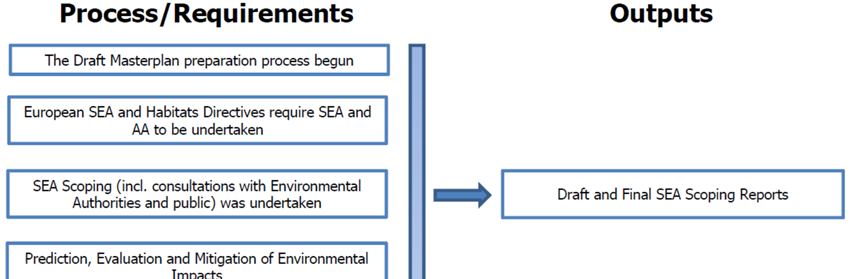
Section 3 SEA Methodology
3.1 Introduction to the Iterative Approach
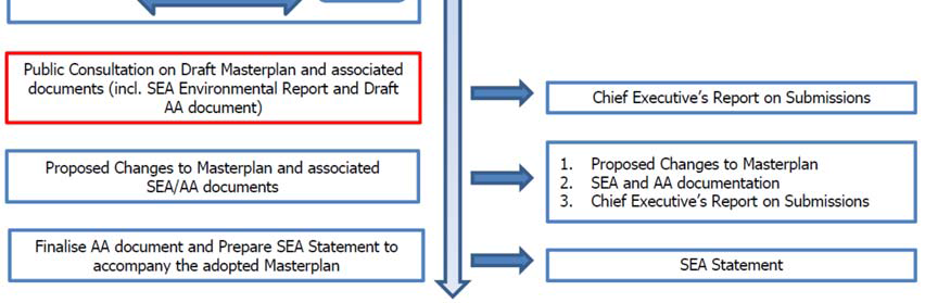
This section details how the SEA has been undertaken alongside the preparation of the Masterplan. Figure 3.1 provides an overview of the integrated Masterplan preparation, SEA and AA processes. The preparation of the Draft Masterplan, SEA and Appropriate Assessment (AA) are taking place concurrently and the findings of the SEA and AA have informed the content of the Masterplan.
The process is currently at a stage where this Environmental Report has been placed on public display alongside the Draft Masterplan.
The findings of the AA which are contained in a Natura Impact Report also accompany the Draft Masterplan on public display.
Submissions made on the Draft Masterplan and associated SEA and AA documents will be responded to in a Chief Executive’s report on public consultation, with updates made to the SEA and AA documentation where relevant. Proposed changes to the Draft Masterplan will be screened for the need to undergo SEA and AA and full, detailed assessments will be undertaken where required.
When the Masterplan is adopted, the SEA and AA documents will be finalised and an SEA Statement, which will include information on
how environmental considerations were integrated into the Masterplan, will be prepared.
Figure 3.1 Overview of Masterplan/SEA/AA Processes
3.2 Appropriate Assessment and Integrated Biodiversity Impact Assessment
3.2.1 Appropriate Assessment
A Stage 2 Appropriate Assessment (AA) has been undertaken alongside the preparation of the Masterplan.
The requirement for AA is provided under the EU Habitats Directive (Directive 1992/43/EEC).
The AA concluded that the Masterplan will not affect the integrity of the Natura 2000 network*
*Except as provided for in Section 6(4) of the Habitats
Directive, viz. There must be:
(a) no alternative solution available;
(b) imperative reasons of overriding public interest for the
plan/programme/project to proceed; and
(c) adequate compensatory measures in place.
The preparation of the Masterplan, SEA and AA has taken place concurrently and the findings of the AA have informed both the Masterplan and the SEA. All recommendations made by the AA were integrated into the Masterplan.
3.3 Flood Risk Assessment
A Flood Risk Assessment (FRA) has been undertaken alongside the preparation of the Masterplan.
The requirement for FRA is provided under ‘The Planning System and Flood Risk Management Guidelines for Planning Authorities’ (DEHLG and OPW, 2009).
The preparation of the Masterplan, SEA and FRA has taken place concurrently and the findings of the FRA have informed both the
Masterplan and the SEA.
The FRA has facilitated the integration of flood risk management considerations into the Masterplan.
3.4 Scoping
3.4.1 Introduction
In consultation with the environmental authorities, the scope of environmental issues to be dealt with by the SEA together with the
level of detail to which they are addressed was broadly decided upon taking into account the collection of environmental baseline data and input from environmental authorities. Scoping allowed the SEA to become focused upon key issues relevant to the environmental components which are specified under the SEA Directive*.
*These components comprise biodiversity, fauna, flora, population, human health, soil, water, air, climatic factors, material assets, cultural heritage including architectural and archaeological heritage, landscape and the interrelationship between the above factors.
As the Masterplan is not likely to have significant effects on the environment in another Member State transboundary consultations as provided for by Article 7 of the SEA Directive were not undertaken.
3.4.2 Scoping Notices
All relevant environmental authorities* identified under the SEA Regulations as amended, were sent SEA scoping notices by the Council indicating that submissions or observations in relation to the scope and level of detail of the information to be included in the environmental report could be made to the Council. Environmental authorities were informed that submissions, or parts of
submissions, made on the AA or FRA would also be taken into account.
*The following authorities were notified: Department of Agriculture, Food and the Marine; Department of Arts, Heritage and the Gaeltacht; Department of Communications, Energy and Natural Resources; Department of the Environment, Community and Local Government; Environmental Protection Agency; Carlow County Council; Laois County Council; Tipperary County Council; Waterford County Council; and Wexford County Council
3.4.3 Scoping Responses
Submissions were made by the Department of Agriculture, Food and the Marine, the Department of Arts, Heritage and the Gaeltacht
and the Environmental Protection Agency. These submissions influenced the scope of the assessments.
3.5 Environmental Baseline Data
The SEA process is informed by the environmental baseline (i.e. the current state of the environment) to facilitate the identification
and evaluation of the likely significant environmental effects of implementing the provisions of the Masterplan and the alternatives and the subsequent monitoring of the effects of implementing the provisions of the Masterplan.
3.6 Alternatives
The SEA Directive requires that reasonable alternatives (taking into account the objectives and the geographical scope of the plan or programme) are identified, described and evaluated for their likely significant effects on the environment. In accordance with this
requirement, alternatives are considered in Section 6.
3.7 The SEA Environmental Report
In this Environmental Report, which will be placed on public display alongside the Draft Masterplan, the likely environmental effects of the Draft Masterplan and the alternatives are predicted and their significance evaluated.
The Environmental Report provides the Council, stakeholders and the public with a clear understanding of the likely environmental
consequences of implementing the Draft Masterplan.
Mitigation measures to prevent or reduce significant adverse effects posed by the
Masterplan are identified in Section 9 - these have been integrated into the Masterplan.
The Environmental Report will be updated in order to take account of recommendations contained in submissions and in order to take account of changes which are made to the Draft Masterplan that is being placed on public display.
The Environmental Report is required to contain the information specified in Annex I of the SEA Directive (see Table 3.1).
3.8 The SEA Statement
On the adoption of the Masterplan by the Council, an SEA Statement will be prepared which will include information on:
How environmental considerations have been integrated into the Masterplan, highlighting the main changes to the Masterplan which resulted from the SEA process;
How the SEA Environmental Report and consultations have been taken into account, summarising the key issues raised in consultations and in the Environmental Report indicating what action was taken in response;
The reasons for choosing the Masterplan in the light of the other alternatives, identifying the other alternatives considered, commenting on their potential effects and explaining why the Masterplan, as adopted, was selected; and
The measures decided upon to monitor the significant environmental effects of implementing of the Masterplan.
3.9 Difficulties Encountered
The lack of a centralised data source that could make all environmental baseline data for the county both readily available and in a consistent format posed a challenge to the SEA process. This difficulty is one which has been encountered while undertaking SEAs at local authorities across the country and was overcome by investing time in the collection of data from various sources and through the use of Geographical Information Systems.
Table 3.1 Checklist of Information included in this Environmental Report
|
Information Required to be included in the Environmental Report |
Corresponding |
|
(A) Outline of the contents and main objectives of the plan or programme, and of its relationship with other relevant plans and programmes |
Sections 2, 5 and 7 |
|
(B) Description of relevant aspects of the current state of the environment and the evolution of that environment without implementation of the plan or programme |
Section 4 |
|
(C) Description of the environmental characteristics of areas likely to be significantly affected |
Sections 4, 6 and 7 |
|
(D) Identification of any existing environmental problems which are relevant to the plan or programme, particularly those relating to European protected sites |
Section 4 |
|
(E) List environmental protection objectives, established at international, EU or national level, which are relevant to the plan or programme and describe how those objectives and any environmental considerations have been taken into account when preparing the Plan |
Sections 5, 6, 7 and 8 |
|
(F) Describe the likely significant effects on the environment |
Sections 6 and 7 |
|
(G) Describe any measures envisaged to prevent, reduce and as fully as possible offset any significant adverse environmental effects of implementing the plan or programme |
Section 8 |
|
(H) Give an outline of the reasons for selecting the alternatives considered, and a description of how the assessment was undertaken (including any difficulties) |
Sections 3, 6 and 7 |
|
(I) A description of proposed monitoring measures |
Section 9 |
|
(J) A non-technical summary of the above information |
Non-Technical |
|
(K) Interrelationships between each environmental topic |
Addressed as it arises within each Section |
Section 4 Environmental Baseline
4.1 Introduction
The SEA Directive requires that the information on the baseline environment is focused upon the relevant aspects of the environmental
characteristics of areas likely to be significantly affected and the likely evolution of the current environment in the absence of the Masterplan. Being consistent with the strategic provisions of the Masterplan, this section provides a strategic description of aspects of environmental components which have the greatest potential to be affected by implementation of the Masterplan, if unmitigated.
Article 5 of the SEA Directive states that the report shall include the information that may reasonably be required taking into account:
Current knowledge and methods of assessment;
The contents and level of detail in the plan or programme and its stage in the decision-making process; and
The extent to which certain matters are more appropriately assessed at different levels in that process in order to avoid duplication of the assessment.
What this means in practice is, inter alia, that SEA involves collating currently available, relevant environmental data; it does not require major new research. Where data deficiencies or gaps exist, this should be acknowledged in the report.
Notwithstanding this, Kilkenny County Council made resources available to facilitate the undertaking of the following studies which have
informed the baseline description provided in this section:
Appropriate Assessment*;
Flood Risk Assessment**; and
Kilkenny Masterplan Area Archaeological Framework***.
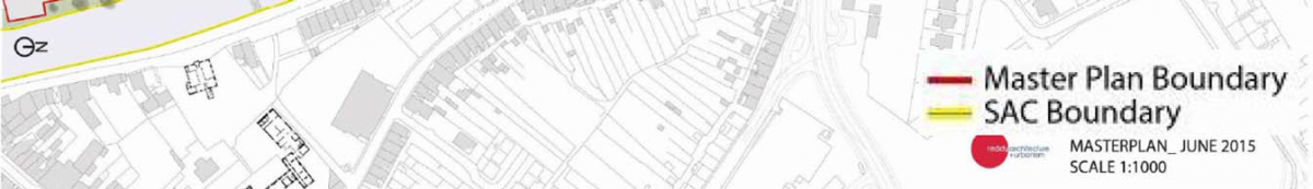
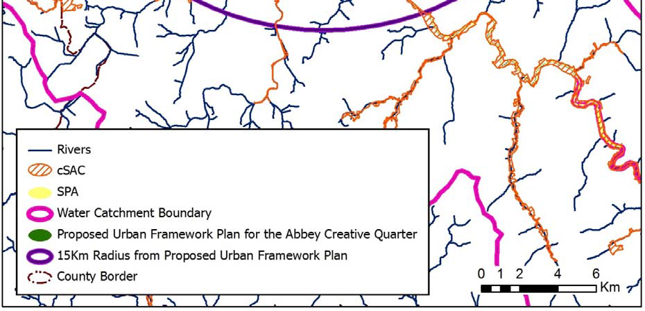
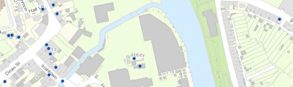
The area to which the Masterplan relates can be seen on Figure 4.1.
*CAAS for Kilkenny County Council (2015) Appropriate Assessment Natura Impact Report for the Draft Masterplan for Abbey Creative Quarter
**RPS for Kilkenny County Council (2015) Abbey Creative Quarter, Kilkenny Flood Risk Assessment
***Courtney Deery Heritage Consultancy (2015) Kilkenny Masterplan Area Archaeological Framework
4.2 Likely Evolution of the Environment in the Absence of the Masterplan
The City Development Plan currently zones the Masterplan area as ‘General Business’ with ‘Recreation, Amenity and Open Space’ zoning provided along the river.
The Masterplan in combination with Proposed Variation No. 1 to the City Development Plan (the Proposed Variation and associated SEA and AA documents have been placed on public display at the same time as the Masterplan and its associated SEA and AA documents) provides a framework for the development of the Masterplan area that adds further direction to the type of development that should occur at this site as well as providing further detail to the protection of the environment that is provided at the strategic City Plan level.
Although higher level environmental protection objectives – such as those of the City Plan and various EU Directives and transposing Irish Regulations – would still apply, the absence of the detailed framework would mean that new development would be less coordinated and controlled.
Less coordinated and controlled development would be less certain to result in the positive effects provided for by the Masterplan and
Variation, namely:
Contribution towards the protection of designated ecological sites (River Barrow and River Nore candidate Special Area of Conservation and the River Nore Special Protection Area) and ecological connectivity
Contribution towards enhancement of ecological connectivity along the banks of the Nore
Reduces need to develop greenfield lands (with associated impacts upon biodiversity elsewhere)
Contribution towards the protection of human health as a result of contributing towards the protection of environmental vectors, especially air
Reduces need to develop greenfield lands (with associated impacts upon soil elsewhere)
Contribution towards the protection of status of surface and ground waters
Contribution towards a shift from car to more sustainable and non-motorised transport modes
Contribution towards managing traffic flows and associated adverse effects on air quality
Contribution towards reductions in travel related greenhouse gas and other emissions to air
Contribution towards reduction in energy usage
Enhances public assets
Facilitates provision of water services and waste management
Contribution towards the protection of architectural and archaeological heritage and its context by facilitating compliance with relevant legislation
Reduces need to develop greenfield lands (with associated impacts upon architectural and archaeological heritage elsewhere)
Contribution towards the protection of landscape designations by facilitating compliance with City Development Plan
Opens up new views
Reduces need to develop greenfield lands (with associated impacts upon landscapes elsewhere)
Less coordinated and controlled development would have the potential to result in an increase in the occurrence of adverse effects on all
environmental components, especially those arising cumulatively. Cumulative effects occur as a result of the addition of many small
impacts to create one larger, more significant, impact. Such adverse effects could include the following and measures – including those
already contained in the City Plan – would need to be complied with in order to ensure that effects were mitigated:
Loss of/disturbance to biodiversity with regard to Natura 2000 Sites, including the River Barrow and River Nore candidate Special Area of Conservation and the River Nore Special Protection Area
Loss of/disturbance to biodiversity with regard to ecological connectivity and non-designated biodiversity
Loss of/disturbance to biodiversity with regard to listed species
Spatially concentrated deterioration in human health
Damage to the hydrogeological and ecological function of soil
Potential interactions with the status of water bodies (River Nore, River Breagagh and groundwater) and entries to the WFD Register of
Protected Areas , arising from:
o Changes in quality, flow and/or morphology; and
o Increases in outflow at waste water treatment plant as a result of increases in population.
Increase in flood risk
The need to provide adequate and appropriate water services (it is the function of Irish Water to provide for such needs)
Failure to contribute towards sustainable transport and associated impacts (energy usage and emissions to air including noise and greenhouse gases)
Increases in waste levels
Effects on the Zone of Archaeological Potential, St. Francis Abbey, Kilkenny Town wall, Evans Tower, entries to the Record of Monuments and Places and other archaeological heritage
Effects on entries to the Records of Protected Structures, National Inventory of Architectural Heritage and Architectural Conservation Areas (St. Canice’s ACA and City Centre ACA) and other architectural heritage
Occurrence of adverse visual impacts especially with respect to protected views and prospects
4.3 Biodiversity and Flora and Fauna
4.3.1 Natura 2000
Candidate Special Areas of Conservation (cSACs) have been selected for protection under the European Council Directive on the
conservation of natural habitats and of wild fauna and flora (92/43/EEC) by the (former) Department of the Environment, Heritage and
Local Government due to their conservation value for habitats and species of importance in the European Union.
Special Protection Areas (SPAs) have been selected for protection under the 1979 European Council Directive on the Conservation
of Wild Birds (79/409/EEC) due to their conservation value for birds of importance in the European Union. SPAs, along with SACs,
comprise Ireland’s Natura 2000 network – part of an EU-wide network of protected areas established under the Habitats Directive.
There are two Natura 2000 sites occurring adjacent to the Masterplan area (the River Barrow and River Nore cSAC and the River Nore
SPA). The boundary of the cSAC was provided by the National Parks and Wildlife Service (NPWS). This boundary was drawn using the
OSI 6 inch mapping overlaid on the most current OSI Mapping. As identified by the ecologist who is undertaking the Appropriate
Assessment, the intended boundary of the cSAC in the vicinity of the Masterplan area is likely to correspond with the SPA boundary (drawn using the most recent mapping). Taking into account this identification, the area subject to both cSAC and SPA designations is mapped on Figure 4.1.
There is only one more Natura 2000 Site within 15km of the Masterplan area Thomastown Quarry cSAC.
Natura 2000 Sites within 15km of the Masterplan area are listed on Table 4.1 and mapped on Figure 4.2.
Table 4.1 Natura 2000 sites within 15km of the Masterplan area
|
Natura 2000 Sites |
||
|
Designation |
Code |
Site Name |
|
cSAC |
002162 |
River Barrow and |
|
002252 |
Thomastown Quarry |
|
|
SPA |
004233 |
River Nore |
The following text comes from the Site Synopsis (Version date: 25.11.2010) for the River Nore SPA (NPWS, 2010):
The River Nore SPA is a long, linear site that includes the following river sections: the River Nore from the bridge at Townparks, (northwest of Borris in Ossory) to Coolnamuck (approximately 3 km south of Inistioge) in Co. Kilkenny; the Delour River from its junction with the River Nore to Derrynaseera bridge (west of Castletown) in Co. Laois; the Erkina River from its junction with the River Nore at Durrow Mills to Boston Bridge in Co. Laois; a 1.5 km stretch of the River Goul upstream of its junction with the Erkina River; the Kings River from its junction with the River Nore to a bridge at Mill Island, Co. Kilkenny. The site includes the river channel and marginal vegetation.
The River Nore SPA is of high ornithological importance as it supports a nationally important population of Kingfisher, a species that is listed on Annex I of the Birds Directive.
The following text comes from the Site Synopsis (Version date: 01.04.2014) for the River Barrow and River Nore cSAC (NPWS, 2014):
The River Barrow and River Nore cSAC consists of the freshwater stretches of the Barrow/Nore River catchments as far upstream as the Slieve Bloom Mountains and it also includes the tidal elements and estuary as far downstream as Creadun Head in Waterford. The site passes through eight counties.
The cSAC was selected for alluvial wet woodlands and petrifying springs, priority habitats on Annex I of the Habitats Directive.
The site is also selected as a candidate SAC for old oak woodlands, floating river vegetation, estuary, tidal mudflats, Salicornia mudflats, Atlantic salt meadows, Mediterranean salt meadows, dry heath and eutrophic tall herbs, all habitats listed on Annex I of the Habitats Directive. The site is also selected for the following species listed on Annex II of the same directive – Sea Lamprey, River Lamprey, Brook Lamprey, Freshwater Pearl Mussel, Nore Freshwater Pearl Mussel, Crayfish, Twaite Shad, Atlantic Salmon, Otter, Desmoulin’s Whorl Snail Vertigo moulinsiana and the Killarney Fern.
Overall, the site is of considerable conservation significance for the occurrence of good examples of habitats and of populations of plant
and animal species that are listed on Annexes I and II of the Habitats Directive respectively. Furthermore it is of high conservation value for the populations of bird species that use it. The occurrence of several Red Data Book plant species including three rare plants in the salt meadows and the population of the hard water form of the Pearl Mussel.
4.3.2 Proposed Natural Heritage Area
Natural Heritage Areas (NHAs) are designated due to their national conservation value for ecological and/or geological/geomorphological
heritage. They cover nationally important seminatural and natural habitats, landforms or geomorphological features, wildlife plant and
animal species or a diversity of these natural attributes. NHAs are designated under the Wildlife (Amendment) Act 2000. Proposed
NHAs (pNHA) were published on a nonstatutory basis in 1995, but have not since been statutorily proposed or designated.
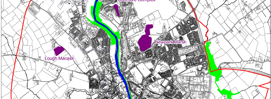
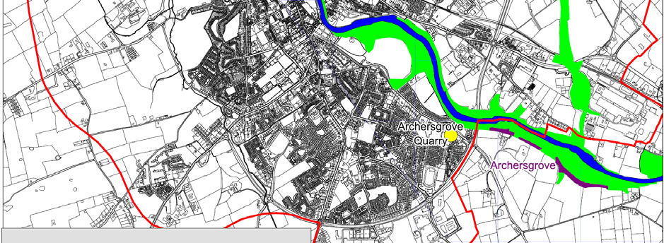
There are three pNHA’s occurring inside the City Development Plan boundary (mapped on Figure 4.3) as follows:
Archersgrove (outside City boundary but adjoining) Site Code 002051
Dunmore Complex (consists of 7 sites, one of which is within the City development boundary) Site Code 001859
Lough Macask 001914
Newpark Marsh 000845
4.3.3 Water Framework Directive Registers of Protected Areas
Under the requirements of the Water Framework Directive, a Registers of Protected Areas has been compiled to identify surface
water and ground water bodies of importance. The aim is to protect and conserve important water bodies for habitats, species, nutrient
sensitive areas, recreational areas and drinking waters. The River Nore within and in the vicinity of Kilkenny City is listed on the Register of Protected Areas for the following:
cSAC and SPA designations;
Salmonid River;
Nutrient Sensitive River (downstream of the City only); and
Groundwater for Drinking Water.
4.3.4 Ecological Networks and Connectivity
Ecological networks are important in connecting areas of local biodiversity with each other and with nearby designated sites so as to prevent islands of habitat from being isolated entities. They are composed of linear features, such as treelines, hedgerows and rivers/streams, which provide corridors or stepping stones for wildlife species moving within their normal range. They are important for the migration, dispersal and genetic exchange of species of flora and fauna particularly for mammals, especially for bats and small birds and facilitate linkages both between and within designated ecological sites, the non-designated surrounding countryside and the City.
Important ecological network features within and adjacent to the Masterplan site comprise the Rivers Nore and Breagagh and, where they remain, their banks.
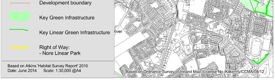
Key green infrastructure valuable to biodiversity and which has been identified by the City Development Plan is mapped on Figure 4.4. In the vicinity of the Masterplan area, the Rivers Nore and Breagagh are identified as being part of the City’s key green infrastructure.
4.3.5 Habitat Survey and Tree Survey
A Habitat Survey was undertaken by Kilkenny Local Authorities for Kilkenny City in 2010. Apart from the River Nore and grassy banks,
the Habitat Survey does not identify any habitats of significance within or adjacent to the Masterplan area.
A Tree Survey was undertaken for Kilkenny City in 2007 which did not identify any trees within the Masterplan area as being worthy of
preservation.
4.3.6 Other Protected Species/Habitats
In addition to biodiversity already mentioned above, other species are protected under law wherever they occur, such as:
‘Protected Species and natural habitats’ as defined in the Environmental Liability Directive (2004/35/EC) and European Communities (Environmental Liability) Regulations 2008 including annexed habitats and species listed under Annexes I, II and IV of the EU Habitats Directive and Annex I of the EU Birds Directive;
Species/Habitats legally protected under the Flora Protection Order in the Wildlife (Amendment) Act 2000;
Other species of flora and fauna and their key habitats which are protected under the Wildlife Acts 1976-2000 including all native mammals; and
Stepping stones and ecological corridors including nature conservation sites (other than Natura 2000 sites), habitats and species locations covered by Article 10 of the Habitats Directive.
4.3.7 Existing Problems
As occurs with the development of all settlements, built development within the vicinity of the Masterplan site has resulted in
loss of biodiversity and flora and fauna however legislative objectives governing biodiversity and fauna were not identified as being currently conflicted with.
Figure 4.1 Area subject to both cSAC and SPA designation in the vicinity of the Masterplan area


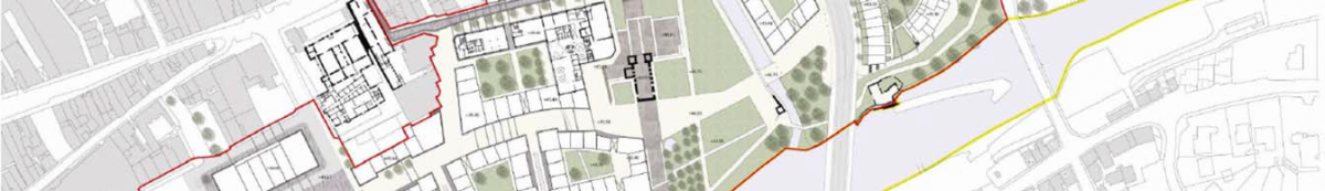
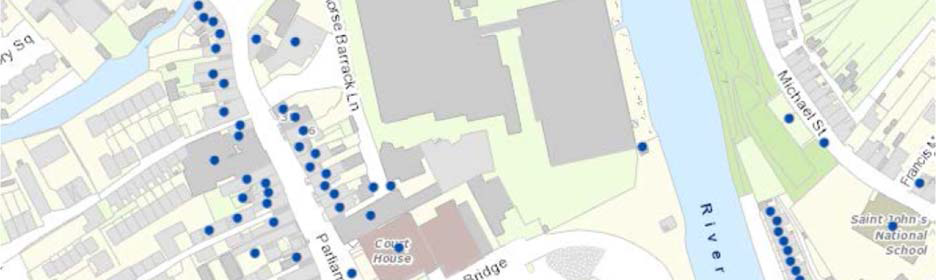
Figure 4.2 Natura 2000 sites occurring within 15 km of Masterplan area
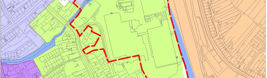
Figure 4.3 pNHAs (and other designated ecological sites) within and adjacent to the City
Figure 4.4 Key Green Infrastructure and Rights of Way
4.4 Population and Human Health
4.4.1 Population
Much of the area in question is a brown field site at the site of the former Smithwick’s Brewery. The population of Kilkenny Legal
Town and its Environs (both Urban and Rural CSO areas) was recorded as being 24,423 persons in 2011.
The Masterplan area will accommodate new residential and employment populations through the development of this brownfield site
– this will allow for a greater number of journeys via sustainable transport modes and associated positive environmental effects on overall energy usage and air and noise emissions.
4.4.2 Human Health
Human health has the potential to be impacted upon by environmental vectors (i.e. environmental components such as air, water
or soil through which contaminants or pollutants, which have the potential to cause harm, can be transported so that they come
into contact with human beings). Hazards or nuisances to human health can arise as a result of exposure to these vectors arising from
incompatible adjacent land uses for example. These factors have been considered with regard to the description of: the baseline of
each environmental component; and the identification and evaluation of the likely significant environmental effects of implementing the Masterplan.
4.4.3 Existing Problems
The Flood Risk Assessment (FRA) undertaken alongside the preparation of the Masterplan has identified lands that are at elevated levels of flood risk within the Masterplan area. The FRA has facilitated the integration of flood risk management considerations into the
Masterplan.
The Kilkenny City (Radestown) drinking water supply is listed on the the EPA’s most recent (Q1 of 2015) RAL. This is due to the presence of elevated levels of trihalomethanes (THMs) above the standard in the Drinking Water Regulations. Remedial action involves the development of a new well field, due to be completed by 2016*. This is the responsibility of Irish Water.
*EPA Drinking Water Remedial Action List Q4 of 2015
4.5 Soil
4.5.1 Introduction
Soil is the top layer of the earth’s crust. It is formed by mineral particles, organic matter, water, air and living organisms. Soil can be
considered as a non-renewable natural resource because it develops over very long timescales. It is an extremely complex, variable
and living medium and performs many vital functions including: food and other biomass production, storage, filtration and
transformation of many substances including water, carbon, and nitrogen. Soil has a role as a habitat and gene pool, serves as a platform for human activities, landscape and heritage and acts as a provider of raw materials. Such functions of soil are worthy of protection because of their socio-economic as well as environmental importance. Soils in any area are the result of the interaction of various factors, such as parent material, climate, vegetation and human action.
To date, there is no Directive which is specific to the protection of soil resources. However, there is currently an EU Thematic Strategy on the protection of soil which includes a proposal for a Soil Framework Directive which proposes common principles for protecting soils across the EU.
4.5.2 Soil Types/Potential Contamination
Because the site has been previously developed many of the soils have been excavated or overlain (and sealed) by development. By
providing for brownfield development, the Masterplan would be likely to reduce the need for greenfield development (and associated
impacts on soil) elsewhere.
The St. Francis Abbey Brewery which is located within the Masterplan site was operated by Diageo Global Supply until production activities ceased on 12th May 2014. With respect to the on-site condition of soils, the potential for contaminated land within the site was
considered by the EPA in their Site Visit Report (March, 2015) which identifies that: The condition of the site was assessed and it is the
opinion of this inspector that the site of the activity was in a satisfactory state on the day of the site visit and it was considered unlikely to cause environmental pollution or to contain any potentially polluting residues.
4.5.3 County Geological Sites
A list of County Geological Sites was developed in partnership with the Geological Survey of Ireland and designated in 2007. One site is
identified in the City, Archersgrove Quarry. This site is designated as a pNHA and mapped on Figure 4.3.
4.5.4 Existing Problems
Legislative objectives governing soil were not identified as being conflicted with.
4.6 Water
4.6.1 The Water Framework Directive
Since 2000, Water Management in the EU has been directed by the Water Framework Directive 2000/60/EC (WFD). The WFD requires
that all Member States implement the necessary measures to prevent deterioration of the status of all waters - surface, ground,
estuarine and coastal - and protect, enhance and restore all waters with the aim of achieving “good status” by 2015. All public bodies are required to coordinate their policies and operations so as to maintain the good status of water bodies which are currently unpolluted and improve polluted water bodies to good status by 2015.
Article 4 of the WFD sets out various exemptions for deterioration in status caused as a result of certain physical modifications to
water bodies. This is provided: all practicable mitigation measures are taken; there are reasons of overriding public interest or the
benefits to human health, safety or sustainable development outweigh the benefits in achieving the WFD objective; there are no better
alternatives; and the reasons for the physical modification are explained in the relevant river basin management plan.
For the purpose of implementing the WFD, Ireland has been divided into eight River Basin Districts (RBDs) or areas of land that are
drained by a large river or number of rivers and the adjacent estuarine/coastal areas. Within each RBD - for the purpose of assessment,
reporting and management - water has been divided into groundwater, rivers, lakes, estuarine waters and coastal waters which are
in turn divided into specific, clearly defined water bodies. The Masterplan area is located within the South-Eastern RBD.
River Basin Management Plans have been prepared for each RBD which are being implemented in order to help protect and improve all waters. The Management Plans provides specific policies for individual river basins in order to implement the requirements of the WFD.
4.6.2 Surface Water
The WFD defines ‘surface water status’ as the general expression of the status of a body of surface water, determined by the poorer of its ecological status and its chemical status. Thus, to achieve ‘good surface water status’ both the ecological status and the chemical status of a surface water body need to be at least ‘good’.
Ecological status is an expression of the structure and functioning of aquatic ecosystems associated with surface waters. Such waters are classified as of “good ecological status” when they meet Directive requirements.
Chemical Status is a pass/fail assignment with a failure defined by a face-value exceedance of an Environmental Quality Standards (EQS) for one or more Priority Action Substances (PAS) listed in Annex X of the Water Framework Directive (WFD). The EQS values for individualPAS substances are set at European level. Good surface water chemical status means that concentrations of pollutants in the water body do not exceed the environmental limit values specified in the Directive.
The area to which the Masterplan relates is bounded to the east by the River Nore and is separated in two by the Breagagh River which
flows into the Nore from the west.
River water status for the period 2007-2009 is shown on Figure 4.5 which status for the period 2010-2012 is shown on Figure 4.6. The status of the main channel of the River Nore has improved from Poor to Moderate while the status of the Breagagh has remained Poor over both monitoring periods.
4.6.3 Ground Water
4.6.3.1 Introduction
Groundwater is stored in the void spaces in underground layers of rock, or aquifers. These aquifers are permeable, allowing both the
infiltration of water from the soils above them and the yielding of water to surface and coastal waters. Groundwater is the part of the
subsurface water that is in the saturated zone - the zone below the water table, the uppermost level of saturation in an aquifer at which the pressure is atmospheric, in which all pores and fissures are full of water.
4.6.3.2 WFD Groundwater Status
For groundwater bodies, the approach to classification is different from that for surface water. For each body of groundwater, both the
chemical status and the quantitative must be determined. Both have to be classed as either good or poor. The WFD sets out a series of criteria that must be met for a body to be classed as good chemical and quantitative status.
The status of groundwater within and adjacent to the Masterplan area is identified as being Good for both 2007-2009 and 2010-2012.
4.6.3.3 Aquifer Vulnerability
The Geological Survey of Ireland (GSI) rates aquifers according to its vulnerability to pollution.
Aquifer vulnerability refers to the ease with which pollutants of various kinds can enter underground water. The Masterplan area is
identified as being of high vulnerability.
4.6.4 Register of Protected Areas
Under the requirements of the Water Framework Directive, a Registers of Protected Areas has been compiled to identify surface
water and ground water bodies of importance. The aim is to protect and conserve important water bodies for habitats, species, nutrient
sensitive areas, recreational areas and drinking waters. The River Nore within and in the vicinity of Kilkenny City is listed on the Register of Protected Areas for the following:
cSAC and SPA designations;
Salmonid River;
Nutrient Sensitive River (downstream of the City only); and
Groundwater for Drinking Water.
4.6.5 Flooding
4.6.5.1 Introduction
Flooding is an environmental phenomenon which, as well have causing economic and social impacts, could in certain circumstances
pose a risk to human health.
4.6.5.2 EU Floods Directive
European Directive 2007/60/EC on the assessment and management of flood risks requires Member States to carry out a preliminary assessment by 2011 in order to identify the river basins and associated coastal areas at risk of flooding. For such zones, flood
risk maps currently being finalised. Flood risk management plans focused on prevention, protection and preparedness will be finalised in
2016. The Office of Public Works has prepared Preliminary Flood Risk Assessment (PFRA) maps which identify areas where the risks
associated with flooding might be significant. These areas, Areas for Further Assessment (AFAs) are where more detailed assessment is required to more accurately assess the extent and degree of flood risk. Flood hazard and flood risk maps for AFAs will be finalised in 2015 and Flood Risk Management Plans will be finalised in 2016.
4.6.5.3 DEHLG Flood Risk Management Guidelines
In 2009 the then Department of the Environment Heritage and Local Government and OPW published The Planning System and
Flood Risk Management Guidelines for Planning Authorities. These are aimed at ensuring a more consistent, rigorous and systematic
approach which will fully incorporate flood risk assessment and management into the planning system. Planning authorities are required to undertake flood risk identification, assessment and management processes as appropriate when preparing land use plans and in the
consideration of applications for planning permission.
4.6.5.4 Flood Risk Assessment
A Flood Risk Assessment (FRA) has been undertaken alongside the preparation of the Draft Masterplan by RPS.
The requirement for FRA is provided under ‘The Planning System and Flood Risk Management Guidelines for Planning Authorities’ (DEHLG and OPW, 2009). The preparation of the Masterplan, SEA and FRA has taken place concurrently and the findings of the FRA have informed both the Masterplan and the SEA. The FRA has facilitated the integration of flood risk management considerations into the Masterplan.
RPS have assessed the flood risk to the proposed development and determined the predominant source of flood risk emanates
from fluvial flooding from the River Nore and River Breagagh. Under the ‘Planning System and Flood Risk Management Planning
Guidelines’ (2009) the application site would be classified predominantly as Flood Zones A and B, and is therefore subject to the Justification Test.
This FRA assesses the proposed development against the requirements of the Development Management Justification Test and proposes arange of flood mitigation measures which comply with the criteria set out under this part of the test.
The proposed development is, in the opinion of RPS, compliant with the ‘Planning System and Flood Risk Management Planning Guidelines’ (2009).
4.6.6 Existing Problems
With regard to overall Water Framework Directive status, the main channel of the River Nore is identified as being of Moderate status while the status of the Breagagh is identified as being of Poor status.
The FRA has identified lands that are at elevated levels of flood risk within the Masterplan area and has facilitated the integration of flood risk management considerations into the Masterplan.
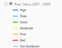
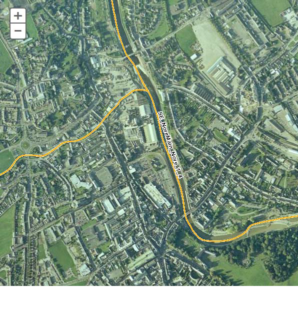
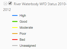
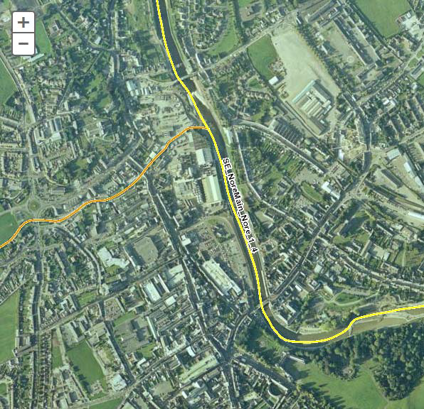
4.7 Air and Climatic Factors
4.7.1 Ambient Air Quality
In order to protect human health, vegetation and ecosystems, EU Directives set down air quality standards in Ireland and the other
Member States for a wide variety of pollutants. These pollutants are generated through fuel combustion, in space heating, traffic, electricity generation and industry and, in sufficient amounts, could affect the well-being of the areas inhabitants. The EU Directives include details regarding how ambient air quality should be monitored, assessed and managed.
The principles to this European approach are set out in the Ambient Air Quality and Cleaner Air for Europe (CAFE) Directive (2008/50/EC) (which replaces the earlier Air Quality Framework Directive 1996 and the first, second and third Daughter Directives; the fourth Daughter Directive will be included in CAFE at a later stage).
The CAFE Directive:
Sets new air quality objectives for PM2.5 (fine particles) including the limit value and exposure related objectives;
Accounts for the possibility to discount natural sources of pollution when assessing compliance against limit values; and
Allows the possibility for time extensions of three years (PM10) or up to five years (NO2, benzene) for complying with limit values, based on conditions and the assessment by the European Commission.
The fourth Daughter Directive lists pollutants, target values and monitoring requirements for the following: arsenic, cadmium, mercury, nickel and polycyclic aromatic hydrocarbons in ambient air.
The CAFE Directive was transposed into Irish legislation by the Air Quality Standards Regulations 2011 (S.I. No. 180 of 2011). It
replaces the Air Quality Standards Regulations 2002 (S.I. No. 271 of 2002), the Ozone in Ambient Air Regulations 2004 (S.I. No. 53 of
2004) and S.I. No. 33 of 1999.
The fourth Daughter Directive was transposed into Irish legislation by the Arsenic, Cadmium, Mercury, Nickel and Polycyclic Aromatic
Hydrocarbons in Ambient Air Regulations 2009 (S.I. No. 58 of 2009).
The EPA’s (2014) Air Quality in Ireland 2013 identifies that, overall, air quality in Ireland compares favourably with other EU Member
States and continues to be of good quality relative to other EU countries.
With regard to the transport sector the report identifies that:
Under the CAFE Directive, Ireland is required to reduce levels of PM2.5 by 10% by 2020. This reduction will be challenging as it will require an integrated approach across a number of sectors including industrial, transport and residential areas.
Ireland must develop and implement policies to reduce travel demand, increase the use of alternatives to the private motor car, reduce NOX emissions from motorised transport and also consider motorised vehicle fuel choice. The EPA identifies that this process will require joined‐up action between Government departments, national agencies and local authorities. These bodies must make air quality an integral part of their traffic management and planning processes.
On NO2 and NOX, the report identifies that:
NO2 concentrations in Ireland in 2013 were below the limit values set out in the CAFE Directive and WHO guidelines.
NO2 levels across all zones of Ireland have remained relatively static since 2003, with signs of a slight increasing trend in the years 2008 ‐ 2010. During this period, NO2 levels have been close to the limit value at Dublin City and Cork City centre monitoring sites with the limit value exceeded in Dublin in 2009. However, NO2 levels decreased in 2010, 2011 and 2012. This downward trend may have stabilised in 2013.
High NOX emissions within urban centres may lead to an exceedance of the limit value in the future due to our continued reliance on motorised vehicles. Although technological advances in the future may lead to lower NOX emissions from individual cars, this technology will take time to make an impact on the levels as they stand. The actions set out in the Smarter Travel Policy for Sustainable Transport (DOT, 2009) should be implemented to ensure that we can control levels of NOX in Ireland in the future. These include actions to reduce travel demand, increase alternatives to the private car, reduce the NOX emissions of motorised transport and
by also considering our choice of motor vehicle fuel.
The Masterplan area will accommodate new residential and employment populations through the development of a brownfield site – this will allow for a greater number of journeys via sustainable transport modes and associated positive environmental effects on overall greenhouse gas emissions, energy usage and air and noise emissions.
4.7.2 Noise
Noise is unwanted sound. The Environmental Noise Regulations (SI No. 140 of 2006) transpose into Irish law the EU Directive
2002/49/EC relating to the assessment and management of environmental noise, which is commonly referred to as the Environmental
Noise Directive or END. The END defines a common approach intended to avoid, prevent or reduce on a prioritised basis the harmful
effects, including annoyance, due to exposure to environmental noise. The END does not set any limit value, nor does it prescribe the measures to be used in the action plans, which remain at the discretion of the competent authorities. Limit values are left to each member state. At this point in time, Ireland does not have any statutory limit values.
As identified above, the Masterplan area will accommodate new residential and employment populations through the development of a
brownfield site – this will allow for a greater number of journeys via sustainable transport modes and associated positive environmental effects on, inter alia, overall noise emissions.
Kilkenny County Council have adopted a Noise Action Plan 2014-2018 which has been designed and is being implemented with the twin aims of:
Avoiding significant adverse health impacts from noise; and
Preserving environmental noise quality where it is good.
4.7.3 Climatic Factors
The key issue involving the assessment of the effects of implementing the Masterplan on climatic factors relates to greenhouse gas
emissions arising from transport. Land-use planning contributes to what number and what extent of journeys occur. By addressing journey time through land use planning and providing more sustainable modes and levels of mobility, noise and other emissions to air and energy use can be minimised.
The Draft Masterplan facilitates improvements in sustainable mobility, thereby facilitating reductions in and limiting increases of
greenhouse gas emissions. Such emissions would occur otherwise with higher levels of motorised transport and associated traffic.
Ireland’s emissions profile has changed considerably since 1990, with the contribution from transport more than doubling and the
share from agriculture reducing since 1998. Travel is a source of:
1. Noise;
2. Air emissions; and
3. Energy use (39% of Total Final Energy Consumption in Ireland in 2012 was taken up by transport, the largest take up of any sector)*.
*Sustainable Energy Ireland (2014) Energy in Ireland 1990 – 2012
Between 2008 and 2011, Ireland's greenhouse gas emissions decreased across all sectors due to the effects of the economic downturn with emissions falling by 15.2% between 2008 and 2011. However, 2012 saw emissions rise by 1.2% when compared with 2011*.
*EPA (2013) Ireland's Greenhouse Gas Emissions in 2012
Between 1990 and 2013, the Transport sector shows the greatest overall increase at 115.5%. Emissions increased by 2.1% in 2013, the first increase in Transport emissions since 2007. However, Transport emissions have decreased by 23.1% below peak levels in 2007 primarily due to the economic downturn, improving vehicle standards due to the changes in vehicle registration tax and the increase use in biofuels. The increase up to 2007 can be attributed to general economic prosperity, increasing population with a high reliance on private car travel as well as rapidly increasing road freight transport*.
*EPA (2014) Ireland's Provisional Greenhouse Gas Emissions in 2013
Maximising sustainable mobility will help Ireland meet its emission target for greenhouse gases under the 2020 EU Effort Sharing target
which commits Ireland to reducing emissions from those sectors that are not covered by the Emissions Trading Scheme (e.g. transport,
agriculture, residential) to 20% below 2005 levels.
The EPA 2015 publication Ireland’s Greenhouse Gas Emission Projections 2014-2035, identifies that:
Under the ‘worst case’ scenario, Ireland is projected to cumulatively exceed its obligations by 4 Mtonnes of CO2eq over the period 2013-2020.
Under the ‘best case’ scenario, Ireland is projected to cumulatively meet its compliance obligations over the 2013- 2020 period and meet its 2020 target. This takes into account the overachievement of the annual limits in the period 2013- 2017 which is banked
and used in the years 2018-2020. The report identifies that achieving the outlook under the ‘best case’ scenario will require focus and effort which includes meeting renewable targets for transport and heat as well as energy efficiency targets.
Transport emissions are projected to show strong growth over the period to 2020 with a 13%-19% increase on current levels depending
on the level of policy implementation. Relative to 2005, transport emissions are projected to remain the same or, at best, decrease by 4% by 2020.
Flooding (see Section 4.6.5) - is influenced by climatic factors. There are emerging objectives relating to climate adaptation and that there is likely to be future Guidance for climate change proofing of land use plan provisions as is flagged in the National Climate Change Adaptation Framework (DECLG, 2012). Some of these objectives might relate to green infrastructure which can achieve synergies with regard to the following:
Provision of open space amenities; 12 EPA (2014) Ireland's Provisional Greenhouse Gas Emissions in 2013
Sustainable management of water;
Protection and management of biodiversity;
Protection of cultural heritage; and
Protection of protected landscape sensitivities.
Flooding and Green Infrastructure are key issues which have been integrated into the Masterplan.
4.7.4 Existing Problems
Legislative objectives governing air and climatic factors in Kilkenny City were not identified as being conflicted with.
4.8 Material Assets
4.8.1 Introduction
Resources that are valued and that are intrinsic to specific places are called ‘material assets’. Material Assets relevant to this SEA include:
Water Services; and
Waste management.
Other material assets covered by the SEA include archaeological and architectural heritage (see Section 4.9) natural resources of economic value, such as air and water* (see Sections 4.7 and 4.6) and transport (see Section 4.7).
*Including water bodies identified in Fáilte Ireland’s (2009) report Determination of Waters of National Tourism Significance and Associated Water Quality Status.
4.8.2 Water Services
4.8.2.1 Irish Water
Since January 2014 the delivery, integration and implementation of strategic water and waste water projects and infrastructural
improvements are now the responsibility of the newly established State body ‘Irish Water’.
Kilkenny County Council no longer has a direct role in this area; however the Local Authority will work with Irish Water to ensure that the
Masterplan and any water services investment plan will align with both the National Spatial Strategy and the Regional Planning Guidelines and that the provision of water/waste water services will not be a limiting factor in terms of forecasted growth.
The function and role of Irish Water includes:
Abstracting and treating water;
Delivering water and waste water services to homes and businesses;
Installing water meters and billing domestic and business customers;
Raising finance to fund improvements and repairs in the water system; and
Maintaining and operating the water system.
The upgrading of the infrastructure will contribute towards compliance with the Water Framework Directive, EU Urban Waste Water
Treatment Directive and Drinking Water Regulations and will help to protect human health and maintain the quality of coastal waters.
The responsibility for the provision of these services now lies with Irish Water, supported by Kilkenny County Council, as appropriate.
4.8.2.2 Waste Water
The EPA’s most recent report on waste water treatment performance ‘Focus on Urban Waste Water Treatment in 2013’, (2014) identified
that the Kilkenny City Waste Water Treatment Plant (WWTP) passed the requirements of the Urban Waste Water Treatment Directive i.e. the WWTP met the standards set in the Directive for effluent quality, and a sufficient number of effluent samples were collected, analysed and reported to the EPA. However, Kilkenny City did not meet the quality standard for phosphorus set in the Directive. Phosphorus removal was provided in late 2013.
The public wastewater treatment scheme in Kilkenny City has capacity for approximately 107,650 Population Equivalent (PE). There is
currently spare capacity in the scheme.
4.8.2.3 Drinking Water Performance
Drinking water must be clean and wholesome. That means it must meet the relevant water quality standards and must not contain any
other substance or micro-organism in concentrations or numbers that constitute a potential danger to human health.
Compliance with the drinking water requirements is determined by comparing the results of analyses submitted by water suppliers
to the standard for 48 parameters specified in the European Communities (Drinking Water) Regulations (No. 2), 2007. To ensure that these standards are met, each water supply must be monitored on a regular basis.
Under Section 58 of the Environmental Protection Agency Act 1992 the EPA is required to collect and verify monitoring results for all
water supplies in Ireland covered by the European Communities (Drinking Water) Regulations, 2000. The EPA publishes their results in annual reports which are supported by Remedial Action Lists (RALs). The RAL identifies water supplies which are not in compliance with the Regulations mentioned above.
The Kilkenny City (Radestown) drinking water supply is listed on the the EPA’s most recent (Q1 of 2015) RAL. This is due to the presence of elevated levels of trihalomethanes (THMs) above the standard in the Drinking Water Regulations. Remedial action involves the development of a new well field, due to be completed by 2016*. This is the responsibility of Irish Water.
*EPA Drinking Water Remedial Action List Q4 of 2015
4.8.3 Waste Management
EU and National waste management policy can be summarised by the waste hierarchy of prevention, recycling, energy recovery and disposal.
For the purposes of waste management planning, Ireland is now divided into three regions: Southern, Eastern-Midlands and Connacht-Ulster. The Kilkenny City is located within the Southern Region. Draft waste management plans for each waste management region were published for public consultation in November 2014.
4.8.4 Existing Problems
The Kilkenny City (Radestown) drinking water supply is listed on the the EPA’s most recent (Q1 of 2015) RAL. This is due to the presence of elevated levels of trihalomethanes (THMs) above the standard in the Drinking Water Regulations. Remedial action involves the development of a new well field, due to be completed by 2016*. This is the responsibility of Irish Water.
* EPA Drinking Water Remedial Action List Q4 of 2015
4.9 Cultural Heritage
4.9.1 Introduction
This section has been informed by and can be read in conjunction with the Masterplan documents, including Section 3 of the
Masterplan and the Kilkenny Masterplan Area Archaeological Framework (Courtney Deery Heritage Consultancy, 2015).
The southern quarter of the Masterplan area contains the majority of the existing buildings and is industrial in nature with large production
and warehouse buildings surrounded by extensive concrete marshalling yards. The River Nore, the River Breagagh and the Old City Walls are hidden by these structures.
St. Francis Abbey Brewery, due to its industrial nature, has for many years been separated from the city. It has been an impediment to creating a permeable city and has prevented the formation of linkages through the city.
Vehicular access to the Brewery site is restricted primarily to the main entrance from Parliament Street. A secondary vehicular access point lies on the southern boundary of the site to the rear of the Courthouse with access from Bateman Quay.
4.9.2 Urban Grain
The City of Kilkenny is readily identifiable by its distinctive urban grain, with the main thoroughfare of High Street and Parliament
Street intersected with parallel slipways in a herringbone pattern.
On the former Smithwick’s Brewery and Bateman Quay sites, historical maps reveal that the Northern and Southern ends of the
Masterplan area was subdivided into long plots of ground with one end on the main street known as burgage plots.
These burgage plots were first established by William Marshall in 1207. A ‘burgess’ rented a burgage plot for a shilling a year and built a
house on the street. Behind the house stretched a long narrow garden for growing fruit and vegetables.
An analysis of the 1841 map of Kilkenny was undertaken as part of the Masterplan preparation process which revealed that while
a strong pattern of burgage plots existed on the southern end of the Masterplan site this pattern diminished to the north of the Courthouse.
To maintain the existing scale within the city centre the Masterplan will be cognisant of the variety and pattern of building heights and plot widths within the existing city centre.
4.9.3 Archaeological Heritage
The Masterplan area is located in the heart of medieval Kilkenny and is located within the Zone of Archaeological Potential for Kilkenny
City (see Figure 4.7). The site encompasses a number of significant heritage structures including:
St Francis’ Abbey (National Monument)
City Walls (National Monument)
Evans Turrett (National Monument)
Woollen Mills (Protected structure)
Tea / Pleasure Houses (Protected Structures)
Bull Inn (Recorded Monument)
The preparation of the Draft Masterplan and accompanying Kilkenny Masterplan Area Archaeological Framework* has been informed
by consultations with the Department of Arts, Heritage and the Gaeltacht. The Masterplan and Framework have been informed by these
ongoing consultations.
*Courtney Deery Heritage Consultancy (2015) Kilkenny Masterplan Area Archaeological Framework
The Department have identified St. Francis’ Abbey as a monument of National importance, noting that it is afforded the highest protection under the National Monuments Acts. Kilkenny Town Wall and Evans Tower have also been
identified as being of national significance.
The Masterplan area’s archaeological heritage is protected under the National Monuments Acts (1930-2004), Natural Cultural Institutions
Act 1997 and the Planning Acts. The Record of Monuments and Places (RMP) is an inventory, established under Section 12 of the National Monuments (Amendment) Act 1994, of sites and areas of archaeological significance, numbered and mapped. The RMP includes all known monuments and sites of archaeological importance dating to before 1700 AD, and some sites which date from after 1700 AD.
The recommendations made by the Kilkenny Masterplan Area Archaeological Framework have been integrated into the Masterplan.
4.9.4 Architectural Heritage
The Planning and Development Act 2000, as amended, provides for conservation principles of care and protection of the architectural
heritage. The Act, inter alia, facilitates the listing of significant buildings and the formulation of policies and objectives relating to
such structures.
The Act includes a number of definitions in relation to architectural heritage which are detailed below.
“Structure” is defined as any building, structure, excavation, or other thing constructed or made on, in or under any land, or any part of a structure so defined, and -
(a) where the context so admits, includes the land on, in or under which the structure is situate, and
(b) in relation to a protected structure or proposed protected structure, includes—
(i) the interior of the structure,
(ii) the land lying within the curtilage of the structure,
(iii) any other structures lying within that curtilage and their interiors, and
(iv) all fixtures and features which form part of the interior or exterior of any structure or structures referred to in subparagraph (i) or (iii).
“Protected structure” means - (a) a structure, or (b) a specified part of a structure, which is included in a record of protected structures,
and, where that record so indicates includes any specified feature which is within the attendant grounds of the structure and which
would not otherwise be included in this definition.
A “Record of Protected Structures” is a record, required to be included in every Development Plan, of every structure which, in the opinion of the planning authority, is of special architectural, historical, archaeological, artistic, cultural, scientific, social or technical interest and which forms part of the architectural heritage within the functional area of the planning authority.
The Planning and Development Act and Regulations (as amended) require that Development Plans include objective(s) to preserve the character of a place, area, group of structures or townscape, taking account of building lines and heights, that -
(a) is of special architectural, historical, archaeological, artistic, cultural, scientific, social or technical interest or value, or
(b) contributes to the appreciation of protected structures,
If the planning authority is of the opinion that its inclusion is necessary for the preservation of the character of the place, area, group of structures or townscape concerned. Such places, areas, groups of structures or townscapes are known as and are referred to in the Act “architectural conservation areas”.
Entries to the Record of Protected Structures within and adjacent to the Masterplan area are mapped on Figure 4.8.
Entries to the National Inventory of Architectural Heritage (NIAH) (these provide the basis for the recommendations of the Minister for Arts, Heritage and the Gaeltacht for the inclusion of particular structures into the Record of Protected Structures) are mapped on Figure 4.9.
There are two main Architectural Conservation Areas within the indicative area to which the Masterplan relates - St. Canice’s Architectural Conservation Area and City Centre Architectural Conservation Area (see Figure 4.10).
4.9.5 Existing Problems
The context of archaeological and architectural heritage has changed over time within the Masterplan site however no existing conflicts with legislative objectives governing archaeological and architectural heritage have been identified.
Figure 4.7 Archaeological Heritage - Zone of Archaeological Importance
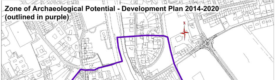
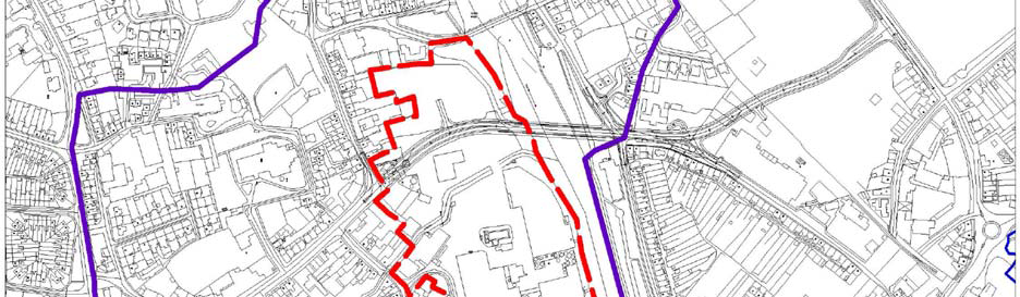
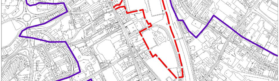
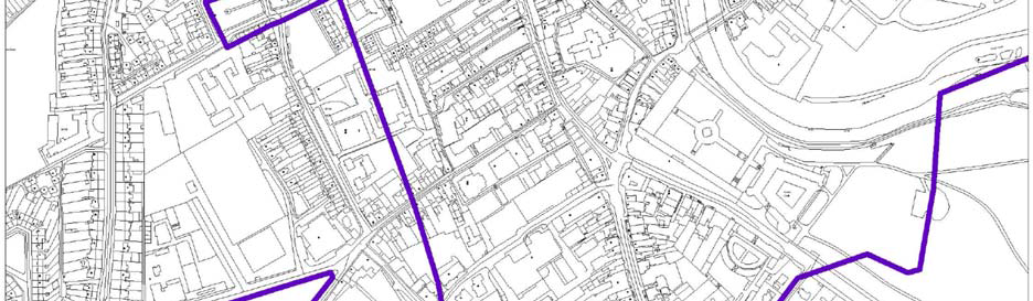
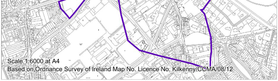
Figure 4.8 Architectural Heritage - Entries to the Record of Protected Structures
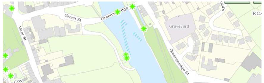
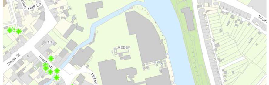
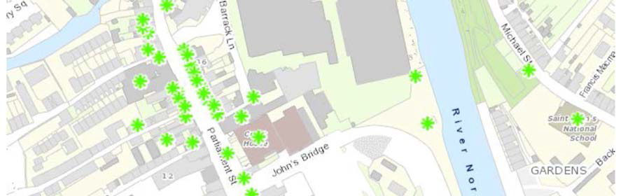
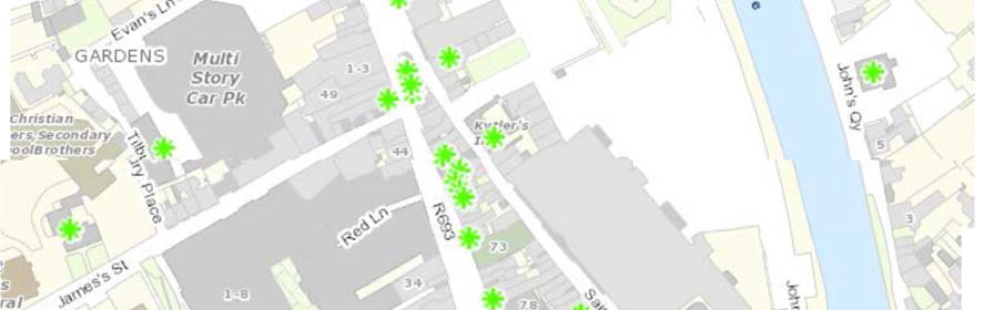
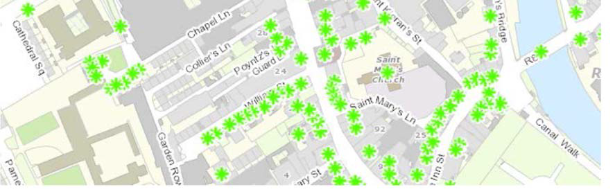
Figure 4.9 Architectural Heritage - Entries to the National Inventory of Architectural Heritage
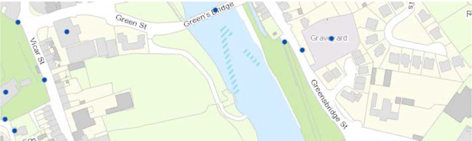
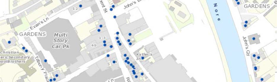
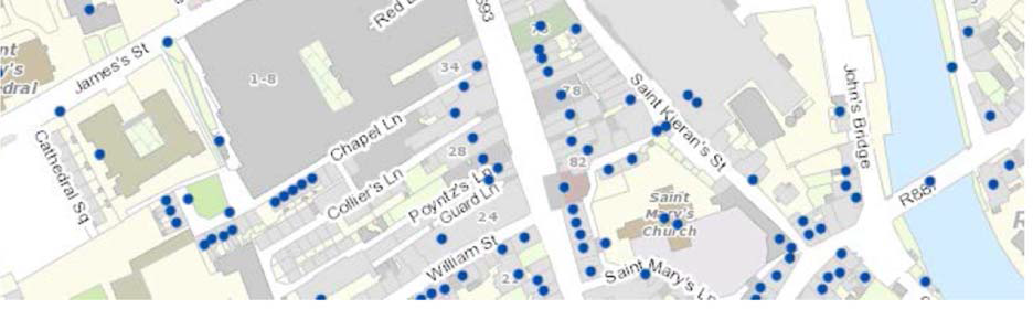
Figure 4.10 Architectural Heritage – Architectural Conservation Areas
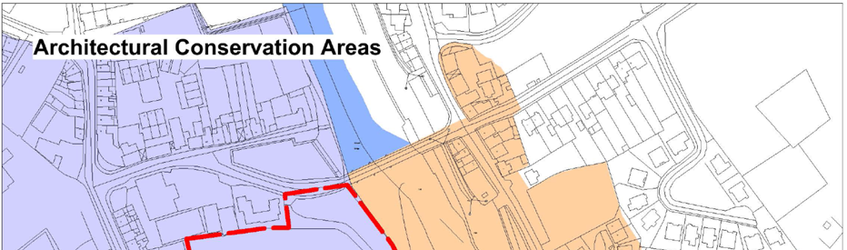
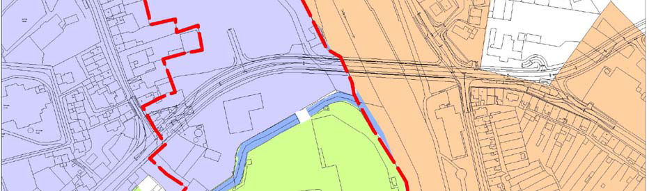
4.10 Landscape
4.10.1 Overview
This section has been informed by and can be read in conjunction with the Masterplan and associated documents.
Landscapes are areas which are perceived by people and are made up of a number of layers: landform, which results from geological and geomorphological history; landcover, which includes vegetation, water, human settlements, and; human values which are a result of
historical, cultural, religious and other understandings and interactions with landform and landcover.
The Masterplan area comprises an area of 8.25 hectares or 20.4 acres which is currently inaccessible to the public and lies at the heart
of the medieval core of Kilkenny City Centre. The topography of the site is generally flat with the ground gently sloping from west to east down to the river. The ground is generally level from south to north, with the ground levels rising at the junction with Greens Bridge.
The River Breagagh and sections of the old city wall traverse the site on an east west axis and effectively subdivide the site into two distinct quarters of very different character. The southern quarter contains the majority of the existing buildings and is quite industrial in
nature with large industrial and warehouse buildings surrounded by extensive concrete marshalling yards. The northern quarter is less developed and was primarily used by the Brewery for vehicular parking, truck washing, etc.
The most northerly section of the site is a parcel of land known as Sweeney’s Orchard. This would best be described as a disused back lot. The site is bordered to the south by Bateman Quay and the Market Yard. To the west lies Parliament Street, containing many three storeys over basement Georgian buildings, Horse Barack Lane and Vicar Street with predominantly two storey residential terraced
buildings. To the north lies some residential properties and industrial units which are accessed from Green Street. To the east is the
River Nore. The River Nore flows from north to south and divides the City into two distinct halves. The River is a predominant landscape
feature in the City, providing amenity in the centre of the City.
There are several existing heritage structure within the site. These are;
St. Francis Abbey,
The City Walls,
Evan’s Turret
Tea Houses
Wall of the Bull Inn
Due to the inaccessibility of the site these structures remain in reasonable condition. There are a further eight individual structures
on the site. These vary in scale from single storey to 7 storeys. A detailed analysis of these buildings suggested that the majority of these structures are not suitable for reuse. However it was determined that the renovation and reuse of the Mayfair and Brewhouse buildings accords with the principle of sustainable re-use of existing building assets.
4.10.2 Legislation
The importance of landscape and visual amenity and the role of its protection are recognised in the Planning and Development Act and Regulations (as amended), which requires that Plans include objectives for the preservation of the landscape, views and the
amenities of places and features of natural beauty.
4.10.3 Protected Views
The current City Development Plan 2014-2020 lists the following views and prospects for protection (note that numbering corresponds to that which is provided on Figure 4.11):
3. View (north) of River Nore and Linear Park from Greensbridge
5. View of St. Mary’s Cathedral, Tholsel and St. Mary’s Church from No. 30‐35 Michael Street
6. View of St. Mary’s Cathedral from Kenny’s Well Road
7. Panoramic view from Dublin Road/Windgap Hill area to River Nore and city skyline
8. View of Castle Park, open countryside from Castle
12. View of Kilkenny Castle from John’s Bridge
While not identified within the development plan the following views are design drivers for the Masterplan;
View from Parliament Street to St. Francis’ Abbey;
view from the Central Access Scheme to St Francis Abbey;
View from St. Francis’ Abbey to the City Wall;
Evans Turret and St. Canice’s Cathedral; and
View from Evans Turret to Kilkenny Castle.
It is the intention to design the Masterplan so that interruption to existing views and prospects is minimised. The development of the
Masterplan area as per the provisions of the Masterplan will open up and incorporate new views around the City, which were previously
blocked by the brewery buildings. These new views will include those to and from National Monuments and significant historical sites and landmarks within the City. It will be a matter for future City Development Plans to add consider and add if relevant and appropriate new views to the list of Protected Views.
4.10.4 Existing Environmental Problems
Developments have resulted in changes to the visual appearance of the landscape within the Masterplan area however legislative objectives governing landscape and visual appearance were not identified as being conflicted with.
Figure 4.11 Views and Prospects
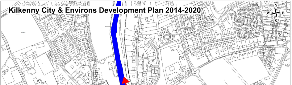
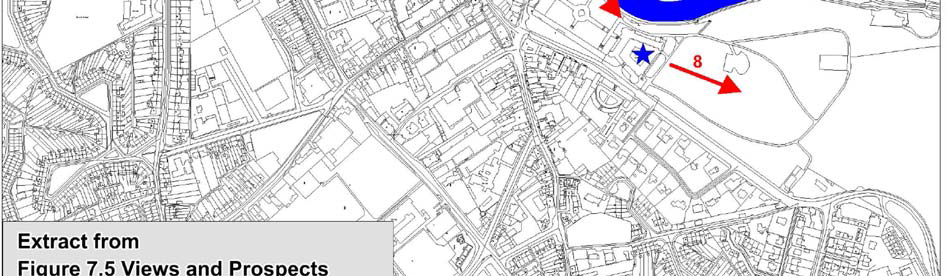
Section 5 Strategic Environmental Objectives
5.1 Introduction
Strategic Environmental Objectives (SEOs) are methodological measures developed from policies which generally govern environmental
protection objectives established at international, Community or Member State level e.g. the environmental protection objectives of
various European Directives which have been transposed into Irish law and which are required to be implemented. Some of these are
detailed below in this section and others are identified on Table 2.1 Relationship with Legislation and Other Plans and Programmes.
The SEOs are set out under a range of topics and are used as standards against which the provisions of the Masterplan and the
alternatives are evaluated in order to help identify which provisions would be likely to result in significant environmental effects and
where such effects would be likely to occur, if - in the case of adverse effects - unmitigated.
SEOs are distinct from the objectives of the Masterplan - although they will often overlap - and they are not given statutory weight by
virtue of their use in Strategic Environmental Assessments.
The SEOs are linked to indicators which can facilitate monitoring the environmental effects of the Masterplan as well identifying targets which the Masterplan can help work towards.
SEOs were developed taking into account feedback provided by the environmental authorities.
The monitoring of potential significant effects within the Masterplan area will be undertaken in conjunction with the monitoring programme for Proposed Variation No. 1 to the Kilkenny City Development Plan. The indicators below are the same as those included as part of the monitoring programme detailed for Proposed Variation No. 1.
5.2 Biodiversity, Flora and Fauna
5.2.1 Habitats Directive 1992
The European Council Directive on the Conservation of natural habitats and of wild fauna and flora (92/43/EEC), referred to as the Habitats Directive, aims to ensure the conservation of certain natural habitats and species which are at favourable conservation status.
Special Areas of Conservation (SACs) are designated and protected under the Habitats Directive 1992 (92/43/EEC) due to their
conservation value for habitats and species of importance in the European Union.
The Habitats Directive establishes Natura 2000, a network of protected areas throughout the EU. SACs together with Special Protection Areas (SPAs) - which are designated under the 1979 Birds Directive - make up the Natura 2000 network of protected sites.
Article 6 of the Habitats Directive provides for the need to undertake Appropriate Assessments of plans or projects which have
the potential to impacts upon Natura 2000 sites.
Article 10 of the Habitats Directive recognises the importance of ecological networks as corridors and stepping stones for wildlife, including for migration, dispersal and genetic exchange of species of flora and fauna. The Directive requires that ecological connectivity and areas of ecological value outside the network of designated ecological sites are maintained, and it recognises the need for the management of these areas through land use planning and development policies.
In Ireland, the habitats and species occurring in both SACs and SPAs are protected from effects of development occurring outside their
boundaries under Section 18 “Prohibition of works on lands outside a European site” of the European Communities (Natural Habitats) Regulations 1997. The Regulations require that where a development is proposed to be carried out, on any land that is not within a protected site and is liable to have an adverse impact on the protected site in question, including direct, cumulative and indirect impacts, an Appropriate Assessment is required.
The integration of the requirements of Article 6 of the Habitats Directive into the Planning and Development Act and Regulations (as amended) and the European Communities (Birds and Natural Habitats) Regulations 2011 puts the requirement for Appropriate
Assessment into context for both projects and plans.
5.2.2 Birds Directive 1979
The 1979 European Council Directive on the Conservation of Wild Birds (79/409/EEC), referred to as the Birds Directive, - as well as
its amending acts - seeks to protect, manage and regulate all bird species naturally living in the wild within the European territory of the
Member States, including the eggs of these birds, their nests and their habitats; and to regulate the exploitation of these species.
The Directive places great emphasis on the protection of habitats for endangered as well as migratory species, especially through the
establishment of a coherent network of Special Protection Areas (SPAs).
SPAs are protected under the Directive and have been designated in Ireland by the Department of Arts, Heritage and the Gaeltacht
due to their conservation value for birds of importance in the European Union.
5.2.3 European Communities (Birds and Natural Habitats) Regulations 2011
The European Communities (Birds and Natural Habitats) Regulations 2011 consolidate the European Communities (Natural Habitats)
Regulations 1997 to 2005 and the European Communities (Birds and Natural Habitats)(Control of Recreational Activities) Regulations 2010, as well as addressing 17 Department of Arts, Heritage, Gaeltacht and the Islands (2002) National Biodiversity Plan Dublin:
Government of Ireland transposition failures identified in the CJEU judgements.
The Regulations have been prepared to address several judgments of the Court of Justice of the European Union (CJEU) against Ireland, notably cases C-418/04 and C-183/05, in respect of failure to transpose elements of the Birds Directive and the Habitats Directive into Irish law.
5.2.4 UN Convention on Biological Diversity 1992
The United Nations Convention on Biological Diversity 1992 requires the promotion of the conservation and sustainable use of
biodiversity.
5.2.5 National Biodiversity Plan 2011
The preparation and implementation of Ireland’s 2nd National Biodiversity Plan 2011* ‘Actions for Biodiversity 2011 – 2016’ complies
with an obligation under the UN Convention on Biological Diversity. The Masterplan has been developed in line with the EU and International Biodiversity strategies and policies.
*Department of Arts, Heritage, Gaeltacht and the Islands (2002) National Biodiversity Plan Dublin: Government of Ireland
The measures Ireland will take are presented as 102 actions under a series of 7 Strategic Objectives. Some of the actions within the plan are continuing elements of existing work and many are requirements under existing EU Directives. The objectives cover the
conservation of biodiversity in the wider countryside and in the marine environment, both within and outside protected areas; the
mainstreaming of biodiversity across the decision making process in the State; the strengthening of the knowledge base on
biodiversity; increasing public awareness and participation; and Ireland’s contribution to international biodiversity issues, including North
South co-ordination on issues of common interest.
5.2.6 Wildlife Act 1976 and Wildlife (Amendment) Act 2000
The basic designation for wildlife is the Natural Heritage Area (NHA). They cover nationally important semi-natural and natural habitats,
landforms or geomorphological features, wildlife plant and animal species or a diversity of these natural attributes. Under the Wildlife
Amendment Act (2000), NHAs are legally protected from damage from the date they are formally proposed for designation. Proposed
NHAs (pNHAs) were published on a nonstatutory basis in 1995, but have not since been statutorily proposed or designated - designation
will proceed on a phased basis over the coming years.
The Planning and Development Act (as amended) defines a ‘wildlife site’ as:
(a) an area proposed as a natural heritage area and the subject of a notice made under section 16(1) of the Wildlife (Amendment) Act 2000,
(b) an area designated as or proposed to be designated as a natural heritage area by a natural heritage area order made under section 18 of the Wildlife (Amendment) Act 2000,
(c) a nature reserve established or proposed to be established under an establishment order made under section 15 (amended by section 26 of the Wildlife (Amendment) Act 2000) of the Wildlife Act 1976,
(d) a nature reserve recognised or proposed to be recognised under a recognition 5 order made under section
16 (amended by section 27 of the Wildlife (Amendment) Act 2000) of the Wildlife Act 1976, or
(e) a refuge for fauna or flora designated 10 or proposed to be designated under a designation order made under section 17 (amended by section 28 of the Wildlife (Amendment) Act 2000) of the Wildlife Act 1976.
5.2.7 SEOs, Indicators and Targets
SEO B1: To ensure compliance with the Habitats and Birds Directives with regard to the protection of Natura 2000 Sites and
Annexed habitats and species*
*‘Annexed habitats and species’ refer to those listed under Annex I, II & IV of the EU Habitats Directive and Annex I of the EU Birds Directive.
Indicator B1: Conservation status of habitats and species as assessed under Article 17 of the Habitats Directive
Target B1: Maintenance of favourable conservation status for all habitats and species protected under national and international legislation to be unaffected by implementation of the Variation*
*Except as provided for in Section 6(4) of the Habitats Directive, viz. There must be:
(a) no alternative solution available;
(b) imperative reasons of overriding public interest for the plan/programme/project to proceed; and
(c) adequate compensatory measures in place.
SEO B3: To avoid significant impacts on relevant habitats, species, environmental features or other sustaining resources and
to ensure compliance with the Wildlife Acts 1976-2010 with regard to the protection of species listed on Schedule 5 of the principal Act
Indicator B3i: Number of significant impacts on relevant habitats, species, environmental features or other sustaining resources resulting from development granted permission in the Masterplan area
Target B3i: Avoid significant impacts on relevant habitats, species, environmental features or other sustaining resources resulting from development granted permission in the Masterplan area
Indicator B3ii: Number of significant impacts on the protection of species listed on Schedule 5 of the Wildlife Act 1976
Target B3ii: No significant impacts on the protection of species listed on Schedule 5 of the Wildlife Act 1976
5.3 Population and Human Health
5.3.1 Population
The population in the Masterplan area will interact with various environmental components. Potential interactions include:
Recreational and development pressure on habitats - consideration of SEOs B1, B2 and B3 cover this issue;
Increase in demand for wastewater treatment - consideration of SEO M1 covers this issue;
Increase in demand for water supply - consideration of SEO M2 covers this issue;
Potential development in floodsensitive areas - consideration of SEO W3 covers this issue; and
Effect on water quality - consideration of SEOs W1 and W2 cover this issue.
5.3.2 Human Health
5.3.2.1 Overview
The impact of implementing the Masterplan on human health is determined by the impacts which the Masterplan will have upon
environmental vectors. Environmental vectors are components, such as air, water or soils, through which contaminants or pollutants, have the potential to cause harm, can be transported so that they come into contact with human beings. Impacts would be influenced by the extent to which new development is accompanied by appropriate infrastructure - this relates to SEOs M1 and M2; impacts upon the quality of water bodies - these relate to SEOs W1 and W2; and the extent of development provided which would affect flood risk - this relates to SEO W3.
5.3.2.2 Emission Limits
Emission limits for discharges to air, soil and water are set with regards to internationally recognised exposure limit values. These are
generally set to be many times the safe exposure limit - in order to provide protection. In the event that a land-use plan began to have adverse health effects on surrounding populations it is likely that it would have been identified as being in breach of such emission
standards at a very early stage - and long before the manifestation of any adverse health effects in the population.
5.3.3 SEO, Indicator and Target
SEO PHH1: To protect human health form exposure to incompatible landuses
Indicator PHH1: Occurrence (any) of a spatially concentrated deterioration in human health arising from environmental factors resulting
from development granted permission in the Masterplan area, as identified by the Health Service Executive and
Environmental Protection Agency
Target PHH1: No spatial concentrations of health problems arising from environmental factors as a result of implementing the Variation
5.4 Soil
5.4.1 Overview
Soil is potentially subject to a series of threats including erosion, decline in organic matter, local and diffuse contamination, sealing,
compaction, decline in biodiversity, salinisation, floods and landslides. A combination of some of these threats can ultimately lead arid or subarid climatic conditions to desertification.
Given the importance of soil and the need to prevent further soil degradation, the Sixth Environment Action Programme* called for the
development of a Thematic Strategy on Soil Protection.
*Decision No 1600/2002/EC of the European Parliament and of the Council of 22nd July 2002 laying down the Sixth Community Environment Action Programme (OJ L 242, 10.9.2002, p. 1).
5.4.2 SEO, Indicator and Target
SEO S1: To avoid damage to the hydrogeological and ecological function of the soil resource
Indicator S1: Soil extent and hydraulic connectivity
Target S1: To minimise reductions in soil extent and hydraulic connectivity
5.5 Water
5.5.1 The Water Framework Directive 2000
Since 2000, Water Management in the EU has been directed by the Water Framework Directive 2000/60/EC (WFD). The WFD has
been transposed into Irish legislation by the European Communities (Water Policy) Regulations 2003 (SI No. 722 of 2003). The
WFD requires that all member states implement the necessary measures to prevent deterioration of the status of all waters -
surface, ground, estuarine and coastal - and protect, enhance and restore all waters with the aim of achieving good status by 2015.
5.5.2 Quality Standards for Surface Waters
The European Communities Environmental Objectives (Surface Waters) Regulations 2009 (SI No. 272 of 2009) is the final major piece of
legislation needed to support the WFD and gives statutory effect to Directive 2008/105/EC on environmental quality standards in the field
of water policy. The Surface Waters Regulations also give further effect to the WFD, establishing a framework for Community action in the field of water policy and Directive 2006/11/EC on pollution caused by certain dangerous substances discharged into the aquatic
environment of the Community.
The Surface Waters Regulations apply to all surface waters - including lakes, rivers, canals, transitional waters, and coastal waters - and
provide, inter alia, for:
The establishment of legally binding quality objectives for all surface waters and environmental quality standards for pollutants;
The examination and where appropriate, review of existing discharge authorisations by Public Authorities to ensure that the emission
limits laid down in authorisations support compliance with the new water quality objectives/standards;
The classification of surface water bodies by the EPA for the purposes of the Water Framework Directive;
The establishment of inventories of priority substances by the EPA, and;
The drawing up of pollution reduction plans by coordinating local authorities (in consultation with the EPA) to reduce pollution by priority substances and to cease and/or phase out discharges, emissions or losses of priority hazardous substances.
In order to satisfy the overall WFD objective of ‘good status’, a surface water body must achieve the requirements of the good
ecological* and chemical** status.
*Ecological status comprises: biological quality elements, physiochemical conditions and hyrdomorphological quality elements. The overall ecological status of the water body is determined by the lowest level of status achieved across all quality elements.
**Chemical status assessment is based on compliance with the standards laid down for priority substances by Directive 2008/105/EC on
environmental quality standards in the field of water policy (the Surface Waters Regulations give effect to the environmental standards established by this Directive).
The EU’s Common Implementation Strategy Guidance Document No. 20 provides guidance on exemptions to the environmental objectives of the Water Framework Directive.
5.5.3 Quality Standards and Threshold Values for Ground Water
Detailed provisions to achieve the aims of the WFD for ground water have been presented in a Groundwater Directive (Directive 2006/118/EC on the protection of groundwater against pollution and deterioration).
This Directive sets up environmental objectives of good groundwater quantity and good groundwater quality (chemical status), as well
as ensuring a continuity to the 1980 Groundwater Directive (Directive 80/68/EEC on the protection of groundwater against pollution
caused by dangerous substances) which is due to be repealed under the WFD by the end of 2013.
Article 3 of the 2006 Directive requires that the assessment of the chemical status of groundwater use both quality standards
identified in Annex I of the Directive and threshold values to be set by individual member states.
Groundwater quality standards are environmental quality standards expressed as the concentration of a particular pollutant, group of pollutants or indicator of pollution in groundwater, which should not be exceeded in order to protect human health and the environment. Annex I of the Directive sets standards for two pollutants: Nitrates - 50mg/l - and; Active substances in pesticides*, including their relevant metabolites, degradation and reaction products - 0,1 μg/l and 0,5 μg/l (total**).
Irish groundwater threshold values*** are currently in the process of being set by the EPA.
*‘Pesticides’ means plant protection products and biocidal products as defined in Article 2 of Directive 91/414/EEC and in Article 2 of Directive 98/8/EC, respectively.
**‘Total’ means the sum of all individual pesticides detected and quantified in the monitoring procedure, including their relevant metabolites, degradation and reaction products.
***Threshold values are to be established by Member States for all pollutants and indicators of pollution which characterise groundwater bodies classified as being at risk of failing to achieve good groundwater chemical status under the WFD. Threshold values are
required to be established in a way that, should the monitoring results at a representative monitoring point exceed the thresholds, this will indicate a risk that one or more of the conditions for good groundwater chemical status - with regard to the ability of groundwater to support human uses and with regard to waters used for the abstraction of drinking water - are not being met.
5.5.4 River Basin Management Plans
Kilkenny is located within the South Eastern River Basin District. This District has a River Basin Management Plan and a Programme of Measures which are implemented in order to enable the achievement of the requirements of the WFD.
5.5.5 Flooding
5.5.5.1 EU Floods Directive
European Directive 2007/60/EC on the assessment and management of flood risks aims to reduce and manage the risks that floods
pose to human health, the environment, cultural heritage and economic activity. The Directive applies to inland waters as well as all
coastal waters across the whole territory of the EU.
The Directive requires Member States to carry out a preliminary assessment by 2011 in order to identify the river basins and associated
coastal areas at risk of flooding. For such zones flood risk maps are currently being finalised. Flood risk management plans focused on
prevention, protection and preparedness will be finalised in 2016.
The Directive is to be carried out in coordination with the Water Framework Directive and Flood Risk Management Plans and River Basin District Management Plans should be coordinated.
5.5.5.2 DEHLG Flood Risk Management Guidelines
In November 2009 the (then) Department of the Environment, Heritage and Local Government (DEHLG) and the OPW issued The
Planning System and Flood Risk Management Guidelines for Planning Authorities. These are aimed at ensuring a more consistent, rigorous and systematic approach which will fully incorporate flood risk assessment and management into the planning system.
The Guidelines require the planning system to, among other things:
Avoid development in areas at risk of flooding, particularly flood plains, unless there are proven sustainability grounds that justify appropriate development and where flood risk can be reduced or managed to an acceptable level, without increasing flood risk elsewhere;
Adopt a sequential approach to flood risk management when assessing the location for new development based on avoidance
, reduction and mitigation of flood risk; and
Incorporate flood risk assessment into the process of making decisions on planning applications and planning appeals.
5.5.5.3 Flood Risk Assessment
A Flood Risk Assessment (FRA) has been undertaken and is available alongside the Masterplan. The FRA has facilitated the
integration of flood risk management considerations into the Masterplan.
5.5.6 SEOs, Indicators and Targets
Note that SEOs W1 and W2 also relate to the quality of soils.
SEO W1: To maintain and improve, where possible, the quality and status of surface waters
Indicator W1i: Classification of Overall Status (comprised of ecological and chemical status) under the European Communities Environmental Objectives (Surface Waters) Regulations 2009 (SI No. 272 of 2009)
Target W1i: Not to cause deterioration in the status of any surface water or affect the ability of any surface water to achieve ‘good
status’*
*Good status as defined by the WFD equates to approximately Q4 in the current national scheme of biological classification of rivers as set out by the EPA.
SEO W2: To prevent pollution and contamination of ground water
Indicator W2: Groundwater Quality Standards and Threshold Values under Directive 2006/118/EC
Target W2: Not to affect the ability of groundwaters to comply with Groundwater Quality Standards and Threshold Values under Directive 2006/118/EC
SEO W3: To comply as appropriate with the provisions of the Flood Risk Management Guidelines for Planning Authorities
Indicator W3: Number of incompatible developments granted permission on lands which pose - or are likely to pose in the future - a significant flood risk
Target W3: Minimise developments granted permission on lands which pose - or are likely to pose in the future - a significant flood risk in compliance with The Planning System and Flood Risk Management Guidelines for Planning Authorities
5.6 Material Assets
5.6.1 Water Services Act 2007
Major legislative revisions were provided for in the Water Services Act 2007 (No. 30 of 2007). The Act incorporates a comprehensive review, update and consolidation of all existing water services legislation, and facilitates the establishment of a comprehensive supervisory regime to ensure compliance with specified performance standards.
5.6.2 Water Services Act 2013
The Water Services Act 2013 provided for the establishment of Irish Water as a subsidiary of Bord Gáis Éireann. The Act provides the
Commission for Energy Regulation with a function to advise the Government in relation to the development of policy regarding the
regulation of the provision of water services. The Act provides that the Commission may do all things necessary in preparation for the
performance of water regulatory functions and that the Commission may undertake the necessary consultations with Bord Gáis Éireann and Irish Water, water services authorities, or any other person.
In the medium-to-long-term Irish Water will produce and implement a series of 6 year Multi- Annual Capital Investment Plans which will
synchronise with the 6 year River Basin Management Plan cycles. The 6 year Capital Investment Plans are to be guided by a 25-year Water Services Strategic Plan which to focuses on how capacity deficits will be addressed and the primary strategic objectives of Irish Water.
5.6.3 Urban Waste Water Treatment Directive 2001
The treatment of wastewater is governed by the Urban Waste Water Treatment Directive (91/271/EEC) (amended by Directive 98/15/EEC) transposed into Irish law by the Urban Waste Water Treatment Regulations 2001 (SI No. 254 of 2001). The Directive aims to protect the environment from the adverse effects of the wastewater discharges by ensuring that wastewater is appropriately treated before it is discharged to the environment. The Regulations stipulate that sewage treatment facilities are in place in all towns by 2005.
Appropriate treatment is essential in order to meet the requirements of the Water Framework Directive (see Section 5.5.1).
5.6.4 Drinking Water Regulations 2007
The European Communities (Drinking Water) Regulations (No. 2) 2007 require the compliance of water intended for human
consumption with 48 parameters.
5.6.5 Waste Management
For the purposes of waste management planning, Ireland is now divided into three regions: Southern, Eastern-Midlands and Connacht-Ulster. Kilkenny City is located within the Southern Region. Draft waste management plans for each waste management region were published for public consultation in November 2014.
5.6.6 SEOs, Indicators and Target
SEO M1: To serve new development with adequate and appropriate waste water treatment infrastructure
Indicator M1: Number of new developments granted permission which can be adequately and appropriately served with waste water treatment infrastructure over the lifetime of the Masterplan
Target M1: All new developments granted permission to be connected to and adequately and appropriately served by waste water treatment infrastructure over the lifetime of the Masterplan
SEO M2: To serve new development with adequate drinking water that is both wholesome and clean
Indicator M2: Number of non-compliances with the 48 parameters identified in the European Communities (Drinking Water) Regulations (No. 2) 2007 which present a potential danger to human health as a result of implementing the Variation
Target M2: No non-compliances with the 48 parameters identified in the European Communities (Drinking Water) Regulations (No. 2) 2007 which present a potential danger to human health as a result of implementing the Variation
SEO M3: To reduce waste volumes, minimise waste to landfill and increase recycling and reuse
Indicator M3: Preparation and implementation of construction and environmental management plans
Target M3: For construction and environmental management plans to be prepared and implemented for relevant projects
5.7 Air and Climatic Factors
5.7.1 Introduction
The impact of implementing the Masterplan on air quality and climatic factors will be determined by the impacts which the Masterplan has upon the greenhouse gas emissions arising from transport which relate to SEO C1.
Travel is a source of:
1. Noise;
2. Air emissions; and
3. Energy use (39% of Total Final Energy Consumption in Ireland in 2012 was taken up by transport, the largest take up of any sector)*.
*Sustainable Energy Ireland (2014) Energy in Ireland 1990 – 2012
Land-use planning contributes to what number and what extent of journeys occur. By addressing journey time through land use planning, noise and other emissions to air and energy use can be minimised. Furthermore, by concentrating populations, greenfield development - and its associated impacts - can be minimised and the cost of service provision can be reduced.
5.7.2 Air Quality
In order to protect human health, vegetation and ecosystems, EU Directives set down air quality standards in Ireland and the other Member States for a wide variety of pollutants. These pollutants are generated through fuel combustion, in space heating, traffic, electricity generation and industry and, in sufficient amounts, could affect the well-being of inhabitants. The EU Directives include details regarding how ambient air quality should be monitored, assessed and managed.
The principles to this European approach are set out in the Ambient Air Quality and Cleaner Air for Europe (CAFE) Directive (2008/50/EC) (which replaces the earlier Air Quality Framework Directive 1996 and the first, second and third Daughter Directives) and the fourth Daughter Directive (2004/107/EC).
The Draft Strategy facilitates improvements sustainable mobility, thereby facilitating reductions in and limiting increases of greenhouse gas emissions, noise emissions and other emissions to air. Such emissions would occur otherwise with higher levels of motorised
transport and associated traffic. The Draft Strategy also facilitates other transport options which would be likely to contribute towards greenhouse gas emissions.
5.7.3 Climatic Factors
The 2020 EU Effort Sharing target commits Ireland to reducing emissions from those sectors that are not covered by the Emissions Trading Scheme (e.g. transport, agriculture and residential) to 20% below 2005 levels.
5.7.4 Noise
Noise is unwanted sound. Traffic noise alone is harming today the health of almost one third of Europeans*.
*World Health Organization Regional Office for Europe (2003) Technical meeting on exposureresponse relationships of noise on health 19-21 September 2002 Bonn, Germany Bonn: WHO
The Noise Directive - Directive 2002/49/EC relating to the assessment and management of environmental noise - is part of an EU strategy setting out to reduce the number of people affected by noise in the longer term and to provide a framework for developing existing Community policy on noise reduction from source. The Directive requires competent authorities in Member States to:
Draw up strategic noise maps for major roads, railways, airports and agglomerations, using harmonised noise indicators* and use these maps to assess the number of people which may be impacted upon as a result of excessive noise levels;
*[Lden (day-evening-night equivalent level) and Lnight (night equivalent level)]
Draw up action plans to reduce noise where necessary and maintain environmental noise quality where it is good; and
Inform and consult the public about noise exposure, its effects, and the measures considered to address noise.
The Directive does not set any limit value, nor does it prescribe the measures to be used in the action plans, which remain at the discretion of the competent authorities.
5.7.5 SEOs, Indicators and Targets
SEO C1: To reduce travel related emissions to air and to encourage modal change from car to more sustainable forms of transport
Indicator C1: Percentage of the City’s population travelling to work, school or college by public transport or non-mechanical means
Target C1: An increase in the percentage of the City’s population travelling to work, school or college by public transport or non-mechanical means
5.8 Cultural Heritage
5.8.1 Archaeological Heritage
5.8.1.1 Valletta Convention 1992
The European Convention on Protection of the Archaeological Heritage known as the Valletta Convention of 1992 was ratified by Ireland in 1997 and requires that appropriate consideration be given to archaeological issues at all stages of the planning and development
process.
5.8.1.2 National Heritage Plan for Ireland 2002
The core objective of the National Heritage Plan for Ireland 2002* is to protect Ireland’s heritage. In this regard the polluter pays and
the precautionary principle are operable.
*Department of Arts, Heritage, Gaeltacht and the Islands (2002) National Heritage Plan for Ireland Dublin: Government of Ireland
5.8.1.3 National Monuments Acts
Archaeology in Ireland is protected under the National Monuments Acts 1930 to 2004.
Recorded monuments are protected by inclusion on the list and marked on the map which comprises the Record of Monuments and Places (RMP) set out County by County under Section 12 of the National Monuments (Amendment) Act, 1994 by the Archaeological
Survey of Ireland. The definition includes Zones of Archaeological Potential in towns and all other monuments of archaeological interest which have so far been identified.
Any works at, or in relation to a recorded monument requires two months’ notice to the Department of the Environment, Heritage and
Local Government under section 12 of the National Monuments (Amendment) Act, 1994.
Direct impacts on national monuments in State or Local Authority care or subject to a preservation order require the consent of the Minister for the Environment, Heritage and Local Government under Section 14 of the National Monuments Act 1930 as amended by Section 5 of the National Monuments (Amendment) Act 2004.
5.8.2 Architectural Heritage
Records of Protected Structures are legislated for under the Planning and Development Act and Regulations (as amended) and include
structures which form part of the architectural heritage and which are of special architectural, historical, archaeological, artistic, cultural, scientific, social or technical interest. Architectural Conservation Areas (ACAs) are places, areas or groups of structures or townscapes which are of special architectural, historical, archaeological, artistic, cultural, scientific, social or technical interest or value, or contribute to the appreciation of protected structures. The ACA designation requires that planning permission must be obtained before significant works can be carried out to the exterior of a structure in the ACA which might alter the character of the structure or the ACA.
5.8.3 SEO, Indicators and Targets
SEO CH1: To protect archaeological heritage including entries to the Record of Monuments and Places and/or their context
Indicator CH1: Percentage of entries to the Record of Monuments and Places - including Zones of Archaeological Potential (and
the context of the above within the surrounding landscape where relevant) – protected from adverse effects resulting from development which is granted permission in the Masterplan area
Target CH1: Protect entries to the Record of Monuments and Places - including Zones of Archaeological Potential (and their context of the above within the surrounding landscape where relevant) from adverse effects resulting from development which is granted permission in the Masterplan area
SEO CH2: To protect architectural heritage including entries to the Record of Protected Structures and Architectural Conservation Areas and their context
Indicator CH2: Percentage of entries to the Record of Protected Structures and Architectural Conservation Areas and their context protected from adverse effects resulting from development which is granted permission in the Masterplan area
Target CH2: Protect entries to the Record of Protected Structures and Architectural Conservation Areas and their context from adverse effects resulting from development which is granted permission in the Masterplan area
5.9 Landscape
5.9.1 Overview
The SEO for landscape is guided by landscape designations contained in the City Development Plan. The Plan lists and protects a number of views relevant to the Masterplan area.
5.9.2 SEO, Indicator and Target
SEO L1: To avoid significant adverse impacts on the landscape - especially with regard to protected views
Indicator L1: Number of complaints received from statutory consultees regarding avoidable impacts on the landscape - especially with regard to protected views - resulting from development which is granted permission in the Masterplan area
Target L1: No developments permitted which result in avoidable impacts on the landscape - especially with regard to protected views - resulting from development which is granted permission in the Masterplan area
Section 6 Description of Alternatives
6.1 Introduction
The SEA Directive requires that reasonable alternatives (taking into account the objectives and the geographical scope of the plan or
programme) are identified, described and evaluated for their likely significant effects on the environment.
The description of the environmental baseline (both maps and text) and Strategic Environmental Objectives (SEOs) are used in the strategic evaluation of alternatives.
In considering the future development of the Masterplan site a number of strategic, high level alternatives were considered. These are detailed below.
6.2 Alternative 1
Redevelop the Brewery Site, and reuse of existing buildings on site (Mayfair, Brewhouse, & Maturation building) providing for a new City
Quarter with linear park.
This would involve the upgrading and retrofitting of the existing buildings to a near zero energy building standard for use as third/fourth level education, office and other appropriate uses depending on demand and the provision of a linear park along the river Nore.
The following would be the key elements of this development strategy:
Mayfair and Brewhouse buildings retained and upgraded and retrofitted, other non-protected buildings demolished;
Develop remaining land for mixed use development; and
Linear park provided along the river Nore from Bateman Quay to Greens Bridge
6.3 Alternative 2
Redevelop the Brewery Site, without retaining the existing buildings, and provide for a new City Quarter with linear park.
This would involve the demolition of all existing industrial buildings and the provision of a linear park along the river Nore.
The following would be the key elements of this development strategy:
Demolition of all existing buildings (excluding St Francis Abbey & City Walls);
Develop the lands for mixed use development; and
Linear Park provided along the river Nore from Bateman Quay to Greens Bridge.
6.4 Alternative 3
Intensive redevelopment of the Brewery Site to maximise the development footprint incorporating mixed uses (e.g. retail, office, leisure and other commercial activity along with third level uses) providing for a new City Quarter.
This would involve maximizing the development potential of the site reducing the linear park to a minimum and intensifying the uses on the site.
The following would be the key elements of this development strategy:
Demolition of all existing buildings (after relevant structures are delisted from protection);
Develop (for mixed uses) buildings and structures to maximise development potential;
Linear park provided along the river Nore but minimised to allow increased development potential.
6.5 Alternative 4
Low intensity intervention with the majority of the Brewery Site devoted to a public park.
This would involve the retention of Mayfair, Brewhouse and Maturation building with the remainder of the area devoted to recreational
use including a linear park along the river Nore from Bateman quay to Greens Bridge.
The following would be the key elements of this development strategy:
Mayfair and Brewhouse buildings retained and upgraded and retrofitted, other non-protected buildings demolished;
Linear park provided along the river Nore from Bateman Quay to Greens Bridge; and
The remainder of the site developed as a public park.
Section 7 Evaluation of Alternatives
7.1 Introduction
This section provides a comparative evaluation of the environmental effects of implementing the four strategic alternatives described in
Section 6. This determination sought to understand whether each alternative was likely to improve, conflict with or have a neutral interaction with environmental components.
7.2 Methodology
The relevant aspects of the current state of the environment (see Section 4) and the Strategic Environmental Objectives (see Section 5 and Table 7.1) are used in the evaluation of alternatives.
The alternatives are evaluated using compatibility criteria (see Table 7.2 below) in order to determine how they would be likely to affect the status of the SEOs. The SEOs and the alternatives are arrayed against each other to identify which interactions - if any - would cause effects on specific components of the environment. Where the appraisal identifies a likely conflict with the status of an SEO the
relevant SEO code is entered into the conflict column - e.g. B1 which stands for the SEO likely to be affected - in this instance ‘to ensure compliance with the Habitats and Birds Directives with regard to the protection of Natura 2000 Sites and Annexed habitats and
species'*.
*‘Annexed habitats and species’ refer to those listed under Annex I, II & IV of the EU Habitats Directive and Annex I of the EU Birds Directive.
The interactions identified are reflective of likely significant environmental effects**:
1. Interactions that would be likely to improve the status of a particular SEO would be likely to result in a significant positive effect on the environmental component to which the SEO relates. The extent of positive effects which would be likely to occur varies and there are two ‘likely to improve columns’ (see Table 7.2).
2. Interactions that would potentially conflict with the status of an SEO and would be likely to be mitigated would be likely to result in potential significant negative effects however these effects could be mitigated. The extent to which effects could be mitigated varies and
there are three ‘likely to be mitigated columns’ (see Table 7.2).
3. Interactions that would probably conflict with the status of an SEO and would be unlikely to be mitigated would be likely to result in a significant negative effect on the environmental component to which the SEO relates.
The degree to which effects can be determined is limited as the Masterplan will be implemented through lower tier decision making and project level environmental assessment as relevant. Nonetheless a comparative evaluation of the various alternatives can be provided.
**These effects include secondary, cumulative, synergistic, short, medium and long-term permanent and temporary, positive and negative effects.
Table 7.1 Strategic Environmental Objectives
|
Environmental Component |
SEO Code |
SEO |
|
Biodiversity, Flora and Fauna |
B1 |
To ensure compliance with the Habitats and Birds Directives with regard to the protection of Natura 2000 Sites and Annexed habitats and species* |
| B2 |
To ensure compliance with Article 10 of the Habitats Directive with regard to the |
|
| B3 |
To avoid significant impacts on relevant habitats, species, environmental features or |
|
|
Population and Human Health |
HH1 |
To protect populations and human health from exposure to incompatible landuses |
|
Soil |
S1 |
To avoid damage to the hydrogeological and ecological function of the soil resource |
|
Water |
W1 |
To maintain and improve, where possible, the quality and status of surface waters |
| W2 |
To prevent pollution and contamination of ground water |
|
| W3 |
To comply as appropriate with the provisions of the Flood Risk Management Guidelines |
|
|
Air and Climatic Factors |
C1 |
To reduce travel related emissions to air and to encourage modal change from car to more sustainable forms of transport |
|
Material Assets |
M1 |
To serve new development with adequate and appropriate waste water treatment |
| M2 |
To serve new development with adequate drinking water that is both wholesome and clean |
|
| M3 |
To reduce waste volumes, minimise waste to landfill and increase recycling and reuse |
|
|
Cultural Heritage |
CH1 |
To protect archaeological heritage including entries to the Record of Monuments and Places and/or their context |
| CH2 |
To protect architectural heritage including entries to the Record of Protected Structures and Architectural Conservation Areas and their context |
|
|
Landscape |
L1 |
To avoid significant adverse impacts on the landscape - especially with regard to protected views |
*‘Annexed habitats and species’ refer to those listed under Annex I, II & IV of the EU Habitats Directive and Annex I of the EU Birds Directive.
Table 7.2 Criteria for appraising the effect of Alternatives on SEOs
|
Likely to Improve |
Likely to Improve |
Least Potential |
Most Potential Conflict with status of SEOs- likely |
Probable Conflict |
7.3 Cumulative Effects
Cumulative effects are one of the types of effects which have been considered by the assessment of the alternatives. Cumulative effects can be described as the addition of many small impacts to create one larger, more significant, impact.
There are 2 types of potential cumulative effects that have been considered, namely:
Potential intra-Plan cumulative effects - these arise from the interactions between different types of potential environmental effects resulting from a plan, programme, etc. The interrelationships between environmental components that help determine these potential
effects are identified on Table 8.4 e.g. interrelationships between: human health and air quality; human health and water quality; human health and flood risk; and ecology and water quality.
Potential inter-Plan cumulative effects - these arise when the effects of the implementation of one plan occur in combination with those of other plans, programmes, projects, etc.
Effects that may arise as a result of implementing the Masterplan have been mitigated to the extent that the only residual adverse effects likely to occur are those which are identified under Section 8.7.
With regard to potential inter-Plan cumulative environmental effects, these occur as a result of the combination of: potential environmental effects which are identified by the assessment; and the effects arising from other legislation, plans, programmes or developments arising. Other legislation, plans, programmes or developments arising which have been considered by the assessment of environmental effects include those which are detailed under Sections 2.5, 4 and 5.
The SEA undertaken for the Masterplan has taken account of the need for the implementation of the Masterplan to comply with all environmental legislation and align with and cumulatively contribute towards – in combination with other users and bodies and their plans etc. – the achievement of the objectives of the regulatory framework for environmental protection and management.
In considering the relationship with legislation and other plans and programmes it is important to note that the Masterplan will be implemented within an area which is already subject to existing plans and programmes for a range of sectors [e.g. water management, land use, energy] at a range of levels [e.g. National, River Basin District, Regional, County and City] that are already subject to SEA and AA.
The assessment of the likely inter-Plan cumulative environmental effects requires knowledge of the likely effects of all plans/developments under consideration. Taking into account available information, potential cumulative effects include those resulting from the Masterplan, the Regional Planning Guidelines for the South East, the Kilkenny County Development Plan, the Kilkenny City Development Plan, the South Eastern River Basin Management Plan and associated Programme of Measures, outputs from the South Eastern Catchment Flood Risk Assessment and Management Study, Irish Water’s Proposed Capital Investment Plan 2014-2016 and relevant projects. Such effects include:
Potential cumulative effects upon the use of water and wastewater treatment capacity;
Potential cumulative effects upon surface and ground water quality;
Potential cumulative effects arising from linear developments;
Potential cumulative effects on flood risk; and
Potential cumulative positive effects arising from improved and secured ecological connectivity along and adjacent to the River Nore.
Some of the issues covered by the Masterplan provisions have been considered already in higher tier plans including the South Eastern Regional Planning Guidelines, the Kilkenny County Development Plan and the Kilkenny City Development Plan. The solutions to these issues are often regional/county solutions which are subject their own consenting procedures. Works arising outside of the Masterplan
area as a result of providing for new development within the Masterplan area including those arising as a result of the cumulative provision of development in the wider City would potentially conflict with a number of environmental components, across the wider City area and beyond, including: ecology, the status of water bodies and the landscape. Some of these conflicts would be mitigated by measures which have been integrated into the Masterplan (see Section 9) with additional mitigation provided through measures arising out of separate consent procedures.
7.4 Detailed Evaluation of Alternatives*
7.4.1 Effects common to all alternatives
A number of potentially significant adverse effects, if unmitigated, are common to all alternatives as each alternative provides for the development of the Masterplan site. These effects would be present to varying degrees as is detailed in Table 7.4 and are as a result of activities including demolition, construction and usage including that arising from recreation and tourism.
Table 7.3 Potentially Significant Adverse Effects common to all Alternatives
|
Environmental/Component |
Potential Significant Adverse Effect, if unmitigated |
|
Biodiversity and Flora and |
Loss of/disturbance to biodiversity with regard to Natura 2000 Sites, including the River Barrow and River |
|
Population and Human Health*** |
Spatially concentrated deterioration in human health |
|
Soil**** |
Damage to the hydrogeological and ecological function of soil |
|
Water***** |
Potential interactions with the status of water bodies (River Nore, River Breagagh and groundwater) and |
|
Flood Risk******* |
Increase in flood risk |
|
Material Assets******** |
The need to provide adequate and appropriate water services (it is the function of Irish Water to provide |
|
Archaeological |
Effects on the Zone of Archaeological Potential, St. Francis Abbey, Kilkenny Town wall, Evans Tower, |
|
Landscape********** |
Occurrence of adverse visual impacts especially with respect to protected views and prospects |
*Footnotes like this are used in this section in order to identify instances where interactions between the relevant alternative
and the relevant SEOs occur. The nature of these interactions is identified on Table 7.4.
**SEOs B1 B2 B3
***SEO HH1
****SEO S1
*****SEOs W1 W2
******The River Nore is a designated Salmonid water under SI 293 of 1988 and groundwater under the area is listed on the Register
for groundwater that is used for drinking water.
*******SEO W3
********SEOs M1 M2 M3
*********SEOs CH1 CH2
**********SEO L1
7.4.2 Alternative 1
Alternative 1 facilitates the reuse and regeneration of brownfield lands thereby contributing towards a higher efficiency of land utilisation, sustainable mobility and a reduction in the need to develop greenfield lands on the outskirts of the City. By reducing the need to develop greenfield lands, potential adverse effects upon environmental components including ecology, landscape designations, architectural and
archaeological heritage and soil will be avoided*. The site also has access to existing water and other services**. This alternative also allows for a greater number journeys via sustainable transport modes and would be likely to contribute towards associated positive environmental effects on overall greenhouse gas emissions, energy usage and air and noise emissions***.
Potential conflicts associated with the redevelopment of the site under this alternative**** - including demolition of certain non-protected buildings and construction of new buildings and other development – are less than those under Alternatives 2 and 3.
*SEOs B1 B2 B3 S1 HH1 W1 W2 W3 CH1 CH2 L1
**SEOs M1 M2 M3
***SEO C1
****SEOs B1 B2 B3 HH1 S1 W1 W2 W3 C1 M1 M2 M3 CH1 CH2 L1
This alternative provides for the retention of designated archaeological and architectural heritage*. In response to the Architectural Heritage Protection - Guidelines for Planning Authorities’ aspiration to reuse existing buildings Alternative 1 proposes to retain the Mayfair and Brewhouse Buildings. The Brewhouse building is not a Protected Structure but it has been identified both as having architectural merit as an industrial building of its type and as not being replicated elsewhere in the City. The Mayfair building is identified as having merit with respect to social heritage. Renovation and re-use of the Mayfair and Brewhouse buildings accords with the principle of sustainable re-use of existing building assets and facilitates the protection of non-designated architectural heritage**.
Once undertaken in compliance with the provisions of the Habitats Directive, the development of the Linear Park from Bateman Quay to Greens Bridge would facilitate contributions towards sustainable mobility and enhancement of ecological connectivity along the banks of the Nore***.
*SEOs CH1 CH2
**SEO CH2
***SEOs B1 B2 B3 C1
7.4.3 Alternative 2
The evaluation for Alternative 2 is the same as that provided for Alternative 1 with one difference. Alternative 2 provides for the demolition of the Mayfair and Brewhouse Buildings. The Brewhouse building is not a Protected Structure but it has been identified both as having architectural merit as an industrial building of its type and as not being replicated elsewhere in the City. The Mayfair building is identified as having merit with respect to social heritage. Demolition of these buildings potentially conflicts with the protection of non-designated architectural heritage*.
*SEO CH2
7.4.4 Alternative 3
Alternative 3 facilitates the reuse and regeneration of brownfield lands thereby contributing towards a higher efficiency of land utilisation, sustainable mobility and a reduction in the need to develop greenfield lands on the outskirts of the City - it does this to a higher intensity than is the case under Alternatives 1 and 2, maximising the development footprint and associated positive effects. By reducing the need to develop greenfield lands, potential adverse effects upon environmental components including ecology, landscape designations, architectural and archaeological heritage and soil will be avoided*. The site also has access to existing water and other services**. This alternative also allows for a greater number journeys via sustainable transport modes and would be likely to contribute towards associated positive environmental effects on overall greenhouse gas emissions, energy usage and air and noise emissions***.
Due to the intensity of the development provided for by this alternative, potential conflicts – and any residual effects – associated with the redevelopment of the site under**** are greater than those likely under Alternatives 1 and 2. This includes loss of cultural heritage (including context and associated interactions with landscape)***** as a result of the demolition of all existing buildings (after relevant
structures delisted are from protection).
The development of the Linear Park under this alternative – which would be required to be developed in compliance with the Habitats Directive – would be minimised and would be unlikely to contribute towards enhancement of ecological connectivity along the banks of the Nore******.
*SEOs B1 B2 B3 S1 HH1 W1 W2 W3 CH1 CH2 L1
**SEOs M1 M2 M3
***SEO C1
****SEOs B1 B2 B3 HH1 S1 W1 W2 W3 C1 M1 M2 M3
*****SEOs CH1 CH2 L1
******SEOs B1 B2 B3 C1
7.4.5 Alternative 4
Alternative 4 would not contribute towards efficiency of land utilisation. Under this alternative there would be a failure to maximise sustainable mobility (and associated interactions with greenhouse gas emissions, energy usage and air and noise emissions)*.
This alternative would not provide for the reduction in the need to develop greenfield lands on the outskirts of the City (as would be provided for by Alternatives 1, 2 and 3) – as a result the avoidance of adverse effects upon environmental components including ecology, landscape designations, architectural and archaeological heritage and soil would not be achieved**.
There would be potential conflicts associated with the redevelopment of the site under this alternative*** - including the demolition of buildings and development of a public park.
This alternative provides for the retention of designated archaeological and architectural heritage****. In response to the Architectural Heritage Protection - Guidelines for Planning Authorities’ aspiration to reuse existing buildings Alternative 4 proposes to retain the Mayfair and Brewhouse Buildings. The Brewhouse building is not a Protected Structure but it has been identified both as having architectural merit as an industrial building of its type and as not being replicated elsewhere in the City. The Mayfair building is identified as having merit with respect to social heritage. Retention of these buildings facilitates the protection of non-designated architectural heritage*****.
Once undertaken in compliance with the provisions of the Habitats Directive, the development of the Linear Park from Bateman Quay to Greens Bridge would facilitate contributions towards sustainable mobility and enhancement of ecological connectivity along the banks of the Nore******.
*SEO C1
**SEOs B1 B2 B3 S1 HH1 W1 W2 W3 CH1 CH2 L1 M1 M2 M3
***SEOs B1 B2 B3 HH1 S1 W1 W2 W3 C1 M1 M2 M3 CH1 CH2 L1
****SEOs CH1 CH2
*****SEO CH2
******SEOs B1 B2 B3 C1
Table 7.4 Evaluation of Alternatives against SEOs
|
Alternative |
Likely to Improve status of SEOs to agreater degree |
Likely to Improve |
Least Potential |
Most Potential |
Probable |
|
Alternative 1 |
B1 B2 B3 HH1 S1 W1 W2 W3 M1 M2 M3 C1 CH1 CH2 L1 Due to reducing the need for greenfield development - and associated impacts – C1 Due to contributions |
B1 B2 B3 HH1 S1 W1 W2 W3 Due to |
|||
|
Alternative 2 |
B1 B2 B3 HH1 S1 W1 W2 W3 M1 M2 M3 C1 CH1 CH2 L1 Due to reducing the |
B1 B2 B3 HH1 S1 W1 W2 W3 Due to |
CH2 Due to loss of non-protected |
||
|
Alternative 3 |
B1 B2 B3 HH1 S1 W1 W2 W3 M1 M2 M3 C1 CH1 CH2 L1 Due to reducing the |
B1 B2 B3 HH1 |
CH1 CH2 L1 |
||
|
Alternative 4 |
CH1 CH2 |
B1 B2 B3 HH1 |
CH1 |
7.4.6 The Selected Alternative for the Masterplan and the Variation
The selected alternative for the Masterplan and the Variation* is Alternative 1.
This alternative facilitates the improvements in various environmental components by accommodating new development on the Masterplan site thereby reducing the need for new greenfield development on the outskirts of the City. This alternative also allows for a greater number journeys via sustainable transport modes and would be likely to contribute towards associated positive environmental effects on overall greenhouse gas emissions, energy usage and air and noise emissions. Potential conflicts associated with the redevelopment of the site under this alternative - including demolition of certain nonprotected buildings and construction of new buildings and other development – are less than those under the other alternatives.
There are potentially significant adverse effects arising from the alternative and these are tabulated overleaf. These effects will be mitigated by, inter alia, the various provisions which have been integrated into the Masterplan. These mitigating provisions together with the contribution that the Masterplan will make towards sustainable mobility will mean that the selected alternative facilitates various significant positive effects upon environmental components.
A number of design options were considered to varying degrees at various stages throughout the Masterplan preparation process. These considerations were informed by the environmental sensitivities which are presented in this SEA Environmental Report and other associated Masterplan documents.
By complying with appropriate mitigation measures - including those which have been integrated into the Draft Masterplan (see Section 9 of this report) – potentially significant adverse environmental effects which could arise as a result of implementing the Masterplan would be likely to be avoided, reduced or offset.
Table 7.4 overleaf details the following with respect to the selected alternative which was developed for the Masterplan and placed on public display (this final design is provided at Figure 7.1):
Significant positive effects facilitated;
Potentially significant adverse effects, if unmitigated; and
Potential significant Residual Adverse Effect once all mitigation is adhered to.
*It is intended to place the Masterplan on a statutory footing by way of Variation No. 1 to the City Development Plan (this Proposed
Variation and associated SEA and AA documents have been placed on public display at the same time as the Draft Masterplan and
its associated SEA and AA documents).
Table 7.5 Significant positive effects facilitated, potentially significant adverse effects, if unmitigated, and residual non-significant adverse effects
|
Environmental/Component |
Significant Positive Effect facilitated |
Potentially Significant Adverse Effect, if unmitigated |
Potential Significant Residual Adverse |
|
Biodiversity and Flora and Fauna |
Contribution towards the protection of |
Loss of/disturbance to biodiversity with regard to Natura 2000 Sites, including the River Barrow and River Nore candidate Special Area of Conservation and the River Nore Special Protection Area |
None |
|
Population and Human Health |
Contribution towards the protection of |
Spatially concentrated deterioration in human |
Flood related risks remain due to |
|
Soil |
Reduces need to develop greenfield lands (with associated impacts upon soil |
Damage to the hydrogeological and ecological function of soil |
None |
|
Water |
Contribution towards the protection of |
Potential interactions with the status of water |
Flood related risks remain due to |
|
Air and Climatic Factors and Sustainable Transport |
Contribution towards a shift from car to |
Failure to contribute towards sustainable transport and associated impacts (energy usage and |
None |
|
Material Assets |
Enhances public assets |
The need to provide adequate and appropriate |
Residual wastes to be disposed of in line with higher level waste management |
|
Archaeological |
Contribution towards the protection of |
Effects on the Zone of Archaeological Potential, St. |
Potential alteration to the context and |
|
Landscape |
Contribution towards the protection of |
Occurrence of adverse visual impacts especially |
None |
*The River Nore is a designated Salmonid water under SI 293 of 1988 and groundwater under the area is listed on the Register for groundwater that is used for drinking water.
Figure 7.1 Final Masterplan Design

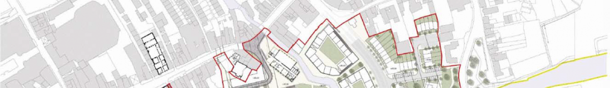


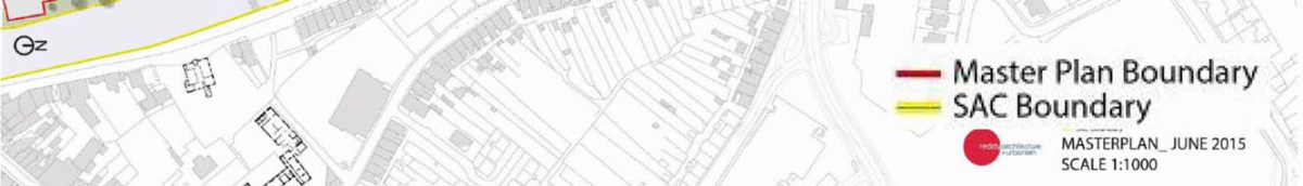
Section 8 Evaluation of Draft Masterplan Provisions
8.1 Overall Findings
The overall findings of the SEA are that:
The Council have integrated all recommendations arising from the SEA, Appropriate Assessment and Flood Risk Assessment processes into the Masterplan, facilitating compliance of the Masterplan with various European and National legislation and Guidelines relating to the protection of the environment and the achievement of sustainable development.
The Masterplan facilitates the reuse and regeneration of brownfield lands thereby contributing towards a higher efficiency of land utilisation, sustainable mobility and a reduction in the need to develop greenfield lands on the outskirts of the City. By reducing the need to develop greenfield lands, potential adverse effects upon ecology, landscape designations, architectural and archaeological heritage and soil will be avoided. By contributing towards sustainable mobility, the Masterplan would be likely to contribute towards compliance with targets relating to greenhouse gas emissions, energy usage and air and noise emissions.
Some Masterplan provisions would be likely to result in significant positive effects such as contributions towards achieving sustainable mobility and the protection of ecology, archaeological heritage and the status of waters.
Some Masterplan provisions would have the potential to result in significant negative environmental effects however these effects will be mitigated by mitigation measures, including those which have been integrated into the Masterplan (see Section 9).
8.2 Methodology
This section evaluates the provisions of the Masterplan. The relevant aspects of the current state of the environment (see Section 4) and the Strategic Environmental Objectives (see Section 5 and Table 7.1) are used in the evaluation of Masterplan provisions.
The provisions of the Masterplan are evaluated using compatibility criteria (see Table 8.1 below) in order to determine how they would be likely to affect the status of the SEOs. The SEOs and the alternatives are arrayed against each other to identify which interactions - if any - would cause effects on specific components of the environment. Where the appraisal identifies a likely conflict with the status of an SEO the relevant SEO code is entered into the conflict column - e.g. B1 which stands for the SEO likely to be affected - in this instance ‘to ensure compliance with the Habitats and Birds Directives with regard to the protection of Natura 2000 Sites and Annexed habitats and species*’.
The interactions identified are reflective of likely significant environmental effects**;
1. Interactions that would be likely to improve the status of a particular SEO would be likely to result in a significant positive effect on the environmental component to which the SEO relates.
2. Interactions that would probably conflict with the status of an SEO and would be unlikely to be mitigated would be likely to result in a significant negative effect on the environmental component to which the SEO relates.
3. Interactions that would potentially conflict with the status of an SEO and would be likely to be mitigated would be likely to result in potential significant negative effects however these effects would be likely to be mitigated by measures which have been integrated into the Masterplan.
The degree to which effects can be determined is limited as the Masterplan will be implemented through lower tier decision making and project level environmental assessment as relevant. Mitigation measures to prevent or reduce significant adverse effects posed by the Masterplan are identified in Section 9 - these have been integrated into the Masterplan.
*‘Annexed habitats and species’ refer to those listed under Annex I, II & IV of the EU Habitats Directive and Annex I of the EU Birds Directive.
**These effects include secondary, cumulative, synergistic, short, medium and long-term permanent and temporary, positive and negative effects.
Table 8.1 Criteria for appraising the effect of Masterplan provisions on SEOs
|
Likely to Improve status of SEOs |
Probable Conflict with status of SEOs- unlikely to be mitigated |
Potential Conflict with status of SEOs- likely to be mitigated |
No Likely interaction with status of SEOs |
Table 8.2 Strategic Environmental Objectives*
|
EnvironmentalComponent |
SEO Code |
SEO |
|
Biodiversity, Flora and Fauna |
B1 |
To ensure compliance with the Habitats and Birds Directives with regard to the |
|
B2 |
To ensure compliance with Article 10 of the Habitats Directive with regard to the management of features of the landscape which - by virtue of their linear and continuous structure or their function act as stepping stones - are of |
|
|
B3 |
To avoid significant impacts on relevant habitats, species, environmental features or other sustaining resources and to ensure compliance with the Wildlife Acts 1976-2010 with regard to the protection of species listed on Schedule 5 of the principal Act |
|
|
Population and |
HH1 |
To protect populations and human health from exposure to incompatible landuses |
|
Soil |
S1 |
To avoid damage to the hydrogeological and ecological function of the soil resource |
|
Water |
W1 |
To maintain and improve, where possible, the quality and status of surface waters |
|
W2 |
To prevent pollution and contamination of ground water |
|
|
W3 |
To comply as appropriate with the provisions of the Flood Risk Management Guidelines |
|
|
Air and Climatic |
C1 |
To reduce travel related emissions to air and to encourage modal change from car to more sustainable forms of transport |
|
Material Assets |
M1 |
To serve new development with adequate and appropriate waste water treatment infrastructure |
|
M2 |
To serve new development with adequate drinking water that is both wholesome and clean |
|
|
M3 |
To reduce waste volumes, minimise waste to landfill and increase recycling and reuse |
|
|
Cultural Heritage |
CH1 |
To protect archaeological heritage including entries to the Record of Monuments and Places and/or their context |
|
CH2 |
To protect architectural heritage including entries to the Record of Protected Structures and Architectural Conservation Areas and their context |
|
|
Landscape |
L1 |
To avoid significant adverse impacts on the landscape - especially with regard to protected views |
*See Section 5 for a description of Strategic Environmental Objectives.
**‘Annexed habitats and species’ refer to those listed under Annex I, II & IV of the EU Habitats Directive and Annex I of the EU
Birds Directive.
8.3 Appropriate Assessment and Flood Risk Assessment
A Stage 2 Appropriate Assessment (AA) and a Flood Risk Assessment (FRA) have both been undertaken alongside the preparation of the Masterplan.
The requirement for AA is provided under the EU Habitats Directive (Directive 1992/43/EEC). The requirement for FRA is provided under ‘The Planning System and Flood Risk Management Guidelines for Planning Authorities’ (DEHLG and OPW, 2009).
The AA concluded that the Masterplan will not affect the integrity of the Natura 2000 network* and the FRA has facilitated the integration of flood risk management considerations into the Masterplan.
The preparation of the Masterplan, SEA, AA and FRA has taken place concurrently and the findings of the AA and FRA have informed both the Masterplan and the SEA. All recommendations made by the AA and SEA were integrated into the Masterplan.
*Except as provided for in Section 6(4) of the Habitats Directive, viz. There must be:
(a) no alternative solution available;
(b) imperative reasons of overriding public interest for the plan/programme/project to proceed; and
(c) adequate compensatory measures in place.
8.4 Potential Adverse Effects and their Determination
Environmental impacts which occur, if any, will be determined by the nature and extent of multiple or individual projects and site specific environmental factors.
Avoidance of conflict with SEOs and the environment is dependent upon compliance with mitigation measures, including those which have emerged through the SEA, AA and FRA processes and which have been integrated into the Masterplan. The potentially significant adverse environmental effectsarising from implementation of the Masterplan are detailed on Table 8.3 below.
Table 8.3 Potentially Significant Adverse Effect, if unmitigated
|
Environmental/Component |
Potentially Significant Adverse Effect, if unmitigated |
|
Biodiversity and Flora and Fauna |
Loss of/disturbance to biodiversity with regard to Natura 2000 Sites, including the River Barrow and River Nore candidate Special Area of Conservation and the River Nore Special Protection Area |
|
Population and Human Health |
Spatially concentrated deterioration in human health |
|
Soil |
Damage to the hydrogeological and ecological function of soil |
|
Water |
Potential interactions with the status of water bodies (River Nore, River Breagagh and groundwater) and entries to the WFD Register of Protected Areas*, arising from: |
|
Air and Climatic Factors and Sustainable |
Failure to contribute towards sustainable transport and associated impacts (energy usage and emissions to air including noise and greenhouse gases) |
|
Material Assets |
The need to provide adequate and appropriate water services (it is the function of Irish Water to provide for such needs) |
|
Archaeological and |
Effects on the Zone of Archaeological Potential, St. Francis Abbey, Kilkenny Town wall, Evans Tower, entries to the Record of Monuments and Places and other archaeological heritage |
|
Landscape |
Occurrence of adverse visual impacts especially with respect to protected views and prospects |
8.5 Interrelationship between Environmental Components
The SEA Directive requires the Environmental Report to include information on the likely significant effects on the environment, including on issues such as biodiversity, fauna, flora, population, human health, soil, water, air, climatic factors, material assets, cultural heritage including architectural and archaeological heritage, landscape and the interrelationship between the above factors.
Likely significant effects on environmental components which are identified include those which are interrelated; implementation of the Masterplan will not affect the interrelationships between these components. The presence of significant interrelationships between environmental components is identified on Table 8.4.
*The River Nore is a designated Salmonid water under SI 293 of 1988 and groundwater under the area is listed on the Register for groundwater that is used for drinking water.
Table 8.4 Presence of Interrelationships between Environmental Components
|
Component |
Biodiversity, |
Population |
Soil |
Water |
Air and |
Material |
Cultural |
Landscape |
|
Biodiversity, |
No | Yes | Yes | Yes | Yes | No | Yes | |
|
Population |
Yes | Yes | Yes | Yes | No | No | ||
|
Soil |
Yes | No | Yes | No | No | |||
|
Water |
No | Yes | No | No | ||||
|
Air and |
Yes | No | NO | |||||
|
Material |
Yes | Yes | ||||||
|
Cultural |
Yes | |||||||
|
Landscape |
8.6 Cumulative Effects
Cumulative effects are one of the types of effects which have been considered by the assessment of the Masterplan provisions. Cumulative effects can be described as the addition of many small impacts to create one larger, more significant, impact.
There are 2 types of potential cumulative effects that have been considered, namely:
Potential intra-Plan cumulative effects - these arise from the interactions between different types of potential environmental effects resulting from a plan, programme, etc. The interrelationships between environmental components that help determine these potential effects are identified on Table 8.4 e.g. interrelationships between: human health and air quality; human health and water quality; human health and flood risk; and ecology and water quality.
Potential inter-Plan cumulative effects - these arise when the effects of the implementation of one plan occur in combination with those of other plans, programmes, projects, etc.
Effects that may arise as a result of implementing the Masterplan have been mitigated to the extent that the only residual adverse effects likely to occur are those which are identified under Section 8.7.
With regard to potential inter-Plan cumulative environmental effects, these occur as a result of the combination of: potential environmental effects which are identified by the assessment; and the effects arising from other legislation, plans, programmes or developments arising. Other legislation, plans, programmes or developments arising which have been considered by the assessment of environmental effects include those which are detailed under Sections 2.5, 4 and 5.
The SEA undertaken for the Masterplan has taken account of the need for the implementation of the Masterplan to comply with all environmental legislation and align with and cumulatively contribute towards – in combination with other users and bodies and their plans etc. – the achievement of the objectives of the regulatory framework for environmental protection and management.
In considering the relationship with legislation and other plans and programmes it is important to note that the Masterplan will be implemented within an area which is already subject to existing plans and programmes for a range of sectors [e.g. water management, land use, energy] at a range of levels [e.g. National, River Basin District, Regional, County and City] that are already subject to SEA and AA.
The assessment of the likely inter-Plan cumulative environmental effects requires knowledge of the likely effects of all plans/developments under consideration. Taking into account available information, potential cumulative effects include those resulting from the Masterplan, the Regional Planning Guidelines for the South East, the Kilkenny County Development Plan, the Kilkenny City Development Plan, the South Eastern River Basin Management Plan and associated Programme of Measures, outputs from the South Eastern Catchment Flood Risk Assessment and Management Study, Irish Water’s Proposed Capital Investment Plan 2014-2016 and relevant projects. Such effects include:
Potential cumulative effects upon the use of water and wastewater treatment capacity;
Potential cumulative effects upon surface and ground water quality;
Potential cumulative effects arising from linear developments;
Potential cumulative effects on flood risk; and
Potential cumulative positive effects arising from improved and secured ecological connectivity along and adjacent to the River Nore.
Some of the issues covered by the Masterplan provisions have been considered already in higher tier plans including the South Eastern Regional Planning Guidelines, the Kilkenny County Development Plan and the Kilkenny City Development Plan. The solutions to these issues are often regional/county solutions which are subject their own consenting procedures. Works arising outside of the Masterplan area as a result of providing for new development within the Masterplan area including those arising as a result of the cumulative provision of development in the wider City would potentially conflict with a number of environmental components, across the wider City area and beyond, including: ecology, the status of water bodies and the landscape. Some of these conflicts would be mitigated by measures which have been integrated into the Masterplan (see Section 9) with additional mitigation provided through measures arising out of separate consent procedures.
8.7 Residual Adverse Effects
Section 9 outlines the measures that have mitigated and will mitigate the potential negative effects that are detailed above. Potential significant residual adverse effects likely to occur - considering the extent of detail provided by the Masterplan and assuming that all mitigation measures are complied with by development - are identified for each of the environmental components on Table 8.5 below.
Table 8.5 Potential Significant Residual Adverse Effects
|
Environmental/Component |
Potential Significant Residual Adverse Effect once all mitigation is adhered to |
|
Biodiversity and Flora and |
None |
|
Population and Human |
Flood related risks remain due to uncertainty with regard to extreme weather events |
|
Soil |
None |
|
Water |
Flood related risks remain due to uncertainty with regard to extreme weather events |
|
Air and Climatic Factors |
None |
|
Material Assets |
Residual wastes to be disposed of in line with higher level waste management policies |
|
Archaeological and |
Potential alteration to the context and setting of designated cultural heritage however these will occur in compliance with provisions of the Masterplan and |
|
Landscape |
None |
8.8 Detailed Evaluation
8.8.1 Section 1 Introduction
|
Likely to Improve status of SEOs |
Probable Conflict |
Potential Conflict |
No Likely interaction with status of SEOs |
|
|
SEA and AA measures |
||||
|
This section includes many of the mitigation measures which have been integrated into the Masterplan through the SEA and AA processes. These are reproduced with the high level mitigating Strategies which are contained within the Masterplan under Section 9 of this report. |
B1 B2 B3 HH1 S1 |
|||
|
Commentary: |
||||
8.8.2 Section 2 Context
| Likely to Improve status of SEOs | Probable Conflict with status of SEOs - unlikely to be mitigated | Potential Conflict with status of SEOs- likely to be mitigated |
No Likely interaction with status of SEOs | |
|
Vision arising from Public Consultation Workshops (Section 2.2.1) |
||||
|
To plan the area as a seamless complement to the medieval city as an inclusive place for an inter-generational Allow for the Government ‘Smarter Travel’ initiative published in 2009 and the ‘Mobility Management Plan’ |
B1 B2 B3 HH1 S1 W1 W2 W3 M1 M2 M3 C1 CH1 CH2 L1 |
B1 B2 B3 HH1 S1 |
||
|
Commentary: |
||||
8.8.3 Section 3 Analysis
| Likely to Improve status of SEOs | Probable Conflict with status of SEOs - unlikely to be mitigated | Potential Conflict with status of SEOs- likely to be mitigated |
No Likely interaction with status of SEOs | ||
|
Masterplan Objectives (Section 3.1.3) |
|||||
|
Arising from an analysis of the issues identified in the Kilkenny City and Environs Development 2014 -2020 Plan the |
B1 B2 B3 HH1 S1 W1 W2 W3 M1 M2 M3 C1 CH1 CH2 L1 |
B1 B2 B3 HH1 S1 W1 W2 W3 M1 M2 M3 CH1 CH2 L1 |
|||
|
Commentary: |
|||||
|
To support employment creation, innovation and lifelong learning. |
B1 B2 B3 HH1 S1 W1 W2 W3 M1 M2 M3 C1 CH1 CH2 L1 |
B1 B2 B3 HH1 S1 W1 W2 W3 M1 M2 M3 CH1 CH2 L1 |
|||
|
Commentary: |
|||||
|
To promote the sustainable development of the city |
B1 B2 B3 HH1 S1 W1 W2 W3 M1 M2 M3 C1 CH1 CH2 L1 |
B1 B2 B3 HH1 S1 W1 W2 W3 M1 M2 M3 CH1 CH2 L1 |
|||
|
Commentary: |
|||||
|
To provide the highest quality living environments possible |
B1 B2 B3 HH1 S1 W1 W2 W3 M1 M2 M3 C1 CH1 CH2 L1 |
B1 B2 B3 HH1 S1 W1 W2 W3 M1 M2 M3 CH1 CH2 L1 |
|||
|
Commentary: |
|||||
|
To guide the location and pattern of development whilst ensuring a relatively compact urban form is |
B1 B2 B3 HH1 S1 W1 W2 W3 M1 M2 M3 C1 CH1 CH2 L1 |
B1 B2 B3 HH1 S1 W1 W2 W3 M1 M2 M3 CH1 CH2 L1 |
|||
|
Commentary: |
|||||
|
To promote balanced and sustainable economic development and employment by ensuring that a diverse |
B1 B2 B3 HH1 S1 W1 W2 W3 M1 M2 M3 C1 CH1 CH2 L1 |
B1 B2 B3 HH1 S1 W1 W2 W3 M1 M2 M3 CH1 CH2 L1 |
|||
|
Commentary: |
|||||
|
To develop an integrated transport strategy for the city linked to land use objectives, which facilitates access |
B1 B2 B3 HH1 S1 W1 W2 W3 M1 M2 M3 C1 CH1 CH2 L1 |
B1 B2 B3 HH1 S1 W1 W2 W3 M1 M2 M3 CH1 CH2 L1 |
|||
|
Commentary: |
|||||
|
To protect, conserve and enhance the built and natural heritage of the city |
B1 B2 B3 HH1 S1 W1 W2 W3 M1 M2 M3 C1 CH1 CH2 L1 |
C1 | |||
|
Commentary: |
|||||
|
To promote the regeneration of the city centre and to protect and promote the city centre as the commercial |
B1 B2 B3 HH1 S1 W1 W2 W3 M1 M2 M3 C1 CH1 CH2 L1 |
B1 B2 B3 HH1 S1 W1 W2 W3 M1 M2 M3 CH1 CH2 L1 |
|||
|
Commentary: |
|||||
|
To advance the redevelopment of the Bateman Quay site for civic and prime retail use |
B1 B2 B3 HH1 S1 W1 W2 W3 M1 M2 M3 C1 CH1 CH2 L1 |
B1 B2 B3 HH1 S1 W1 W2 W3 M1 M2 M3 CH1 CH2 L1 |
|||
|
Commentary: |
|||||
|
To provide a hierarchy of parks, open spaces and outdoor recreation areas and to use the river corridors of |
B1 B2 B3 HH1 S1 W1 W2 W3 M1 M2 M3 C1 CH1 CH2 L1 |
B1 B2 B3 HH1 S1 W1 W2 W3 M1 M2 M3 CH1 CH2 L1 |
|||
|
Commentary: |
|||||
*These rivers are partly designated within the Natura 2000 Network.
8.8.4 Section 4 Masterplan Strategies
| Likely to Improve status of SEOs | Probable Conflict with status of SEOs - unlikely to be mitigated | Potential Conflict with status of SEOs- likely to be mitigated |
No Likely interaction with status of SEOs | |
|
Connectivity and Movement Strategy (Section 4.1) |
||||
|
The Connectivity and Movement Strategy addresses a number of issues including Smarter Travel / Mobility Management |
B1 B2 B3 HH1 S1 W1 W2 W3 M1 M2 M3 C1 CH1 CH2 L1 |
B1 B2 B3 HH1 S1 W1 W2 W3 M1 M2 M3 CH1 CH2 L1 |
||
|
Commentary: |
||||
|
Conservation & Heritage Strategy (Section 4.2) |
||||
|
The Conservation and Heritage Strategy addresses both archaeology and architectural heritage and includes strategies for archaeology, heritage structures and existing structures. |
CH1 CH2 L1 | B1 B2 B3 HH1 S1 W1 W2 |
W3 M1 M2 M3 C1 |
|
|
Commentary: |
||||
|
Key Urban Design Strategy (Section 4.3) |
||||
|
The Key Urban Design Strategy incorporates a number of strategies including Movement Strategy, Public Realm |
B1 B2 B3 HH1 S1 W1 W2 W3 M1 M2 M3 C1 CH1 CH2 L1 |
B1 B2 B3 HH1 S1 W1 W2 W3 M1 M2 M3 CH1 CH2 L1 |
||
|
Commentary: |
||||
|
4.4 Sustainability Strategy |
||||
|
The Sustainability Strategy addresses various issues including Transport, Environmental Quality, Density and Mixed |
B1 B2 B3 HH1 S1 W1 W2 W3 M1 M2 M3 C1 CH1 CH2 L1 |
B1 B2 B3 HH1 S1 W1 W2 W3 M1 M2 M3 CH1 CH2 L1 |
||
|
Commentary: Contribution towards the protection of designated ecological sites (candidate Special Area of Conservation and Special Protection Area) and ecological connectivity |
||||
8.8.5 Section 5 Masterplan Proposals
| Likely to Improve status of SEOs | Probable Conflict with status of SEOs - unlikely to be mitigated | Potential Conflict with status of SEOs- likely to be mitigated |
No Likely interaction with status of SEOs | |
|
Connectivity and Movement Strategy (Section 4.1) |
||||
|
This section includes the final Masterplan design and phasing details. |
B1 B2 B3 HH1 S1 W1 W2 W3 M1 M2 M3 C1 CH1 CH2 L1 |
B1 B2 B3 HH1 S1 W1 W2 W3 M1 M2 M3 CH1 CH2 L1 |
||
|
Commentary: |
||||
Section 9 Mitigation Measures
9.1 Integration of Environmental Considerations
The Draft Masterplan has been prepared with environmental considerations being one of the key Masterplan informants and influences.
The undertaking of Strategic Environmental Assessment, Appropriate Assessment (see Section 9.3) and Flood Risk Assessment (see Section 9.4) has further informed the Draft Masterplan. By integrating related
recommendations into the Masterplan, the Council have ensured that both the beneficial environmental effects of implementing the Masterplan have been and will be maximised and that potential adverse effects have been and will be avoided, reduced or offset.
The text of the Masterplan outlines how the various Strategies in the Masterplan will contribute towards environmental protection and sustainable development. Key Strategies and the environmental components which they would benefit are identified in the subsections below.
In addition to these Strategies, proposals for development within the Masterplan area must comply as appropriate with the relevant provisions included within the Kilkenny City Development Plan 2014-2020. A number of City Plan provisions which contribute towards environmental protection and sustainable development are reproduced in an Appendix to the Masterplan and on Table 9.1 below. Proposals for development are required to adhere to these and the other provisions contained within the City Plan.
9.2 Strategies contained within the Masterplan
9.2.1 Connectivity and Movement Strategy
The Connectivity and Movement Strategy addresses a number of issues including Smarter Travel / Mobility Management Plan, Pedestrian and Cyclist Movement and Public Transport.
Likely Positive effects facilitated by this Strategy include the following:
Contribution towards a shift from car to more sustainable and nonmotorised transport modes
Contribution towards managing traffic flows and associated adverse effects on air quality
Contribution towards reductions in travel related greenhouse gas and other emissions to air
Contribution towards reduction in energy usage
9.2.2 Conservation and Heritage Strategy
The Conservation and Heritage Strategy addresses both archaeology and architectural heritage.
Likely Positive effects facilitated by this Strategy include the following:
Contribution towards the protection of architectural and archaeological heritage and its context by facilitating compliance with relevant legislation
9.2.3 Urban Design Strategy
The Urban Design Strategy addresses various issues including Movement Strategy, Archaeology Strategy, Environmental Strategy and Architectural Strategy.
Likely Positive effects facilitated by this Strategy include the following:
Contribution towards a shift from car to more sustainable and nonmotorised transport modes
Contribution towards managing traffic flows and associated adverse effects on air quality
Contribution towards reductions in travel related greenhouse gas and other emissions to air
Contribution towards reduction in energy usage
Contribution towards the protection of architectural and archaeological heritage and its context by facilitating compliance with relevant legislation
Contribution towards the protection of designated ecological sites (candidate Special Area of Conservation and Special Protection Area) and ecological connectivity
Contribution towards the protection of status of surface waters
9.2.4 Sustainability Strategy
The Sustainability Strategy addresses various issues including Transport, Environmental Quality, Energy and Water Conservation.
Likely Positive effects facilitated by this Strategy include the following:
Contribution towards a shift from car to more sustainable and non-motorised transport modes
Contribution towards managing traffic flows and associated adverse effects on air quality
Contribution towards reductions in travel related greenhouse gas and other emissions to air
Contribution towards reduction in energy usage
Contribution towards waste management
Contribution towards the protection of designated ecological sites (candidate Special Area of Conservation and Special Protection Area) and ecological connectivity
Contribution towards the protection of status of surface waters
9.3 Appropriate Assessment
The Appropriate Assessment resulted in a number of updates being made to the Masterplan which are detailed below:
Removal of all proposals for development within the Natura 2000 sites.
Insertion of the following text into Section 1 Introduction:
This Masterplan requires that:
1. All projects and plans arising from the Masterplan will be screened for the need to undertake Appropriate Assessment under Article 6 of the Habitats Directive. A plan or project will only be authorised after the Council has ascertained, based on scientific evidence, Screening for Appropriate Assessment, and a Stage 2 Appropriate Assessment where necessary, that:
a. The Plan or project will not give rise to significant adverse direct, indirect or secondary effects on the integrity of any European site (either individually or in combination with other plans or projects); or
b. The Plan or project will have significant adverse effects on the integrity of any European site (that does not host a priority natural habitat type/and or a priority species) but there are no alternative solutions and the plan or project must nevertheless be carried out for imperative reasons of overriding public interest, including those of a social or economic nature. In this case, it will be a requirement to follow procedures set out in legislation and agree and undertake all compensatory measures necessary to ensure the protection of the overall coherence of Natura 2000; or
c. The Plan or project will have a significant adverse effect on the integrity of any European site (that hosts a natural habitat type and/or a priority species) but there are no alternative solutions and the plan or project must nevertheless be carried out for imperative reasons for overriding public interest, restricted to reasons of human health or public safety, to beneficial consequences of
d. primary importance for the environment or, further to an opinion from the Commission, to other imperative reasons of overriding public interest. In this case, it will be a requirement to follow procedures set out in legislation and agree and undertake all compensatory measures necessary to ensure the protection of the overall coherence of Natura 2000.
2. No projects giving rise to significant cumulative, direct, indirect or secondary impacts on Natura 2000 sites arising from their size or scale, land take, proximity, resource requirements, emissions (disposal to land, water or air), transportation requirements, duration of construction, operation, decommissioning or from any other effects shall be permitted on the basis of this Masterplan (either individually or in combination with other plans or projects*).
Proposals for development within the Masterplan area must comply as appropriate with the relevant provisions included within the Kilkenny City Development Plan 2014- 2020. A number of City Plan provisions which contribute towards environmental protection and sustainable development are reproduced in the Masterplan.
3. Proposals for development should ensure that they are consistent with all the provisions contained within the City Plan.
Insertion of the following text into Section 4.3.2 Environment Strategy:
Developments which may lead to adverse impacts on the River Nore will not be permitted as part of the Masterplan. Linear Park development and associated works will not be permitted within the boundaries of either Natura 2000 site, unless it is demonstrated, by means of project level Appropriate Assessment, that such development will not lead to adverse impacts on the integrity of the sites**.
Insertion of the following text into Section 4.3.3 Linear Park Strategy:
In addition to the provision of walking and cycling facilities along the river bank, access to the river for water based leisure facilities will be considered in the detailed design of the park subject to compliance with the EU Habitats and Birds Directives.
Insertion of the following text into Section 4.3.8 New Street / Lanes Strategy:
Have regard to the natural heritage and ensure compliance with the requirements of the EU Habitats and Birds Directives.
Insertion of the following text into Section 4.4.7 Water Conservation:
Details of this proposal will need to consider the potential for adverse effects on the ecology of the River Barrow and Nore cSAC and the River Nore SPA as required under Article 6 of the EU Habitats Directive
*Except as provided for in Section 6(4) of the Habitats Directive, viz. There must be: a) no alternative solution available b) imperative reasons of overriding public interest for the
plan to proceed; and c) Adequate compensatory measures in place.
**Except as provided for in Section 6(4) of the Habitats Directive, viz. There must be: a) no alternative solution available, b) imperative reasons of overriding public interest for the
plan to proceed; and c) Adequate compensatory measures in place.
9.4 Flood Risk Assessment
The Flood Risk Assessment assessed the flood risk in the context of the proposed development and identified suitable mitigation measures which were incorporated into the Masterplan where appropriate, including setting finished floor levels for the development.
Table 9.1 Selected provisions from the Kilkenny City Development 2014-2020 and potential adverse effects, if unmitigated
|
Environmental/ |
Potential |
Kilkenny City Development Plan Provision (policy/objective/development management standard) |
|
Biodiversity and |
Loss of/disturbance |
See also measures on this table under Soil, Water, Flood Risk Management and Drainage and Water Services |
|
Population and |
Spatially |
See also measures on this table under Soil, Water, Water Services, Air and Climatic Factors and Flood Risk Management |
|
Soil |
Damage to the |
See also measures on this table under Biodiversity, Flora and Fauna, Water, Water Services and Flood Risk Management |
|
Water |
Potential interactions |
See also measures on this table under Biodiversity, Flora and Fauna, Soil, Water Services and Flood Risk Management |
|
Flood Risk |
Increase in flood risk |
See also measures on this table under Human Health |
|
Water Services |
The need to provide |
See also measures on this table under Human Health |
|
Air and Climatic |
Failure to contribute |
See also measures on this table under Human Health |
|
Waste |
Increases in waste levels |
To implement the Joint Waste Management Plan for the South East Region |
|
Archaeological |
Effects on the Zone of Archaeological |
See also measures on this table under Landscape |
|
Landscape |
Occurrence of |
See also measures on this table under Biodiversity, Flora and Fauna, Archaeological Heritage and Architectural Heritage |
Section 10 Monitoring Measures
10.1 Introduction
The SEA Directive requires that the significant environmental effects of the implementation of plans and programmes are monitored. The monitoring of potential significant effects within
the Masterplan area will be undertaken in conjunction with the monitoring programme for Proposed Variation No. 1 to the Kilkenny City Development Plan. The indicators below are the same as those included as part of the monitoring programme detailed for Proposed Variation No. 1.
Monitoring can enable, at an early stage, the identification of unforeseen adverse effects and the undertaking of appropriate remedial action.
10.2 Indicators and Targets
Monitoring is based around indicators which allow quantitative measures of trends and progress over time relating to the Strategic Environmental Objectives identified in Section 4
and used in the evaluation. Each indicator to be monitored is accompanied by the target(s) which were identified with regard to the relevant strategic actions.
Table 10.1 overleaf shows the indicators and targets which have been selected for monitoring the likely significant environmental effects of implementing the Masterplan, if unmitigated.
The Monitoring Programme may be updated to deal with specific environmental issues - including unforeseen effects - as they arise. Such issues may be identified by the Council or identified to the Council by other agencies.
10.3 Sources
Measurements for indicators generally come from existing monitoring sources. Existing monitoring sources include those maintained by the Council and the relevant authorities e.g. the Environmental Protection Agency, the National Parks and Wildlife Service and the Central Statistics Office.
Internal monitoring of the environmental effects of grants of permission in the Council will provide monitoring of various indicators and targets on a grant of permission by grant of permission* basis. Where significant adverse effects - including positive, negative, cumulative and indirect - have the potential to occur upon, for example, entries to the RMP, entries to the RPS or ecological networks as a result of the undertaking of individual projects or multiple individual projects such instances should be identified and recorded and should feed into the monitoring evaluation.
10.4 Reporting
A stand-alone Monitoring Report on the significant environmental effects of implementing Proposed Variation No. 1 to the Kilkenny City Development Plan and the Masterplan will be prepared in 2017 and again in 2019. The Kilkenny City Development Plan will be reviewed in 2019-2020 and monitoring arrangements will be re-examined at this stage. Monitoring reports should address the indicators set out below.
The Council is responsible for the ongoing review of indicators and targets, collating existing relevant monitored data, the preparation of monitoring evaluation report(s), the publication of these reports and, if necessary, the carrying out of corrective action.
10.5 Thresholds
Thresholds at which corrective action will be considered include:
The occurrence of flood events;
Court cases taken by the Department of Arts, Heritage and the Gaeltacht regarding impacts upon archaeological heritage including entries to the RMP;
Complaints received from statutory consultees regarding avoidable environmental impacts resulting from development which is granted permission in the Masterplan area;
Boil notices on drinking water; and
Fish kills.
*The likely significant effects of development proposals on environmental sensitivities are further determined during the development management process. By documenting this determination (e.g. whether a proposed development will impact upon a Protected Structure or whether a proposed development can be adequately served with water services) while granting permissions, or at a later date, the requirement to monitor the effects of implementing the Masterplan can be achieved.
Table 10.1 Selected Indicators, Targets and Monitoring Sources
|
Environmental |
Selected Indicator(s) |
Selected Target(s) |
Source (Frequency) |
|
Biodiversity, |
B1: Conservation status of habitats and species as assessed under Article 17 of the Habitats Directive |
B1: Maintenance of favourable conservation status |
Internal monitoring of environmental effects of grants of permission (grant by grant). |
|
B2: Percentage loss of functional connectivity without |
B2: No significant ecological networks or parts |
Internal monitoring of environmental effects of grants of permission (grant by grant). |
|
|
B3i: Number of significant impacts on relevant habitats, species, environmental features or other sustaining |
B3i: Avoid significant impacts on relevant habitats, |
Internal monitoring of environmental effects of grants of permission (grant by grant). |
|
|
Population |
PHH1: Occurrence (any) of a spatially concentrated |
PHH1: No spatial concentrations of health problems |
Consultations with EPA and Health Service Executive (at |
|
Soil |
S1: Soil extent and hydraulic connectivity |
S1: To minimise reductions in soil extent and |
Internal monitoring of environmental effects of grants of |
|
Water |
W1i: Classification of Overall Status (comprised of |
W1i: Not to cause deterioration in the status of any |
Internal monitoring of environmental effects of grants of permission (grant by grant). |
|
W2: Groundwater Quality Standards and Threshold |
W2: Not to affect the ability of groundwaters to |
Internal monitoring of environmental effects of grants of permission (grant by grant). |
|
|
W3: Number of incompatible developments granted |
W3: Minimise developments granted |
Internal monitoring of environmental effects of grants of permission (grant by grant). |
|
|
Material |
M1: Number of new developments granted permission which can be adequately and appropriately served with |
M1: All new developments granted permission to be |
Internal monitoring of environmental effects of grants of |
|
M2: Number of non-compliances with the 48 |
M2: No non-compliances with the 48 parameters |
EPA The Provision and Quality of Drinking Water in Ireland |
|
|
M3: Preparation and implementation of construction and environmental management plans |
M3: For construction and environmental |
EPA National Waste Reports |
|
|
Air and |
C1: Percentage of the City’s population travelling to work, school or college by public transport or nonmechanical |
C1: An increase in the percentage of the City’s |
CSO Population Data (every c. 5 years). |
|
Cultural |
CH1: Percentage of entries to the Record of Monuments |
CH1: Protect entries to the Record of Monuments |
Internal monitoring of environmental effects of grants of |
|
CH2: Percentage of entries to the Record of Protected |
CH2: Protect entries to the Record of Protected |
Internal monitoring of environmental effects of grants of |
|
|
Landscape |
L1: Number of complaints received from statutory |
L1: No developments permitted which result in |
Internal monitoring of environmental effects of grants of |
*Good status as defined by the WFD equates to approximately Q4 in the current national biological classification of rivers.
Contents
Materials
Observations
Observations
Nature Conservation - SEA
While overall the SEA is comprehensive with respect to the natural heritage it has unfortunately been restricted to looking at designated sites within a 15km radius which is a rule of thumb often...