There does not seem to be much thought gone into how the plan fits in with the rest of Kilkennys Smarter Travel objectives. There is no indication how people are meant to travel from one area of the...
4.3 Urban Design Strategy
Closed23 Jun, 2015, 7:00am - 21 Jul, 2015, 6:00pm
Urban Design Strategy (Download Urban Design Strategy)
4.3.1 Character Areas
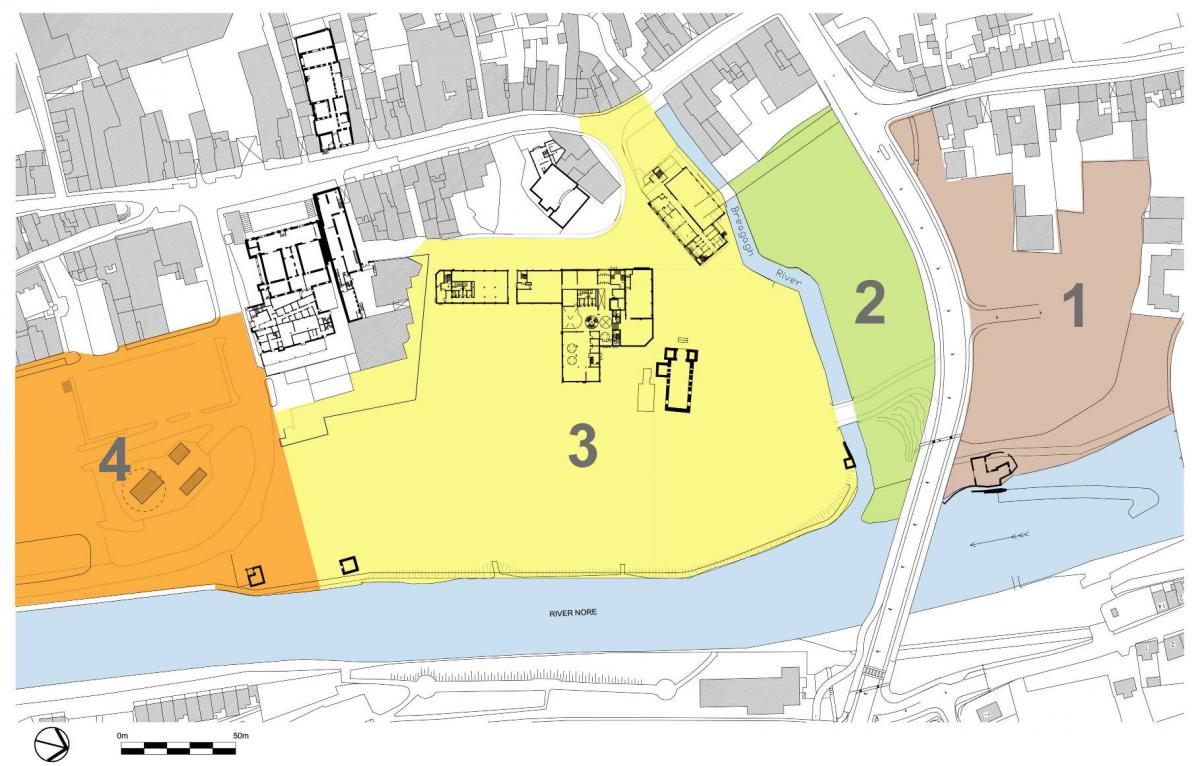
The Abbey Creative Quarter area can be subdivided into five distinctive character areas. The character of each area is distinguished by the prevailing scale, built character and land uses. Some characteristics are shared by more than one area, and the boundaries between some areas may also overlap. However, in the main, there is a distinctive quality to each of the four character areas, which is useful to consider when developing a policy on scale for the future development of the Quarter.
1. Sweeneys Orchard (The Gardens )
This area is located to the rear (east) of Vicar Street which is a primarily residential street with some commercial uses, such as the Kilkenny Inn Hotel and north of the Central Access Scheme. The garden is a notable feature of the individual residential plots with commercial uses converting their rear gardens into car parking areas.
The area itself was used by Diageo as a Marshalling Yard for its articulated vehicles. The ground is predominantly covered with a concrete. The prevailing height is 2 to 3 storeys.
While abutting the River Nore the construction of a 2.4 metre high wall along its south and east boundaries removes its connection with the river.
2. Bregagh North (Mills and Industry)
This area is located to the north of the River Bregagh and to the south of the Central Access Scheme. It was used by Diageo as a Marshalling Yard for their larger articulated vehicels and as a car park. The area is visually dominated by the Truck Wash Building and concrete yard which extends over the majority of the area. Both the Truck Wash and Hop Store buildings will be removed from the site prior to the Council taking possession.
Prevailing height of this area is 2 storeys.
Localised sections of upstanding walls remains associated with the Bull Inn remain along the western boundary.
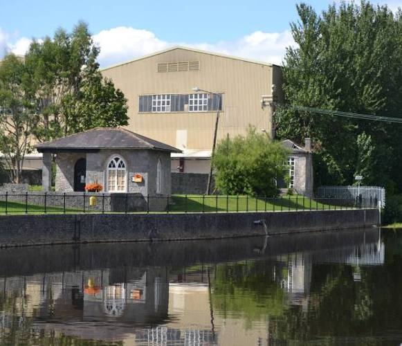
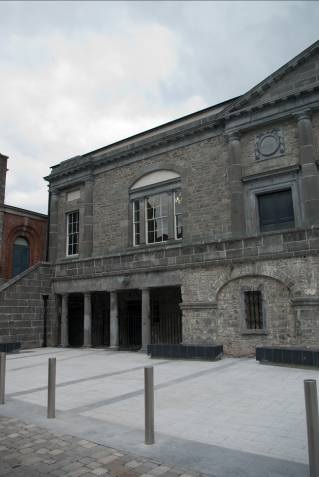
3. The Brewery
This area is currenlty dominated by the existing St.Francis Abbey Brewery Buildings consisting of; Bottling Store, Kegging Store , the Mayfair Building, Brewhouse Building, and the Maturation Building.
The large Maturation Tanks extending to effectively seven stories in height (25 metres) are currently the dominant feature in this area. However most of the Diageo Brewery Buildings will be removed from the site prior to the Council taking possession. It is proposed to retain the Mayfair and Brewhouse Buildings.
The Brewhouse Building will be the most significant building within this character area. It has a strong industrial aesthetic whose design in part is reminiscent of the Bauhaus Building (The Bauhaus was first founded by Walter Gropius in Weimar. It was founded with the idea of creating a "total" work of art in which all arts, including architecture, would eventually be brought together. The Bauhaus style later became one of the most influential currents in modern design, modernist architecture and art, design and architectural education. The Bauhaus had a profound influence upon subsequent developments in art, architecture, graphic design, interior design, industrial design, and typography.) Sections of the building are clad in red brick with a framed structure with glazed infill sections characterising the remainder of the building. It is a 3 and part 4 storey building with chimneys punctuating the skyline.
St.Francis Abbey, a National Monument, sits at the centre of this area. It is unfortunately surrounded by a concrete yard reflecting its location within a modern brewery.
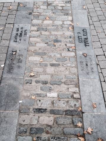
Kilkenny’s City Wall, also a National Monument sitting on the southern bank of the River Bregagh forms the northern boundary of this area with Evans Turret located at the end of the city wall at the confluence of the Rivers Nore and Bregagh.
While abutting the River Nore it has no connection with the river.
4. The Market Yard
Immediately adjoining this area is Kilkenny Courthouse. This protected structure was recently extended to its rear (east) with a modern 4 and part 5 storey granite clad building.
This area is primarily retail uses with some commercial. It contains fine grain and larger footprint/scale buildings. The area is characterised by the expansion surface level public car park providing spaces for approximately 700 cars. While abutting the River Nore this area has no connection with the river.
The prevailing height is 2 storeys (Dunnes Stores) with notable exceptions such as Winstons and the Bank of Ireland Building which are 4 and 3 storeys in height respectively.
Conclusion
The Character Areas described above are important in considering the appropriate scale of new development in Kilkenny and are used to inform guidance on scale.
4.3.2 Environmental Strategy
In addition to the archaeological requirements of the site, the location of the riverside park, adjoining the River Nore, and the designation of the river as a candidate Special Area of Conservation (cSAC) and Special Protection Area (SPA), will need to be considered in the preparation of the detailed design of the scheme. This will be very significant factor in the design process and it is likely to have a very significant impact on layout and facilities to be provided within the riverside park area.
Developments which may lead to adverse impacts on the River Nore will not be permitted as part of the Masterplan. Linear Park development and associated works will not be permitted within the boundaries of either Natura 2000 site, unless it is demonstrated, by means of project level Appropriate Assessment, that such development will not lead to adverse impacts on the integrity of the sites.
The boundary of the cSAC as indicated was provided by the National Parks and Wildlife Service (NPWS). This boundary was drawn using the OSI 6 inch mapping overliad on the most current OSI Mapping. The intended boundary of the cSAC in the vicinity of the masterplan area is likely to correspond with the SPA boundary (drawn using the most recent mapping.)
A detailed Environmental Report has been prepared by Kilkenny County Council. This report is available in full in Appendix B;
4.3.3 Linear Park Strategy
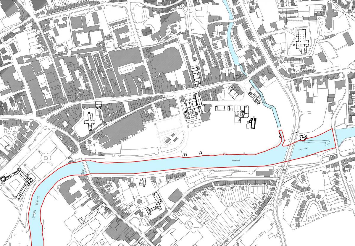
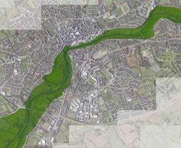
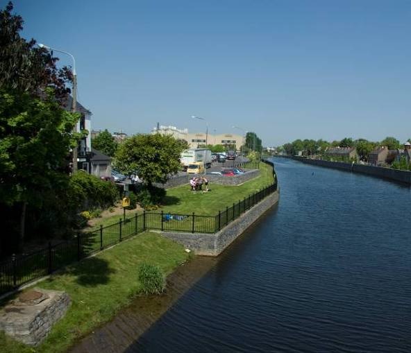
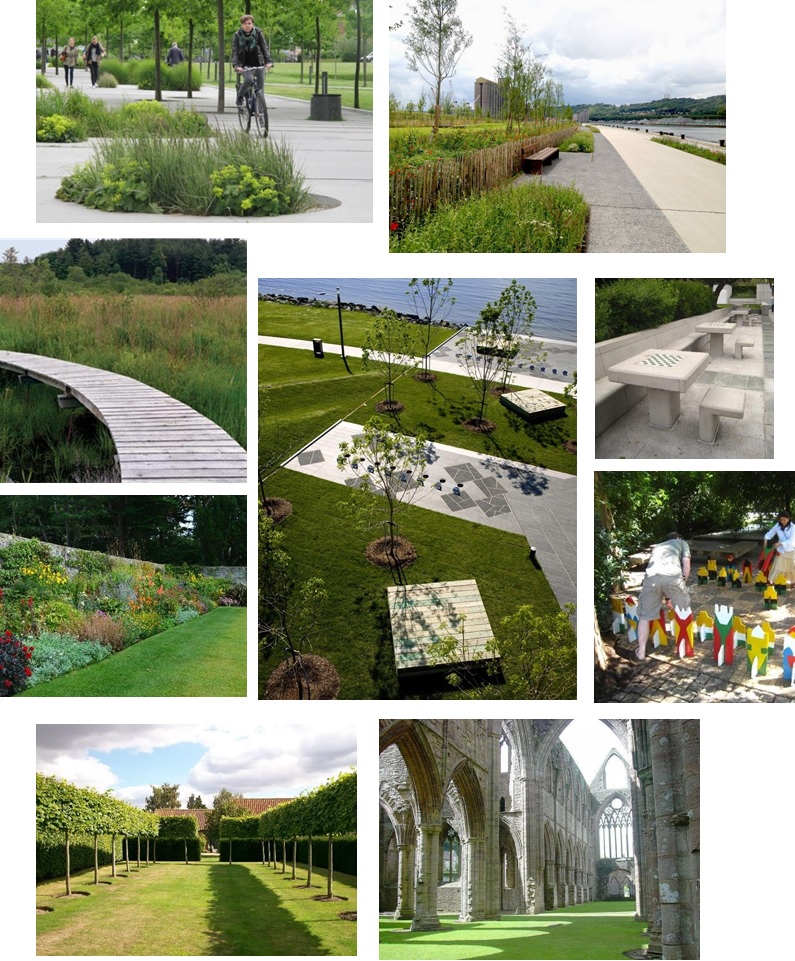
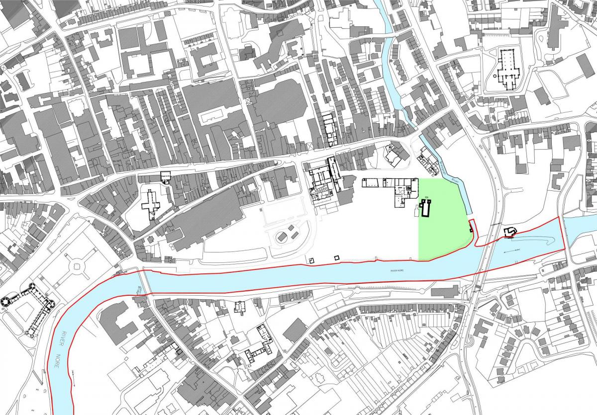
At the heart of the city lies the River Nore flowing from north to south and dividing the town into two distinct halves. The River is the predominant landscape feature in the City providing many opportunities for the enjoyment of nature in the centre of the City. Historically, and more recently, there has been emphasis placed on providing access to the river with a series of river walks on both banks of the river to the north and south of the town. The missing link is right at the centre of the city along Bateman Quay where pressure from development and, in particular, car parking has detracted from the riverside experience. The development of a new City ‘River Garden’ seeks to provide a redress to this missing link.
To achieve these objectives the Council ran a competition in 2014 for the design of a Linear Park and subsequently appointed Mitchell & Associates (Landscape Architects) to prepare design for the Linear Park along the River Nore within the Abbey Quarter Area.
The Council has secured funding from Failte Ireland for the development of a linear park which is to occupy the section of river bank in the centre of the City between John’s Bridge and Green’s Bridge and, by doing so, increase connectivity to the already established riverside walks further up and down stream. This Linear Park represents the first phase of delivery of the development principles set down in the Masterplan for Abbey Creative Quarter.
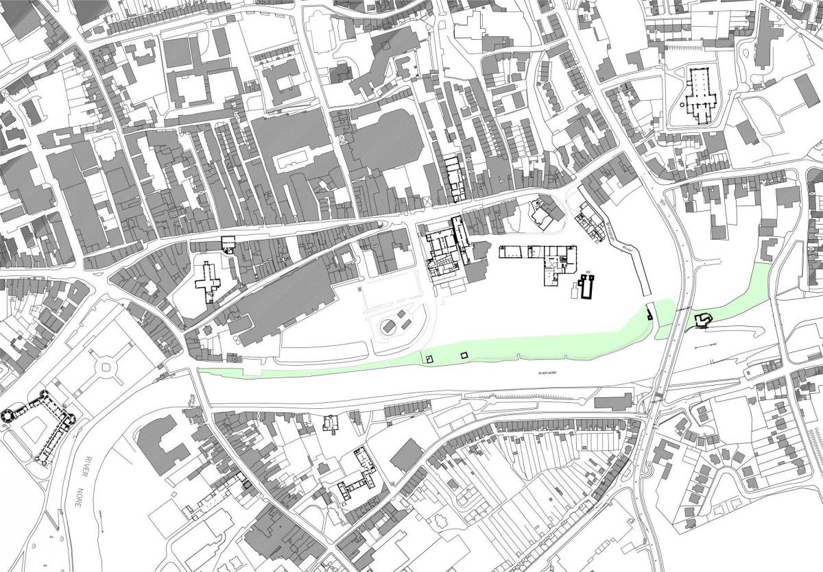
Walking Trails
The Noreside walking trails include the Nore Valley Walk from the city centre to Bennettsbridge stretching South for 11km, and the Bishops Meadows Walk to the North of the city stretching north for 2.6km. These walks are both on the western bank of the River Nore. Currently there is a fracture in this trail as the Smithwick’s Brewery site does not allow public access along the river bank.
In line with objective 6B of the Kilkenny City & Environs Development Plan 2014 - 2020 “To complete the River Nore Linear Park within the lifetime of the Plan”, provision has been made in the Masterplan for the development of a riverside park along the western bank of the River Nore between Bateman Quay and Greens Bridge. This riverside park will complete the missing link in the Nore Valley Walk.
This riverside park will incorporate a meandering circulation route along the riverbank, accommodating both Pedestrians and Cyclists.
The detailed design of the riverside garden will divide the park into a number of sections, with different planting and landscape layouts, suitable to its riverside location, provided along the route. This will create interesting focal points in the garden, creating a sense of place and inviting people to further explore the garden.
The garden will be designed to reflect the former and historical uses of the site, with the layout of the site to give consideration to the location of burgage plots and historical planting such as orchards within the site. Subject to their availability, it is also intended to incorporate elements from the brewing process into the park design as features, to reflect the former use of the site as a brewery.
River Amenities
The river is at the heart of the city and the completion of the linear park through the city will help to provide a focus onto the river. The creation of the park will ensure that the river is opened up to the city, inviting people to enjoy and embrace the opportunities presented to the city by the river.
In addition to the provision of walking and cycling facilities along the river bank, access to the river for water based leisure facilities will be considered in the detailed design of the park subject to compliance with the EU Habitats and Birds Directives.
The existing boat slip to the north of the confluence with the River Breagagh will be incorporated into the park design providing continued access for the Canoes, Kayaks and other boats to the river.
In addition to the protection and improvement of existing access points to the river, the design of the park will look to facilitate additional access points to the river, subject to environmental considerations. This will facilitate access to the river for other leisure uses such as swimming, which has become increasingly popular along this section of the river in recent years with the annual River Nore Swim and the holding of various national and international triathlon events in the city.
Other Amenities
The design of the park will also provide for a skate park facility within the masterplan area.
4.3.4 Archaeological Sensitivity Mapping
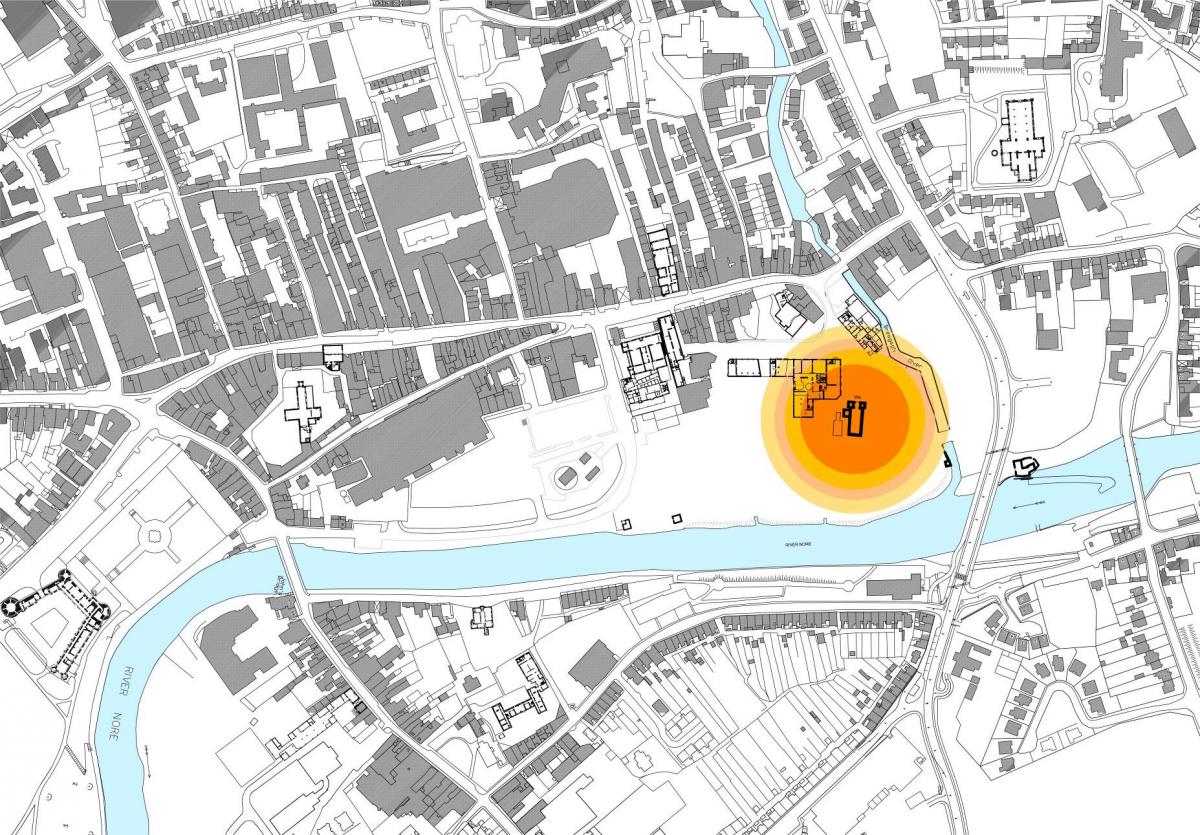
The archaeological review undertaken in the preparation of this Masterplan has identified the area incorporating St Francis Abbey, Evans Turrett, St Francis Well and the City walls as an area of high archaeological potential, requiring archaeological excavations. These excavations are required to answer key questions about the history and development of the site and to gather information to appropriately conserve the upstanding monuments and understand their setting and how the site developed over time. Preservation in-situ is considered the preferred option when developing and constructing within such an archaeological sensitive area.
A detailed Architectural Strategy has been prepared by Kilkenny County Council. This report is available in full in Appendix C ;
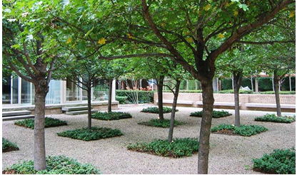
4.3.5 Public Park / Garden
The archaeological review undertaken in the preparation of this Masterplan has identified the area incorporating St Francis Abbey, Evans Turrett, St Francis Well and the City walls as an area of high archaeological potential. Accordingly, it is proposed to develop a park / garden in this area with St Francis Abbey as its focus.
The design of the park area will incorporate, where possible, any archaeological remains that might be uncovered in the archaeological excavations and to represent other buried features through either soft or hard landscaping as appropriate. The detailed design and development of a park in this area will be informed by the archaeological review and excavations, with the detailed design subject to consultation and agreement with the relevant statutory bodies.
It is intended that the access to the site through this area will be developed as a civic space, with any vehicular movement through the area to be restricted through the provision of bollards in the area of the existing bridge over the River Breagagh. This will ensure that the space is dominated by pedestrians and cyclists, creating an appropriate setting for the National Monuments in the area and creating an important sense of place.
This civic area will be designed as a ‘shared space’ using a layout and materials that will clearly identify it as being a pedestrian focused area. The area will be designed to be suitable for hosting outdoor events such as the Arts Festival and other outdoor performances.
4.3.6 Public Realm Strategy
Kilkenny City & Environs Development Plan 2014 - 2020 and Kilkenny City Centre Local Area Plan set out a series of policies to develop the public realm within the city centre.
- To protect, enhance, improve, extend and where appropriate create new public/civic spaces throughout the city.
- To maintain important historic details within the civic spaces such as historic paving, cobblestones, post boxes, spur stones etc.
- To reduce the impact of traffic congestion in the historic centre by traffic calming measures, more efficient signage and pedestrianisation.
To conserve and enhance biodiversity in new and existing civic spaces.
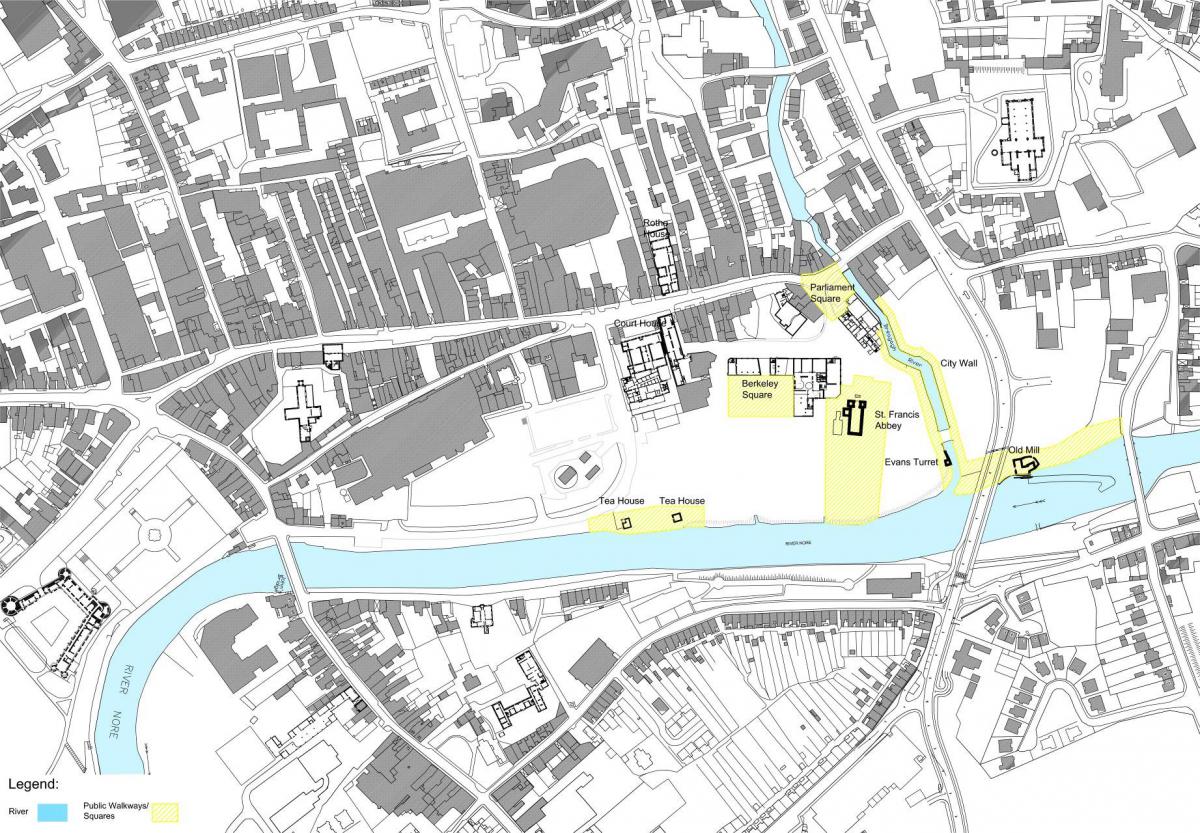
- St. Francis Abbey, - New Square
- Evan’s Turret, - New walkway
- Old City Wall, - New walkway
- Old Mill buildings - New Promenade / Linear Park
- Tea House. – New Promenade / Linear Park
In addition it is proposed to create appropriate new civic spaces for the buildings proposed to be retained on site;
- Mayfair – New Public Square
- Brewhouse – New Square
- 4.3.7 Movement Strategy
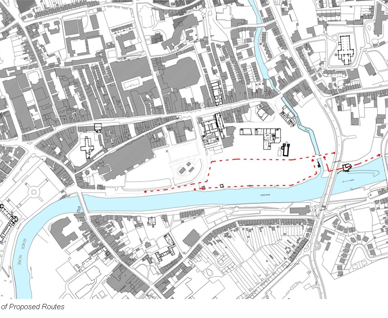
- Need for a route on a north south axis through the site utilising the existing bridge over the River Bregagh in order to minimise disturbance in the are of the City Walls (a National Monument) identified.
- Within the Masterplan area, pedestrian and cyclist movements shall take precedence over vehicular traffic.
- Secure bike parking facilities will be provided at Bateman Quay, centrally adjacent to St.Francis Abbey and to the north of the Bregagh River, adjacent to the CAS.
- Provision of a pedestrian dominant shared surface within the central section of the Masterplan area.
- Provision of a shared surface along Bateman Quay.
- Provision of a pedestrian crossing of the River Breagagh.
4.3.8 Pedestrian Streets / Lanes Strategy
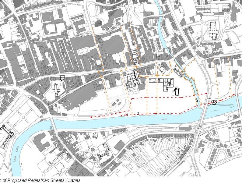
- Various movement desire lines on an east west axis linking Parliament Street to the River Nore.
In response to the Council’s objectives with regard to urban grain and slipways it is proposed to;
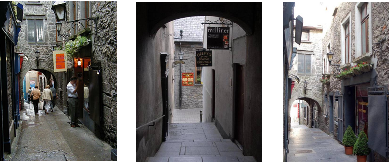
- Create extensions of existing slipways located to the west of Parliament Street on an east west axis reminiscent of the historical burgage plot.
- Implement traffic management and calming schemes for the City as the need arises.
- Have regard to the Architectural Heritage.
Have regard to the natural heritage and ensure compliance with the requirements of the EU Habitats and Birds Directives.
4.3.8 New Building Strategy
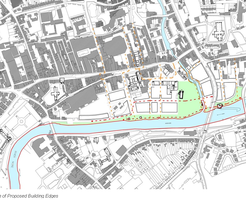
In response to the Council’s objectives to extend the existing street pattern and scale into the Masterplan Site it is proposed to;
- Provide appropriately scaled new buildings to form edges to the Linear Park and new public squares.
- Provide appropriately scaled new buildings to form streets, lanes and slipways along the proposed routes previously identified.
Compile an Architectural Design Guide specifying the building design requirements for each plot within the Masterplan Area
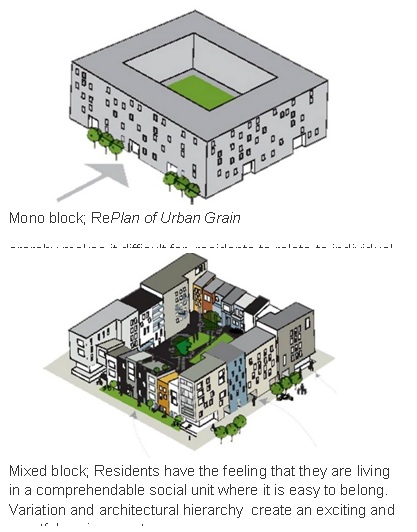
4.3.9 Urban Grain Strategy
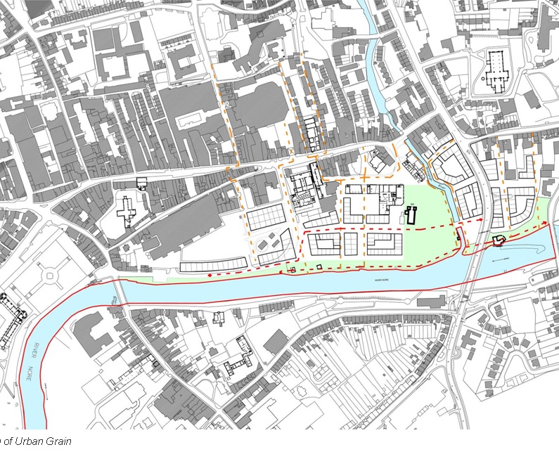
In response to the Council’s objectives to extend the existing street pattern and scale into the Masterplan Site it is proposed to;
- Sub divide the urban blocks into building units more in keeping with Kilkenny.
- Provide varied building heights and façade treatments in keeping with the architecture of Kilkenny City.
Further Masterplan Development
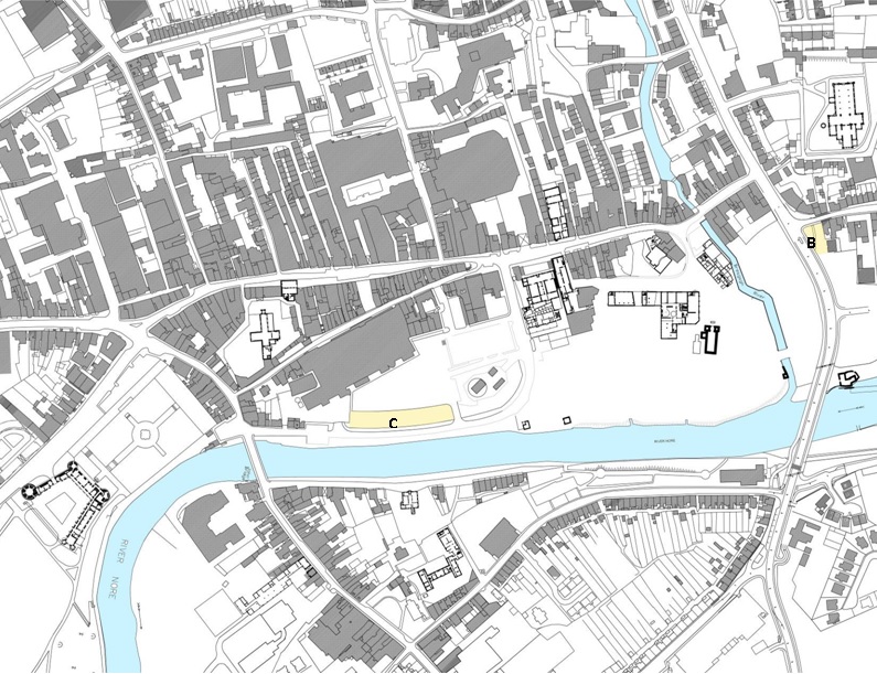
Further design development will be required to determine the most appropriate response to the following;
- Area between the Masterplan and Vicar Street / New Road
- Corner of Vicar Street and Central Access Scheme
- Bateman Quay
Contents
Observations
Observations
Urban Design
1. Sweeneys Orchard (The Gardens) - This part of the site is owned by Kilkenny County Council and as such can be developed appropirately at anytime, the housing as suggested is a good idea but needs...
4.3. Urban Design Strategy.
4.3.3 Linear Park Strategy
It is important that a balance is struck between the city ‘River Garden’ concept, and the protection of the natural habitats at the rivers edges. There is value in...
Urban Design
1 Sweeneys Orchard (The Gardens) This part of the site is owned by Kilkenny County Council and as such can be developed appropirately at anytime, the housing as suggested is a good idea but needs...
Shadow Analysis
Given that there are tall builidings facing onto the river and the linear park, a shadow analysis needs to be done.