DAR - Section 4 Understanding buildings fabric and surveys
DAR - Section 4 Understanding buildings fabric and surveys (Download Section 4: Understanding buildings, fabric and surveys)
PART IV: UNDERSTANDING THE MONUMENTS & BUILDINGS
4.1 THE MASTERPLAN AREA
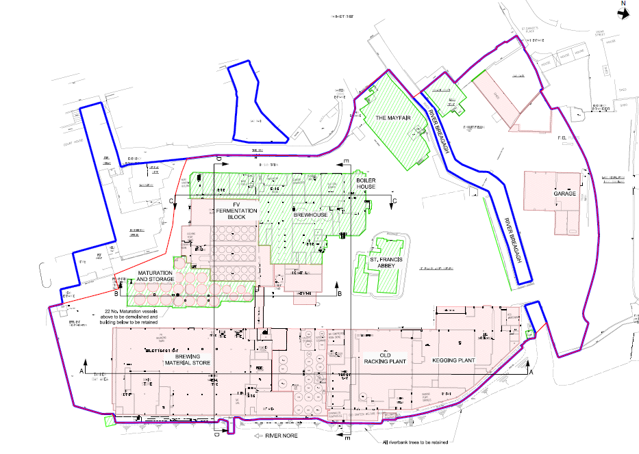
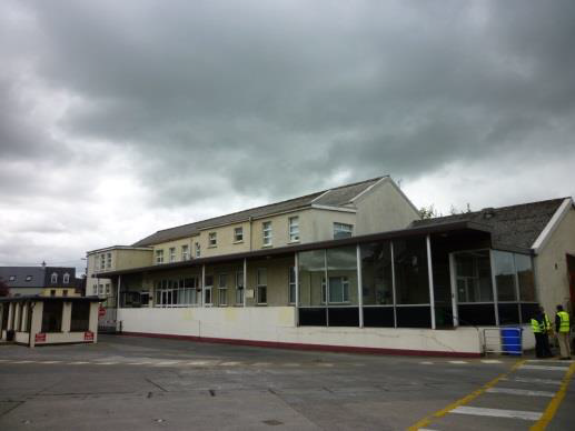
The Masterplan area contains many different structures that reflect the historic, social and economic past of Kilkenny. As well as the archaeological monuments south of the River Breagagh, the area consists of a bottling and kegging store, a brewhouse, maturation towers building, the Mayfair building, the sample rooms, a fermentation block and adjacent but outside the Masterplan development is the visitor centre (Protected structures 1200087).
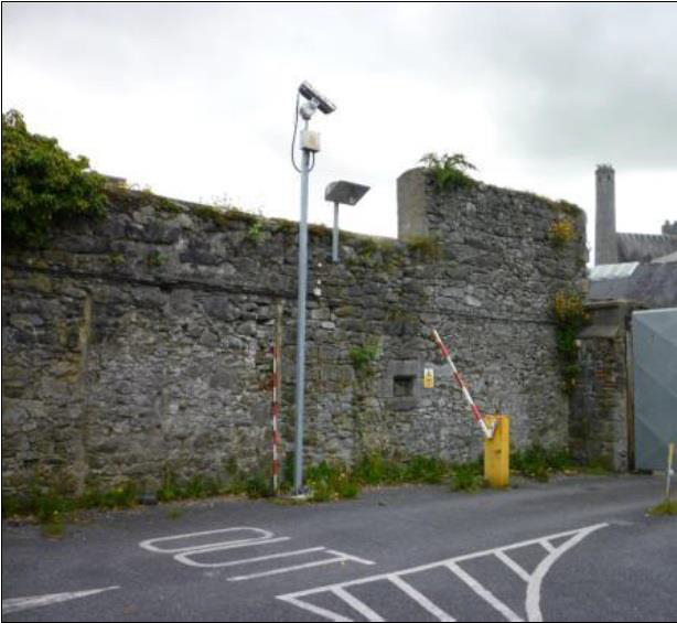
North of the Breagagh modern buildings such as the truck wash, hop store/squash court, car parking shed and fuelling tank facility are present (Figure 24). The demolition of a number of structures to slab level on site (ie no excavation work required) will take place prior to Kilkenny County Council taking ownership of the site, these structures are highlighted in brown in Figure 24.
Figure 24 Proposed demolitions shown in brown, structure highlighted in green are to be retained
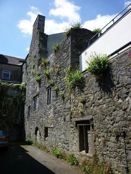
Saint Francis’ Abbey is located within the urban centre of Kilkenny previously neglected from the public gaze it now has the potential to form a prominent position at the north end of the historically known Hightown. It lies to the southwest of Evan’s Tower and town wall, both national monuments, and to the north of a former brewhouse building and an attractive collection of 19th century structures which now act as a visitor centre while the rear of several protected structures (Plates 33 and 34) some with interesting archaeological features such as drip stones and chamfered windows overlook the site from the west.
Plates 33 and 34 Rear of protected structures (RPS B143 (KK09-026091) and B141) that face onto the Masterplan area

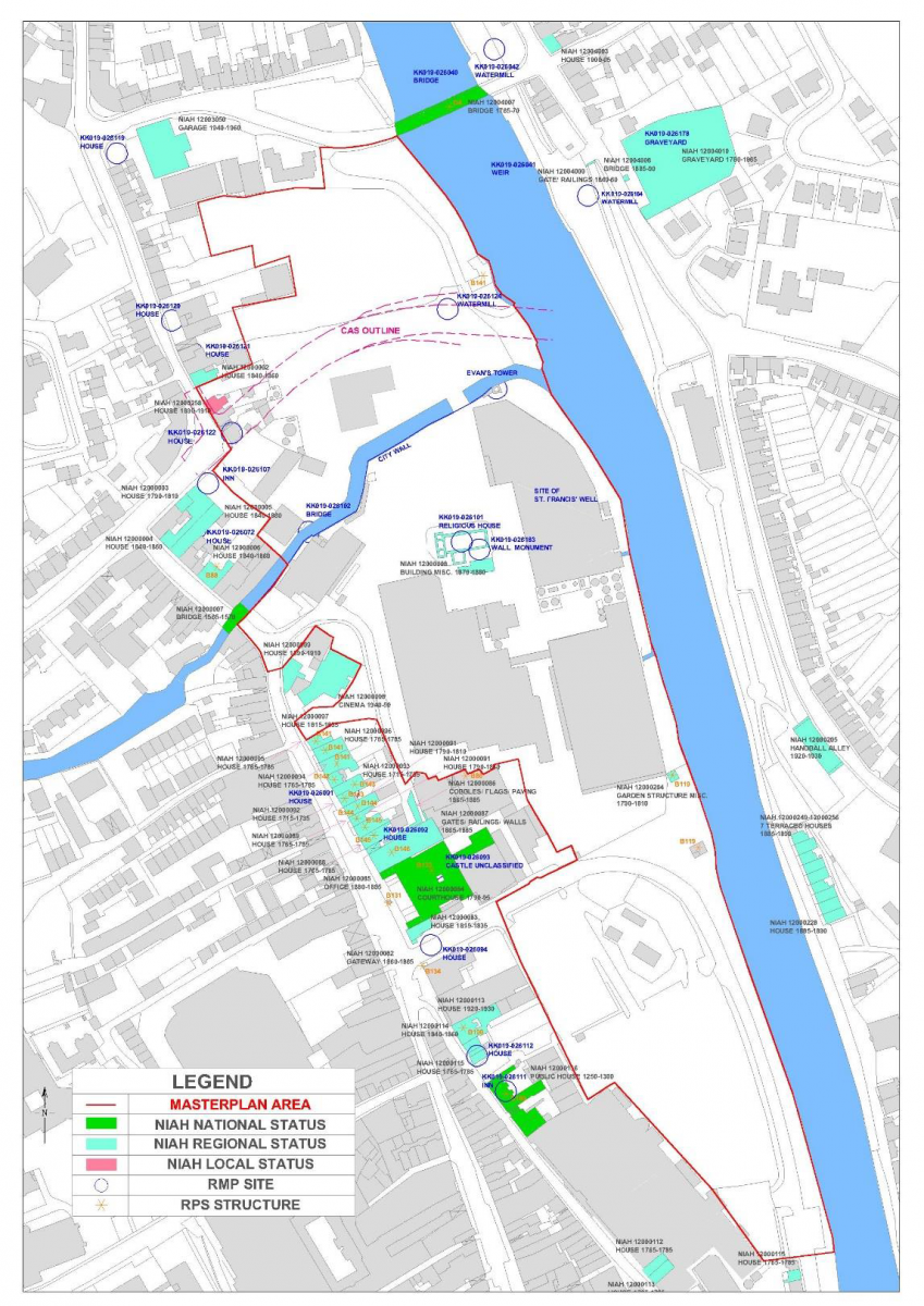
This disparate group of landmark and vernacular buildings contribute to Kilkenny’s architectural and cultural identity. The plan below shows the key historic structures within the plan area (Figure 25).
Part and parcel of the identity of the plan area is the connection it has with waterways, namely the River Breagagh which bisects the area in an east-west orientation and the River Nore which forms the eastern boundary allowing views to the far side of the river and further afield. Flood alleviation works were installed along the River Nore in 2000 in order to reduce the risk of further flooding.
Archaeological excavation has also detected the remnants of former mill races and culverts south of the River Breagagh trending northwest-southeast that issue into the river Nore* and river side revetments. While the mills of Green Bridge are a prominent feature to the north of the River Breagagh.
A concrete slab some 300-400mm thick forms the existing ground level within the former brewery site. The only vegetation within the brewery occurs along the tree lined bank of the River Nore and in the immediate environs of St Francis’ Abbey. To the south along Bateman Quay there is a grassy bank adjacent to the River Nore.
*O’Meara 2006, McLoughlin 2014 and Reid 1996, Section III of the report
Figure 25 Monuments and historic structures within the Masterplan area
4.2 DESCRIPTION OF THE BUILDINGS AND FABRIC
Within the Masterplan area, structures stand in various states of repair, whilst some have been stabilised in modern times, or are currently scheduled for stabilisation work in the near future, others are showing signs that remedial work is required. The main phases of building, namely: St Francis’ Abbey, the Horse Barracks and the Brewery to the south of the River Breagagh and the mill structures to the north of the river are still legible to a greater or lesser extent throughout the area.
4.2.1 St Francis’ Abbey
St Francis’ Abbey was founded by Richard Marshall between 1231 and 1234 and it is recorded that it initially grew from a small rectangular chapel to a substantial monastic establishment as funding and patronage allowed. The abbey underwent extensive renovations in the first half of the 14th century and the elegant craftsmanship and stone masonry achievements are celebrated in the east window which is formed by a cluster of seven lancet lights divided by slender mullions and the stone figures which depict the friars that adorn the bell tower. The upstanding remains contain the eastern choir, central bell tower and sacristy now used as a chapel on site. The transept, northern isle, nave, cloister and western range are no longer upstanding and are now all located below ground, (see OPW original plan Figure 6). A bench mark at the base of the western elevation(380mm above existing ground level) is recorded at 44.99OD.
Following an inspection in 1867 of the bell tower at St Francis’ Abbey several cracks and fissures were reported to the Kilkenny Archaeological Society. In 1868 Thomas Drew, Architect drew up plans to secure and stabilize the Bell Tower at St Francis’ Abbey. It was anticipated that these works, which involved the insertion of braces and shoring (see below) would support the tower, and would cost in the region of £100, a cost that could not be met at the time by the Society.
Drew commented that the tower was in a critical state and urgently required work to ensure its preservation. He proposed to commence work on the north side where the exposed masonry of the haunch should be cleaned and raked out and thoroughly grouted with Portland cement. The masonry should then be raised to its original level and then covered with flags and jointed in cement. Once this was properly set, the great arch could be accurately centred and braced and the openings in the east and west faces also braced. The south wall should then be strongly shored, this would necessitate the removal of a roof of a building belonging to Messrs. Smithwick and Son’s. Then the exposed masonry of the southern haunch would be examined, raked out and if found practicable some long stones inserted in the haunch under the line of the face of the tower, the loose masonry should be grouted, raised and covered in a similar manner to the other side. Drew commented that the floor over the arch should be laid with flags in cement, or ‘in such other manner as will prevent the percolation of any water into the masonry’*, an issue which is still visibly present on the walls within the interior of the tower today.
Other options were sought and it was suggested that the tower could be propped by the provision of two beams of red deal, placed beneath the vault, close by the south internal wall. Another method of stabilisation proposed was to place two pillars of cast iron, as props, in the same position as the timber beams**. While this latter solution was again outside the monetary reach of the society, an arrangement must have been agreed and additional funding secured from the Corporation of Kilkenny as it is observed in the 1869 proceedings of the society that cast-iron props had been inserted and it was hoped that work would commence on repairing the haunch of the tower. It was also noted that there was now an opportunity of having the choir windows and the sedilia opened (which had been previously bricked up). These cast iron pillars are still in place today. From photographic evidence (OPW archive) of before and after (1926-1928) it appears that the concrete supporting structure was inserted under the arch of the bell tower c. 1927 (Plates 5-6 Section I and Plates 35-37).
*The Journal of the Kilkenny and South-East of Ireland Archaeological Society, 1867, New Series, Vol. 6, No. 1pp 69-73
**The Journal of the Historical and Archaeological Association of Ireland, 1868, Third Series, Vol. 1, No. 1, 81-82 and 267
Plate 35 Northern elevation of Tower 1928
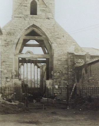
Plate 36 Work in progress to East Window
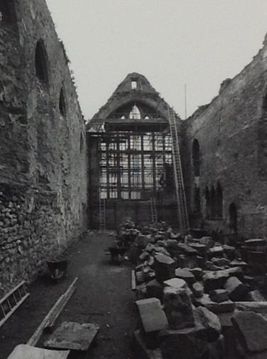
Plate 37 Underside of vaulting in tower
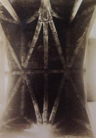
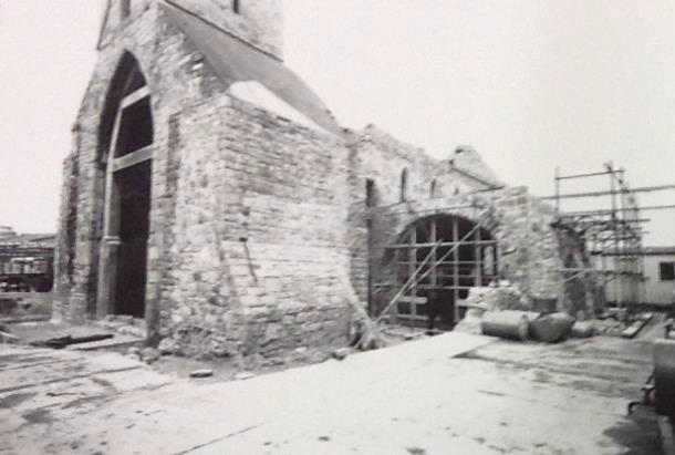
Plate 38 Work in progress on the sacristy
As part of the demolition works to the DIAGEO site, a photographic survey of the Abbey has been carried out and vibration monitors installed. Hoarding has been placed around the entire structure to ensure the protection of the National Monument. All work is taking place in consultation with the authorities under Ministerial Consent.
A. Sacristy
The sacristy is a single cell masonry structure that has been considerably repaired and reconstructed in the last fifty years (Plates 38 and 40). It was restored as an oratory by Smithwicks*. There is one door in the west wall. This structure will be retained as part of the Masterplan works and incorporated into a newly created public realm for St Francis Abbey.
B. The Sample Rooms
The sample rooms structure is a modern construct (c.1980’s). It presents as a modest one storey, three bay range to the south of the brewery. It is listed in the NIAH building survey as being of architectural regional interest (NIAH12000008). It is a detached gothic style building with features such as paired window openings and a well-designed doorcase. It has a pitched slate roof with clay ridge tiles and is constructed of random rubble limestone walls with cut-limestone quoins to corners. While the survey states that the masonry work and craftsmanship used further enhances the visual link with the abbey, the structure does block and obstruct views of the abbey from the south and while intending to blend in with the medieval structure is clearly a building of a later date. During construction a skull was revealed in a test pit at the west end of the building (this is detailed in Section III of the report).
This building does not enhance the abbey and does not conform with the layout of a Franciscan friary or take into account of the below ground remains. Further to discussion with the Authorities it is proposed to remove this structure as part of the Masterplan process in order to reveal the southern elevation of the abbey and allow excavation works to take place.
*Lanigan, K. M and Tyler, G., 1987, 26
Plates 39 Sample Rooms
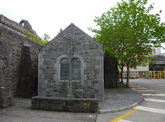
Plate 40 The Sacristy today
A couple of areas were noted in relation to conservation issues within the abbey and require intervention and on-going monitoring:-
• A nearby weeping willow tree is in contact with the tall, slender stone mullions which form the east window and the OPW have been alerted to this.
• Tower to west end of the upstanding remains is leaking significant amounts of water and has many open joints.
• Large span arches to the south side of abbey have moved previously and are showing signs of ongoing movement.
The Minister for the OPW5 in relation to Heritage Services has publically stated that the main focus in recent years has been on the protection and maintenance of structures with a greater emphasis on minor improvements works rather than on major capital projects. Any investment funds that are available will go to sites most in need and importantly to where capacity has been identified that will generate increased business and receipts. The planned re-investment of surplus receipts generated from creating such additional capacity will support a strong incentive to increase activity at Heritage sites and improve business opportunities.
The reintroduction of the apprenticeship programme is to be welcomed and the National Monuments division has recently recruited 21 apprentices in the crafts of carpentry, joinery and stone masonry. This will assist in ensuring that these skills will be maintained and benefit the conservation of historic buildings, including those at St Francis’ Abbey in the future.
All proposed excavation works associated within the Abbey are detailed in the archaeological strategy in section VI of the report.
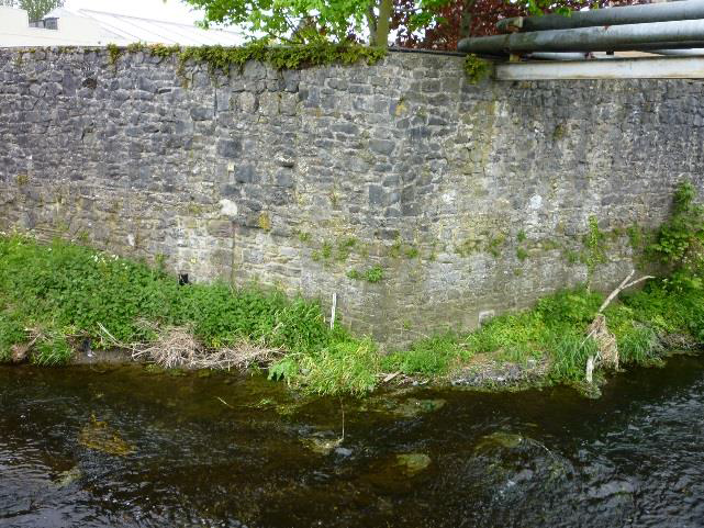
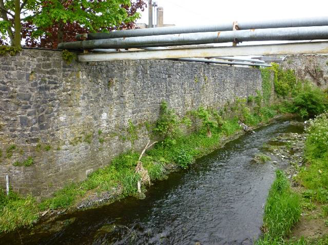
4.2.2 The Medieval City Wall and Mural Towers
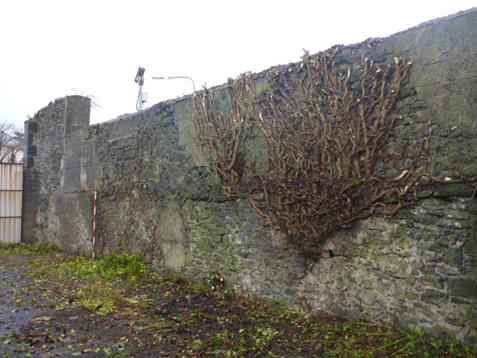
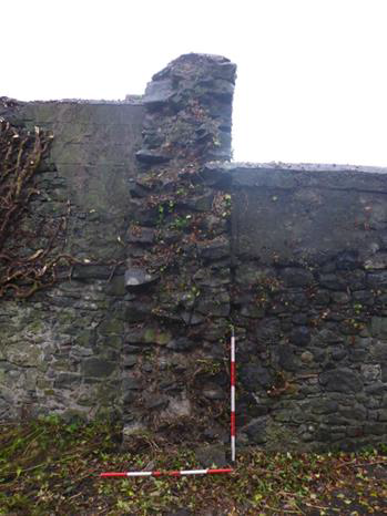
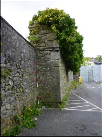
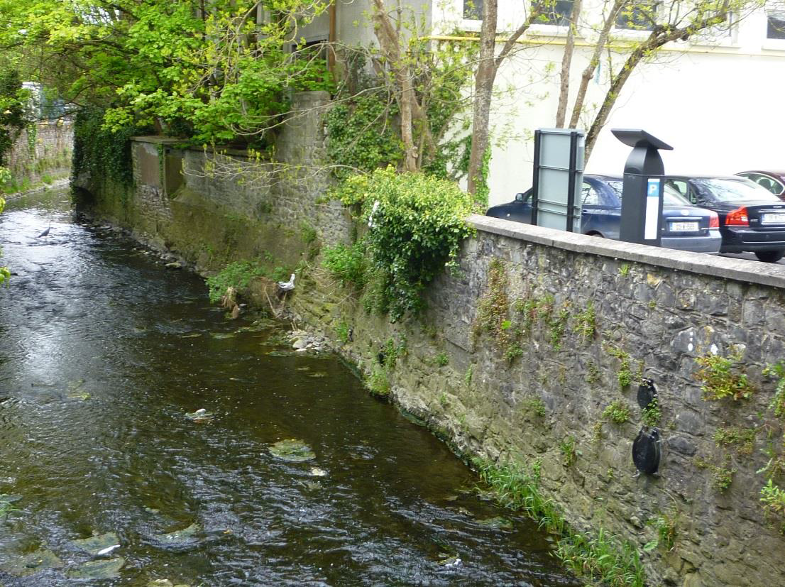
The city wall bisects the plan area in an east-west orientation, while it is a mixture of original wall and rebuild, it has a special significance in defining the medieval town. At the lower reaches of the River Breagagh, this is one of the longest surviving stretches of the City Wall in Kilkenny and while some of it is not easy to access there is the potential to enhance and protect this feature, as well as protecting views from the opposite river bank (from the north looking south). The City Wall is recognised in the NIAH as being of National importance. The structure is a National Monument.
Policy Declaration*:
‘The known and expected circuits of the defences (both upstanding and buried, whether of stone or embankment construction) and associated features of all town defences are to be considered a single national monument and treated as a unit for policy and management purposes. There should be a presumption in favour of preservation in-situ of archaeological remains and preservation of their character, setting and amenity’.
Associated with the wall are the following elements: Evan’s Tower and wall walk, and Cottrell’s Bridge.
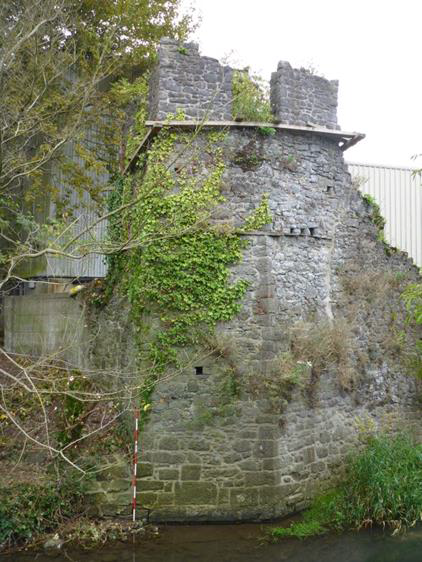
Evan’s tower is built as an irregular four sided structure, with an angled face on the north side, projecting out over the River Breagagh and a triangular corner pointing south-east. The monument is approached from the west by a rising stair (a wall walk) between the external parapet and an internal wall, built over a vault which has now collapsed. The feature appears as a double stretch of walling approx. 1.20m wide (from interior of one wall to the exterior of the other wall). The lower levels are intact and it tapers to a single wall. The wall walk attaches to the western side of the tower and forms part of the city defences in a seamless manner. The short length of wall survives to a height of some 3 metres above the river level. It extends westwards from the tower as far as the modern brewery access bridge across the River Breagagh.
The tower has a basement level (with an internal arched entrance, a first floor and an upper level with remains of windows or crenellations). Judging from its appearance when still roofed, it is likely that the tower has been modified and heightened to form a garden feature overlooking the river (perhaps in the 18th century, see Section V, illustrations and drawings of the tower from 1810 onwards). The external string course and associated holes might therefore reflect the base of an earlier parapet. The monument is braced with wooden posts at the upper levels (now rotted and not forming any function) and repairs have occurred in many places. As part of the River Nore Flood Relief Scheme 2001-2005 measures were taken to survey and secure the fabric of the tower.
Conservation works were undertaken by Consarc (Figure 26) and entailed the erection of internal scaffolding, the infilling of the joist pockets with salvaged stone and small sneck stones were set in lime mortar. This work allowed additional Cintec anchors to be inserted on order to stabilise the structure. All work was carried out under licence to the Department of Arts, Heritage, Gaeltacht and the Islands (now DAHG) (archaeological licence no. 01E0632).
The ground level in the immediate vicinity south of the tower is built up with soil and debris and overgrown with vegetation. The tower is located approximately 5m to the north of the former kegging store, now decommissioned from use and scheduled for demolition. All machinery has been removed and the warehouse is not considered to be of architectural heritage merit. The tower and wall walk are both National Monuments.
*Dept Environment, Heritage and Local Government 2008 National Policy on Town Defences
Figure 26 Plan survey of Evan’s Tower by Consarc (c. 2001)
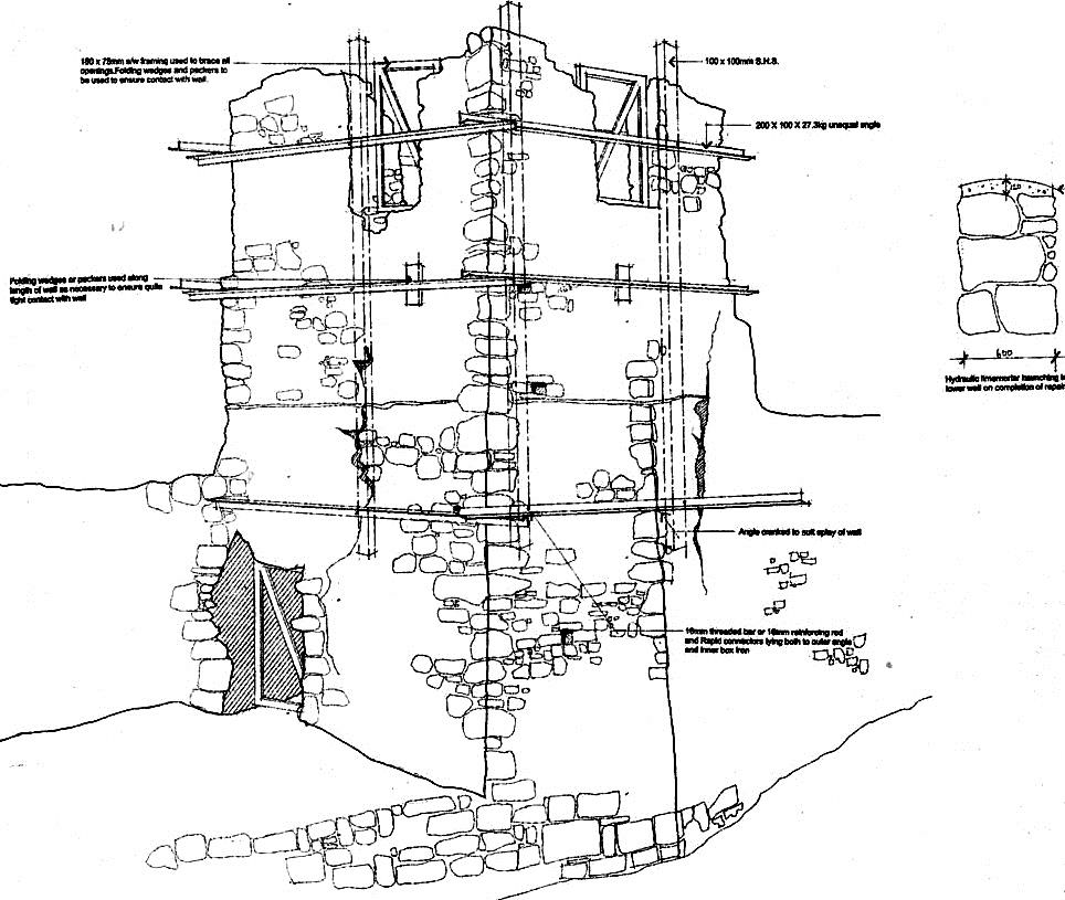
Plate 41 East elevation showing the repair work (2014)
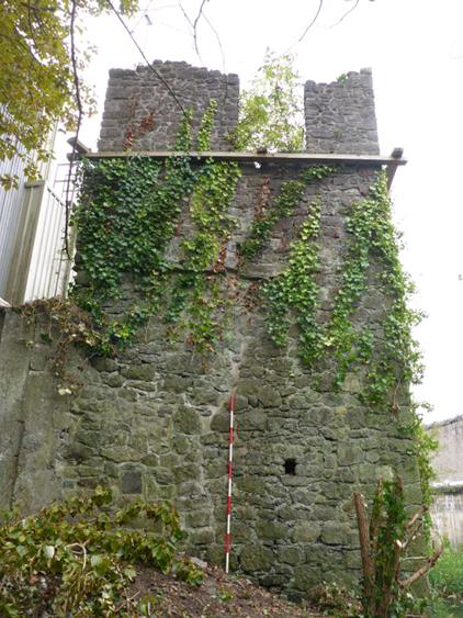
Plate 42 Northeast elevation
4.2.3 Structural Assessment: Evan’s Tower and Wall Walk
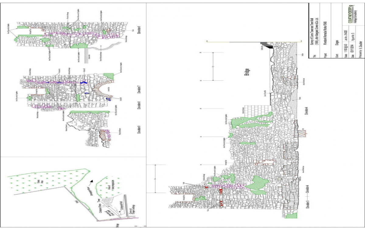
Inspection of written and survey details of previous works (Figure 27) and an inspection of the tower itself show that the overall stability of the structure is relatively secure. The works to the lower river levels, the stitching using cintec anchors, repointing and flaunching to the wall tops of the tower carried out in 2001 are all evident and have improved the stability of the tower compared with the pre 2001 situation.
Timber temporary props placed prior to carrying out the works in 2001 have been left in place and are now rotted and redundant. The exception is to the west wall where some propping is still required.
The inside of the three standing walls of the tower have many joist pockets and loose stones. The fourth wall facing to the wall walk is much degraded and has fallen exposing a large section of hanging unsupported masonry. This was propped but the timber has rotted and fallen.
There is significant buildup of ground to the south (land side) face of the tower and its vaulting has suffered and is in a precarious state. The fallen stone and raised ground level prevent the building from being fully recorded and understood.
The river side wall walk is relatively intact, however at the landside of the wall walk there are many loose stones; fallen sections of mortared wall and severely leaning sections of wall. Previous stone steps up to the tower have fallen and the stones that formed the steps appear to have been removed - probably many years ago. There were no remedial works carried out to this wall in recent years except timber temporary propping.
Plates 43 Evan’s Tower and wall walk landside
Plates 44 Evan’s Tower and wall walk riverside elevation
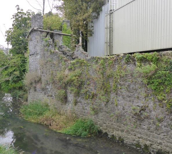
Figure 27 Geodetic Survey of Evan’s Tower and Wall Walk courtesy of Margaret Gowen & Co Ltd
Piling works were carried out in the vicinity of the tower and wall walk in September and October of 2014 to allow soil remediation measures to take place. These works were archeologically and structurally monitored. There was no sign of movement in the recent pointing to previous crack lines in the tower or outer face of the city wall despite the nature of the work. The un-mortared nature of the inner face of the City Wall and wall walk, makes it more difficult to confirm if any movement was experienced but there does not appear to be any degradation to the monument resulting from these piling operations.
Proposed interventions (Demolition contract, work undertaken by Diageo)
The immediate proposals in the vicinity of Evan’s Turret and adjoining City wall include a full digital survey of the remains, vibration monitoring and the installation of temporary works (wooden props) to replace those that have rotted away since 2000 (Appendix F ref LE drgs 101 & 102)
The nearby twentieth century framed warehouse is to be demolished to slab level only. A fuller assessment of the monument particularly the sub ground structures will be much easier post demolition when access is improved.
Proposed works post demolition
When demolition works have been carried out it is recommended that an archaeological test excavation limited to two number trial pits is carried out to understand the depth of foundations, ground conditions and to sample the archaeological deposits (Appendix F ref LE 112).
In order to inform the conservation strategy of the monument, excavation work is to take place after the demolition of the adjacent building. All work is to be carried out by hand under Consent from the Minister as this is a monument of national importance. It is assumed that this excavation may be fairly extensive. These works will be undertaken by archaeologists assisted by the general contractor and stonemasons and will involve ongoing assessment of the ruin stability and design of propping to the arches as the excavation increases in depth. A detailed assessment of the standing remains charting the different phases and building techniques of the Tower can also take place by a building archaeologist at this stage of the process.
There are a number of possible end products to the remedial works to Evan’s Tower and wall walk. All would be subject to the appropriate permissions and also involve coordination with the masterplan for the area. The options that should be discussed / explored are outlined below:-
Stabilise all upstanding remains as they are and leave tower only accessible for maintenance – i.e. public access precluded
This solution will encompass the minimum amount of work required and is likely to involve the stabilisation of existing arch abutments in traditional masonry work using stone salvaged from the site set in appropriately matched lime mortars. Once abutments have been repaired the arches will be pinned using replacement tooled stone where any stones missing and natural slate slithers and mortar matched to existing to pin between the arch stones to stabilise the arches. Stitching using Cintec anchors or similar will only be deployed where it gives the option of retaining more original structure than traditional masonry repair techniques allow.
There may be situations such as inside the tower where replacing the original stone vaulting would involve too much conjecture and the overall stability of the tower may not require such rebuild. This can only be assessed when the fallen stone work has been cleared and indeed the proposed end use / product decided upon.
Stabilise all upstanding remains as they are and with enough local new build to support modern intervention of steps and deck and guard rails so tower can be used as viewing point.
Stabilise all upstanding remains and rebuild vaulting and stone steps and wall walk walls so that tower can be used as part of public amenity as close to original form as possible.
These proposals have been devised having considered the policies and recommendations put forward in the Kilkenny Conservation Plan*.
*Kilkenny City Walls Conservation Plan 2005 Oxford Archaeology for the Heritage Council pg 50-56 and158
4.2.4 Structural Assessment: The Town Wall
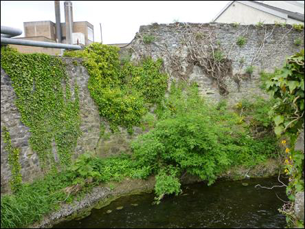
The medieval wall, which formed part of the friary precinct and the urban defences, was surveyed and conserved during the River Nore Flood Alleviation works in 1999 and 2001 from the River Nore to the corner of the Horse Barracks. In 2004 Consarc on behalf of Mottt McDonald undertook a condition survey and repair works of the masonry walls from Irishtown Bridge to the corner of the Horse Barracks, essentially completing the survey and consolidation works to this stretch of walling (Appendix F*).
The wall is in a stable condition and relatively free from vegetation along is upper courses while vegetation has grown back at the lower levels partially obscuring the original City Wall (Plates 45-48 and 71-74).
*Appendix F contains a copy of the original Consarc drawings and photos which detail the level of work required to conserve the masonry wall from Irishtown Bridge to the corner of the Hose Barracks (site of)
Figure 28 Plan showing Condition of City Wall September 1999, courtesy of Margaret Gowen & Co Ltd
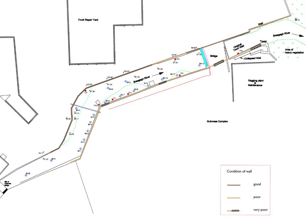
Appendix F contains the original digital survey drawings undertaken by Margaret Gowen & Co Ltd in 1999 showing the extent of the original City Wall and the modern reconstruction and rebuilt wall. The survey also details areas of repaired masonry and features such as relieving arches, outflow pipes and blocked opes within the wall. While the masonry is in a reasonable condition and repointed with lime mortar in 2001 and 2004, notes and drawings from that time show the condition of the wall which can generally be taken as the current condition. There is one breech in this section of wall, effectively separating Evan’s Tower and wall walk from the main section of City Wall. This breech forms a bridge which was constructed c.1974 and this was used to access the northern banks of the River Breagagh by the brewery site. The original City Wall runs underneath this bridge and was repaired and repointed with lime mortar in 2001.
Conservation works to date have consolidated the remaining original City Wall, rebuild and features. Prior to any work taking place in the vicinity of this monument a monitoring survey may need to be undertaken in order to assess the effectiveness and present condition of the conservation measures that took place between 1999-2005.
As part of the Masterplan works vegetation regrowth should be removed and a visual inspection of the existing conservation works take place. As part of a long term strategy a maintenance programme could be implemented (Plates 71-74) which would involve an inspection and clearance of vegetation at regular intervals to be determined by a conservation professional.
Plate 45
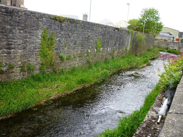
Plate 46
Plates 47-48 Show the present day condition (2015) of the area that was subject to survey 1999-2001
For Masterplan works in association, adjacent or affecting town defences the following criteria are considered by the DAHG when reviewing applications*:
To seek the protection and preservation in-situ of these national monuments including the town walls, embankments and ditches, gates, bastions or ancillary fortifications or portions thereof;
To seek the preservation of important views and prospects inside and outside the walls so as to preserve the setting of the monuments and to increase the appreciation of the circuit and character of the walled town.
The Department may require a satisfactory buffer area to be established between any new development and the town defences in order to ensure the preservation and enhancement of the amenity associated with the presence of town defences within the historic urban pattern;
To require any proposals for works to town defences to be preceded by a detailed measured survey of the monuments so as to have an appropriately detailed record;
To provide pre-planning advice to developers where town defences are close to or included in their proposal site;
To require the involvement of qualified and experienced conservation professionals in the detailed design and overseeing of works to town defences;
Not to favour new roads crossing the wall or the line of the wall or the formation of any new openings in the wall;
To favour the minimal intervention necessary to the authentic fabric of the monument and avoidance of unnecessary reconstruction;
To require good quality, context-sensitive design for development proposals affecting the upstanding town defences that would not detract from the character of the town defences or their setting by reason of the location, scale, bulk or detailing;
To encourage the enhancement of the setting of town defences including the pedestrianisation of town gates where this can be achieved without requiring new roads to be opened through the circuit of the walls. To encourage also the improvement of signage and public utilities structures, etc. where these affect the visual amenity of the defences;
To require as a condition of Ministerial Consent that appropriate programmes of regular maintenance and repair works to the town defences be put in place;
To promote the retention of the existing street layout, historic building lines and traditional burgage plot widths within historic walled towns where these derive from medieval or earlier origins and to discourage the infilling or amalgamation of such plots and removal of historic boundary walls save in exceptional circumstances.
*DEHLG 2008 National Policy on Town Defences pgs 10-11
4.2.5 The Bull Inn
The ‘Bull Inn’ is located on the south side of St Canice’s Place (formerly known as Bull Alley). The only upstanding remnant of this seventeenth century inn is a substantial stone wall which forms part of a recorded monument (KK019-026107). There is a cut-stone, square, chamfered ope at ground–floor level. From the street and to the west of the entrance this medieval structure presents as a substantial masonry wall over 4m high with limestone quoin stones. It has been repaired and stabilised on its north-western edge. The Bull Inn wall is constructed in random rubble limestone and is truncated to first floor level with an undulating broken wall head.
In order to facilitate a full assessment of the wall by a conservation architect, vegetation was removed from the wall under archaeological supervision in November 2014. The purpose of the archaeological monitoring was to ensure that the removal of vegetation from the wall would not damage the structure, and in the event that any masonry was dislodged from the wall, it could be recorded, catalogued and retained on site for future re-use.
4.2.5.1 Structural Assessment: The Bull Inn Wall
The Bull Inn wall and associated adjoining upstanding masonry walls are in a ruinous condition. This is typical of walls that no longer have the roofs with which they were once protected nor the use for which they were originally constructed.
The wall is overall structurally stable but has suffered mortar loss, robbing of dressed stones, later insertions and disruption of fabric from vegetation growth.
The wall needs careful repair consisting of removal of vegetation including the roots of the plants, local reinsertion of stones, general repointing and a new weathering detail to the wall top to prevent water ingress into the core fabric.
All works to walls of historic fabric should be carried out in materials to match the original such as soft flexible lime based mortars and sands to match the river deposit sands and gravels. All replacement stones should be if possible retrieved from local fallen random rubble and any new dressed stones such as lintels and quoins clearly marked (albeit in a desecrate location) with the date of insertion.
A series of drawings showing stabilisation measures are included in Appendix F. An appropriate design solution should be sought for the successful inclusion of this feature wall into the overall Masterplan development, it could form part of a modern street scape. As part of the Masterplan process the Bull Inn will now be open to view by the public and part of the public realm of Kilkenny further enhancing the medieval fabric of the city.
Plates 49-52: A collection of photographs showing the Bull Inn wall from the southwest face and southwest return after the removal of vegetation and the northeast wall with the chamfered stone ope and southeastern corner.
4.2.6 The Tea Houses
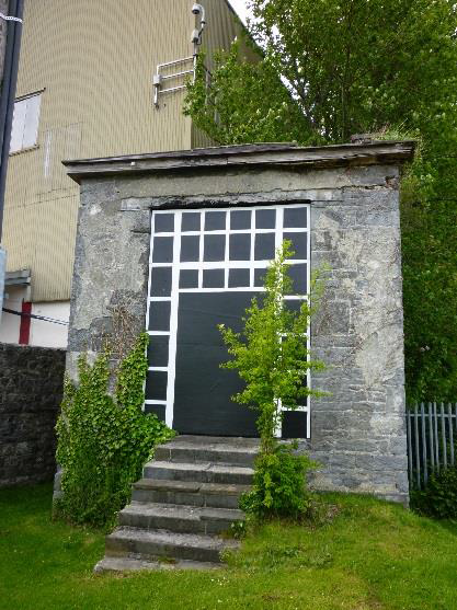
Around the beginning of the nineteenth century a series of five Tea-Houses (called ‘Pleasure Houses on the 1839-1842 Ordnance survey) were constructed along Bateman Quay between what is now the southern end of the former brewery complex and Johns Bridge. There are two upstanding teahouses located within the Masterplan area (Plates 53 and 54), one has been consolidated and is now used as a commercial premises, the other while upstanding, is a derelict, roughly rectangular building. Stabilisation and conservation measures are graphically represented in Appendix F.
Plate 53 Tea House – consolidated
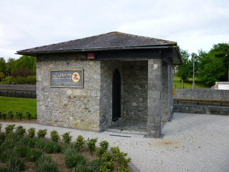
Plate 54 Sentry Box Tea House
The following account of the latter teahouse is taken from Chapter 7 River transport and leisure by Adam Slater in The River Nore Drainage Scheme* The building measures 5.9m (north-south) by 4.8m (east-west) and is approximately 7.5m from the present ground to eaves. The roof is timber framed, sloped to the east and west, and slated although showing extensive damage. Externally the walls are unevenly coursed and carefully mortared, with large stressed quoins on all corners. The eastern wall has no doors or windows and is surmounted centrally by a tall brick chimney.
The western wall features a window and doorway topped with shallow cambered arches of stone, whilst the southern wall comprises of a large doorway, which probably was originally ornate in décor and is accessed via a flight of eight stone steps, giving access to the upper floor of the structure. A large window 2m high by 1m wide, in the northern wall, also associated with the upper floor previously afforded a view of St Francis’ Abbey and Greens Bridge.
The ground floor has domestic fixtures and fittings in contrast to the first storey which is painted and has a fine, Victorian Stucco-type plastered ceiling (in danger of collapse) similar to that in Bridge House, John’s Street Kilkenny.
The tall, relatively narrow imposing architecture of this pleasure-house and its closeness to the City Jail gained it the local name of ‘The Sentry Box’. An associated semi-circular riverside revetment wall was removed under archaeological supervision as part of the River Nore flood alleviation scheme.
Internally the building is comprised of two floors. Although the floor itself seems to have been destroyed by fire the recesses for wooden beams can still be seen. The ground floor is accessed through the western facing doorway: A large brick lined fireplace with a cambered brick surround is visible in the eastern wall. Heavy rendering, damaged by fire covers most of the walls. No stairs or evidence of a stairwell to connect this with the upper floor is visible. The upper floor was accessed via a set of wide stone steps leading to large doorway in the southern wall, which mirrors the large window in the northern wall.
The upper floor has a small brick lined fireplace with a cambered brick surround centrally placed into the eastern wall with a brick lined flue visible through missing plaster. The walls are heavily plastered, and occasionally demonstrate patches of red pigment colouring. An arched recess with a fixed timber bracket, possibly for a lamp marks the centre third of the western wall.
The high ceiling is decorated in white, moulded Stucco plaster which is largely damaged and partially destroyed. Centrally, a motif of an acanthus flower and leaves in a patera medallion is surrounded with a rectangular, moulded plaster coving, decorated with leaf-like ovals, a feature which is repeated at the ceilings edge as a clyma recta, both are typically Georgian in form. Similarities between this small ceiling and the larger one visible in the larger room overlooking the river in Bridge house can be seen and this well preserved plasterwork was reputed to be the work of eighteenth century Italian craftsmen**.
The fireplaces indicate that the lower floor was more functional and domestic, with a hearth large enough to cook and boil water on. Whilst the upper floor hearth is narrow and only good for producing heat for the room. The separate entrances to each floor also indicate a measure of segregation. Probably the owners of the building used the upper floor for viewing the sights whilst their servants for food production occupied the lower floor.
The second upstanding teahouse (Plate 53), 35m to the south of the afore mentioned structure, this has been renovated. As part of the River Nore drainage works two engineering test-pits were dug beside the river and landsides walls of this structure to assess the depths of the foundations prior to commencement of nearby engineering works and the exposed deposits and walls were recorded. The building was also surveyed as part of this scheme.
The ‘Tea House’ is rectangular in plan, 8m-east west by 6.5m north south with an open, flagged porch area and limestone pillar forming the south-western corner. The porch area provides access to an ornate south-facing doorway. The south wall has a large window, which like the door is of gothic revival style with rolled stone mouldings and jambs with brick relieving arches immediately above. All walls of this structure are of coursed rubble with large squared stressed quoins. A large patch of the western wall appears to have been extensively repaired with smaller uncoursed rubble. An engineering test pit excavated alongside this rebuild shows that it continued down at least 1.9m below the present ground surface. The north-facing wall is featureless and also shows signs of extensive re-building, being of newer coursed rubble stone.
*Margaret Gowen & Co Ltd 2005 unpublished report
**Finn J & Murphy JCJ 1962 John Street, North and South Sides. Old Kilkenny Review:No 14 pp25-39.
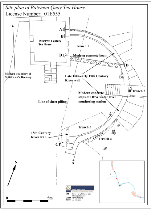
Figure 29 Site plan of Tea House after MGL 2001
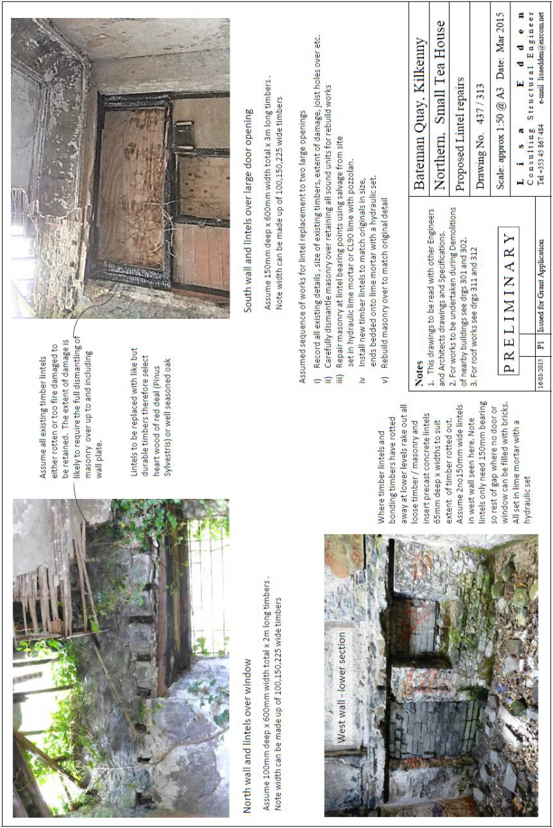
The more northern Tea House is in close to its original form but in a very ruinous state. Timber elements such as the first floor have rotted away and the roof is in an extremely precarious condition. The Tea-House backs onto the Smithwick’s brewery modern masonry boundary wall of the brewery. The roof and ceiling including the fine moulded ceiling decoration are in danger of complete collapse. There has been significant loss of fabric already. The degradation of the timber lintels and bonding timbers puts the wall tops and other local sections of the four external walls in jeopardy.
It is proposed as part of the demolition works to stabilise this structure and the following works will take place:
Essential structural works include:-
• Stabilising and reinstatement of the roof
• Rescuing as much as possible of the ceiling ornamentation to inform repair works.
• Replacement of rotted lintels and bonding timbers throughout the building
Such works will leave the building weather tight and stable but not necessarily attempt to re-create lost details.
Proposed works to stabilise the Tea House include the following:
Install vibration monitors.
Crop vegetation.
Digitally survey building and submit to design team and Kilkenny County Council.
Proceed with bracing doorway and large rear window and secure the building from unauthorised entry.
Carefully separate adjoining walls from buildings that are to be demolished to reduce any vibration on the Tea House.
Proceed with adjoin demolition works.
As part of the Masterplan process further conservation works are detailed in Figures 31-33.It is proposed that the Tea House will be conserved and renovated to facilitate its use as a commercial premises.
Plates 55-56
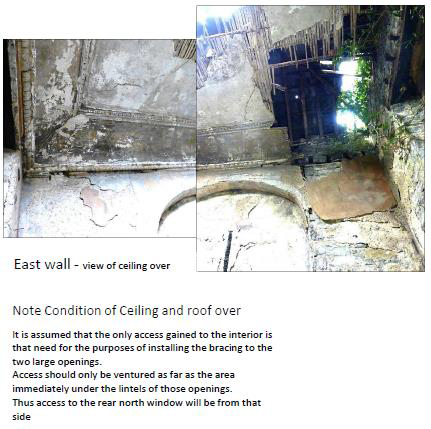
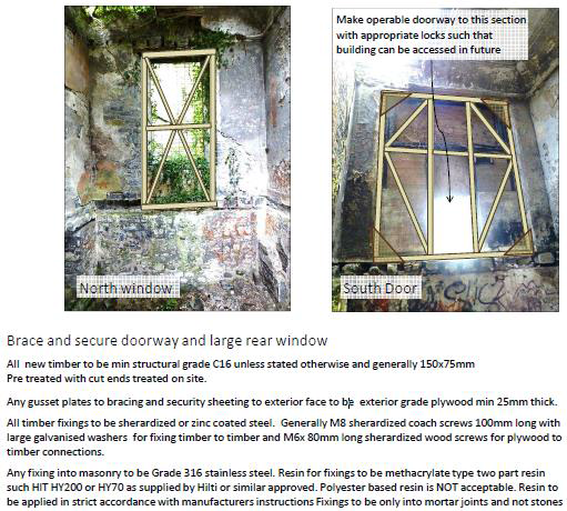
Figure 31 Tea House Roof Condition
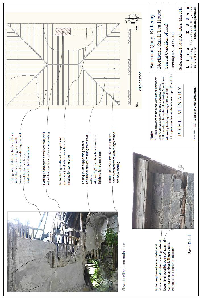
Figure 32 Tea House Proposed Roof Repairs
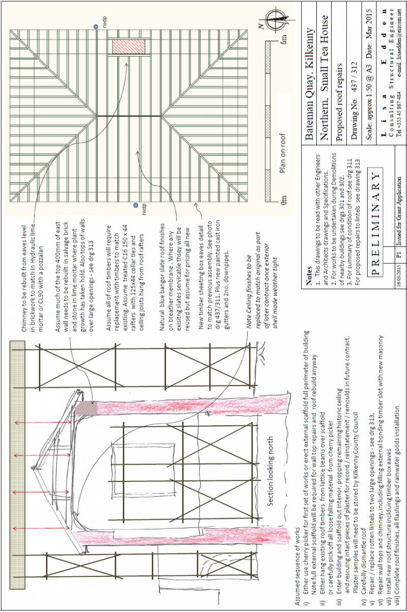
Figure 33 Tea House Proposed Lintel Repairs
4.2.7 Original Gateway
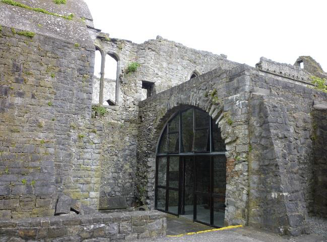
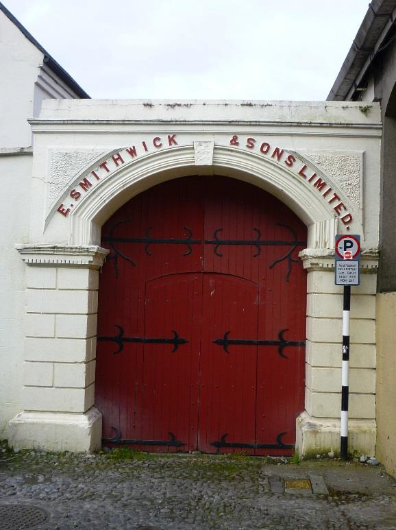
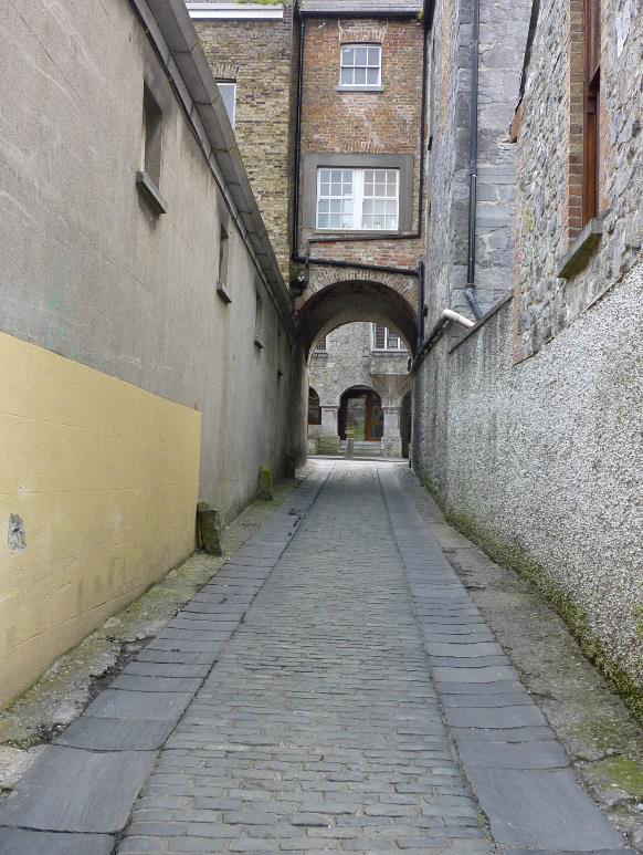
The original gateway (NIAH 12000087) to the brewery dates to about 1875 and fronts onto Jenkin’s Lane (Plate 18). The gateway comprises a segmental-headed carriageway with a pair of painted rusticated rendered piers having dentilated moulded cornices. There are tongue-and-groove timber panelled double doors with decorative wrought iron hinges, moulded archivolt having keystone, raised lettering, tooled rendered panels. This entrance feature forms a picturesque feature in the streetscape of Jenkin’s Lane. The limestone cobbling of the lane with cut-limestone flagged wheel tracks is an attractive and protected (NIAH 12000086) aspect of the streetscape. This laneway and entrance while located outside the Masterplan area can provide pedestrian access into towards the area and out to Parliament Street.
Plates 57-58 Original gate and laneway
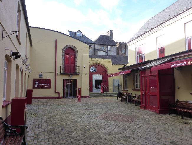
4.2.8 The Visitor Centre
The visitor centre is now housed in No 44 Parliament Street, a protected structure (B146) and included in the NIAH survey (NIAH 1200085). This Victorian structure, built c. 1882 has a redbrick façade and a stone ashlar plinth at ground level. To two buildings to the rere are placed around an internal courtyard. The original brewmaster house and office is located on the northern side of this courtyard and while it is much altered with unsympathetic building additions and finishes, the original structure is very much evident. The other sides of the courtyard are flanked by rendered buildings now used as part of the visitor experience and offices. This collection of buildings is to be retained by and remain in the ownership of Diageo. They are to be collectively used and developed as a visitor centre showcasing the Smithwicks experience and continuing the association of the Smithwicks family and the tradition of brewing on the site.
Plates 59-60 Visitor Centre showing Brew Masters Hous
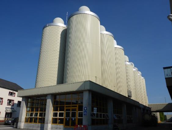
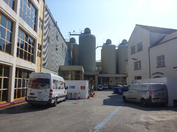
4.2.9 The Maturation Building
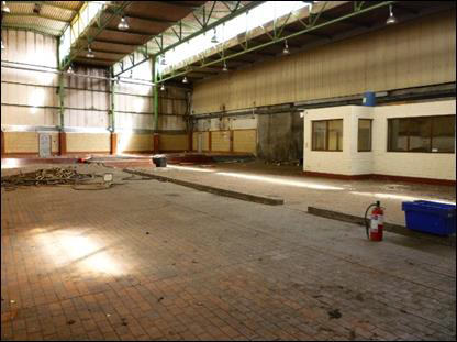
The Maturation building has been redundant since the cessation of brewing operations at the brewery site. The building comprises a single-storey concrete structure that is utilised as a support to the 22 large maturation tanks of the brewery. The late 20th century structure was an integral component of the brewery operations on the site, where the tanks were used for the maturation and storage of beer. Processes such as centrifuging and bottoming of yeast as well as maturation over 14 days took place in the Maturation Building.
The traditional maturation process involved storing beer in casks to allow them to mature naturally, thus improving the flavour (the German word ‘lager’ means ‘storage’). In traditional beer production, beers would be ‘lagered’ or stored for as long as nine months. This allowed for the production of beer using the new season’s malted barley and hops in the autumn when temperatures were mild, with fermentation occurring when the beers were stored in cellars over the cold winter, to be available fully matured as a light, fresh drink during the summer. With the advent of modern machinery and processes, such as rapid continuous maturation systems, the required flavour changes can be achieved within a few hours and storage times reduced to as little as three days.
Plates 61-62 Maturation Building external elevations
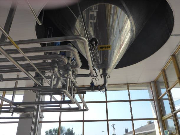
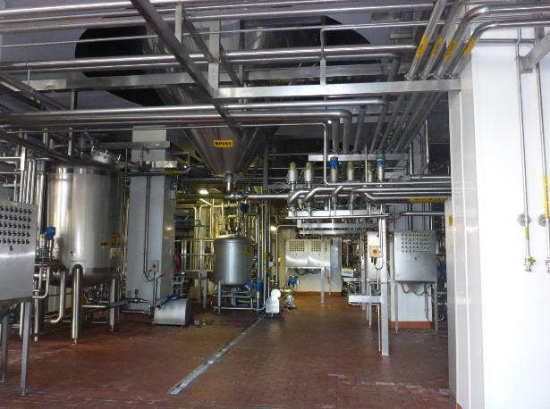
The interior of the building is largely open and filled with natural light. The spaces are divided by rendered concrete columns. The base of the maturation tanks protrude from the ceiling and are connected to a series of valves and pipes that are controlled automatically. The building is well ventilated with window openings within the glass pane structure and a number of emergency and double doors leading to the exterior. The floor is tiled and drains are present to distribute any excess liquid, spills through a waste system. The only separate room in the structure is a small sampling and quality control station.
Each multipurpose vessel (MPV) is numbered, with MPV 68-89 labelled forming a total of 22 vessels. Beneath these vessels are control panels which automate the different lines to and from each vessel. The following plates show the equipment (metal vats, pipes and control panels) that is still in situ around MPV 89 and 69.
Plates 63-64 Maturation Building internal workings
The large maturation tanks sitting on top of the main structure make this a highly visible and distinctive building within the brewery site. While the Maturation building is of a modern industrial and technical heritage interest the removal of the tanks as proposed with the existing planning permission will result in a significant loss of integrity.
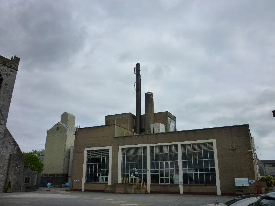
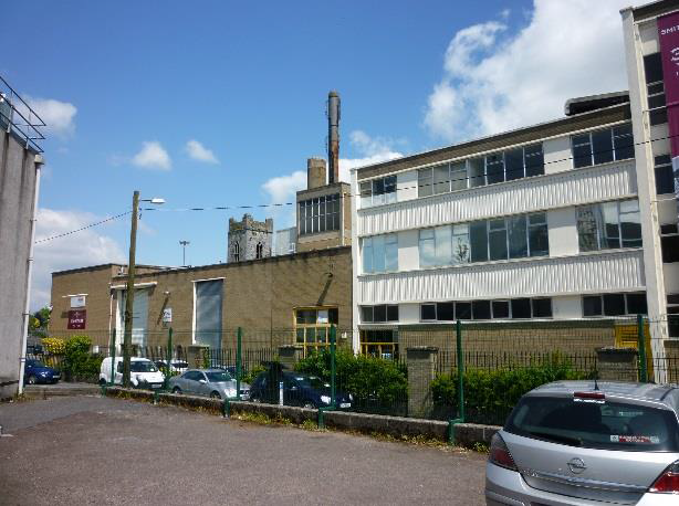
4.2.10 The Brewhouse
The St Francis’ Abbey Brewery has a long-standing industrial presence in the city and although many of its modern structures are not of historic architectural significance, the brewhouse has become a landmark building within Kilkenny and its skyline.
The photograph below (Plate 65) shows the northern elevation of the Brewhouse, which is a concrete structure with a steel framed clad infill elements such as brick built in the 1960’s. Large expanses of symmetrically laid panes of glass punctuate the elevations of the structure ensuring plenty of light to the interior. The structure has a number of accumulated extensions up to the 1980’s and extends to five stories high along it eastern elevation and four stories at the northeast. The structure as part of the large scale brewing industry at St Francis’ Abbey Brewery, Kilkenny, is of industrial heritage interest.
Plates 65-66 Brewhouse northern and northeast external elevations
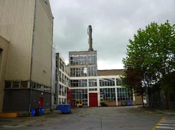
Plates 67 Brewhouse western external elevations
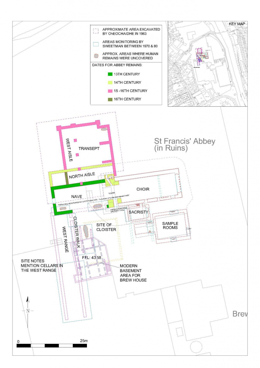
The interior of the structure was stripped out and modernised in the 1990’s. The building functioned as a brewhouse and contained the boiler house, engine room and operation centre. At the northern end are the only subsurface stores of the entire structure, accessed by a ladder. These present as narrow confined spaces and appear to relate to the location of the cloister walk identified by Sweetman revealed during the archaeological monitoring programme in the 1970’s and would have formerly formed part of the cloisteral range (Figure 34). The floor level recorded for this structure is +43.58OD and the original ground level recorded on St Francis’ Abbey is +44.61OD putting the cellars approximately 1.03m below the original ground level.
Plate 68 Brewhouse subterranean plant room
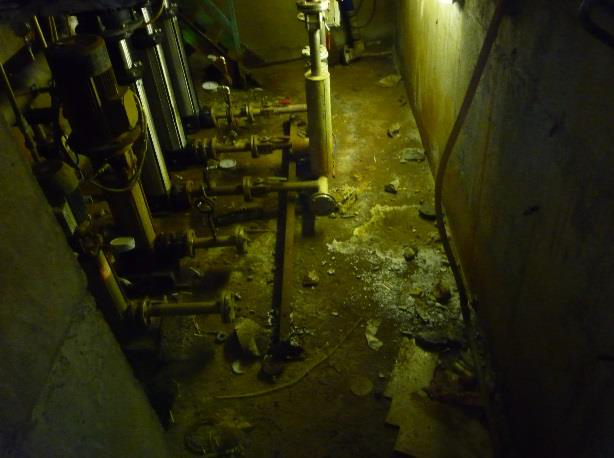
Plate 69- Interior of Brewhouse
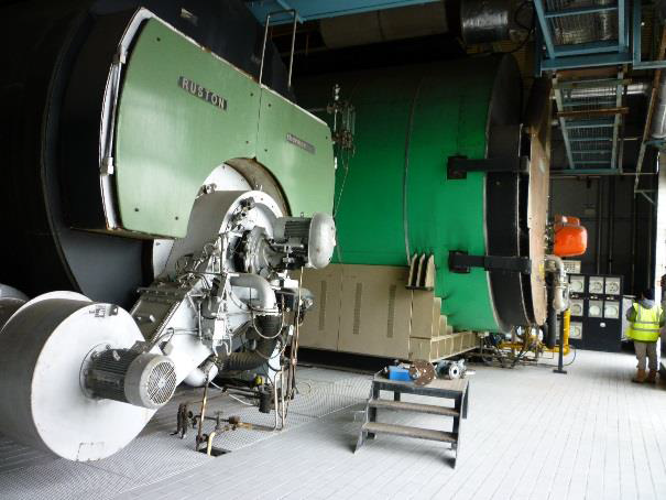
Plates 70 and 71 Large metal vats within the Brewhouse
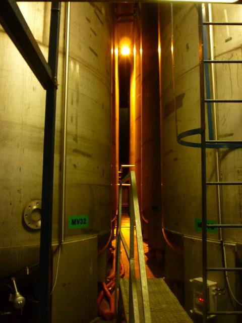
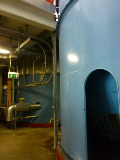
Fig. 34 Plan of St Francis’ Abbey and investigations and subsurface plant room
4.2.11 The Mayfair
The Mayfair building referred as the ‘Mayfair Ballroom’ on the 1946 OS ed. map is a structure of social and cultural heritage interest. It originally functioned as a ballroom and attracted big bands throughout the 1950s-1970s, until due to the decline of showbands it closed its doors in 1973. Since then and until recently it was used as offices, kitchens, welfare facilities and a staff canteen for the brewery.
The 1930’s structure consists of a mass concrete frame and is two stories high to the southeast where a covered walkway provides access to offices along the front of the building, it is not considered to be of architectural heritage significance. The rear of the structure is built up against the city wall and the River Breagagh.
Plate 72 Mayfair Building – front elevation
It is partially located on the site of the ‘Horse Barracks’ which were built in 1699 and later demolished to make way for the expanding brewery. Part of the city wall along the River Breagagh could have been reused, built up to once form the northern extent of this former building and the existing wall could be the last upstanding remnants of the Horse Barracks (Plates 71-72). A separate archaeological and architectural study on the Mayfair Building has been produced by Kilkenny Archaeology (2014)* in order to inform the proposed redevelopment of this building.
While the Mayfair building is associated with the past brewing complex the structure itself is not of architectural significance and is not protected structure or considered to be of architectural merit within the record. The building is located at the entrance of the present brewing complex and its height complements the surrounding building scale, affording views of St Francis’ Abbey from St Canice’s Round Tower. From a sustainability view point the retention of structures are to be welcomed also retaining the familiar can benefit the creation of interesting places by bringing the old, existing and new building stock together.
*Kilkenny Archaeology 2014 Archaeological Assessment The Mayfair Ballroom unpublished report for Reddy architecture + urbanism
Plates 73-74 Section of walling to the immediate east of the Mayfair Building landside and riverside
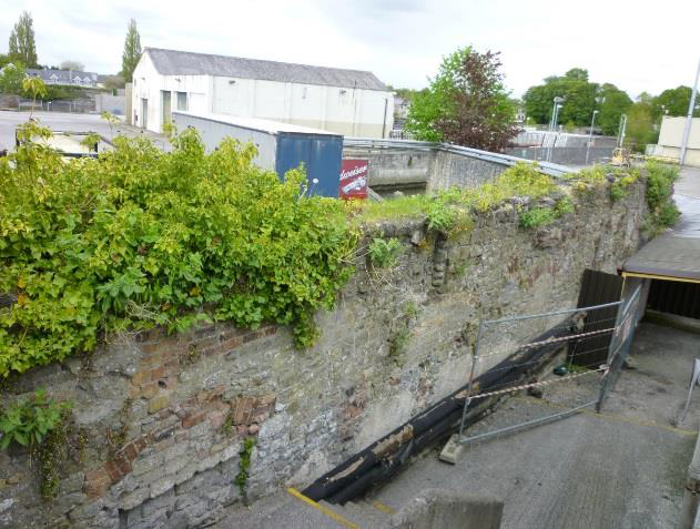
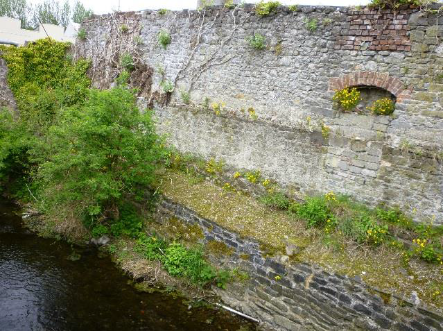
Plate 75 City Wall to the rear of the Mayfair Building taken from the east showing spring stones of a former bridge site
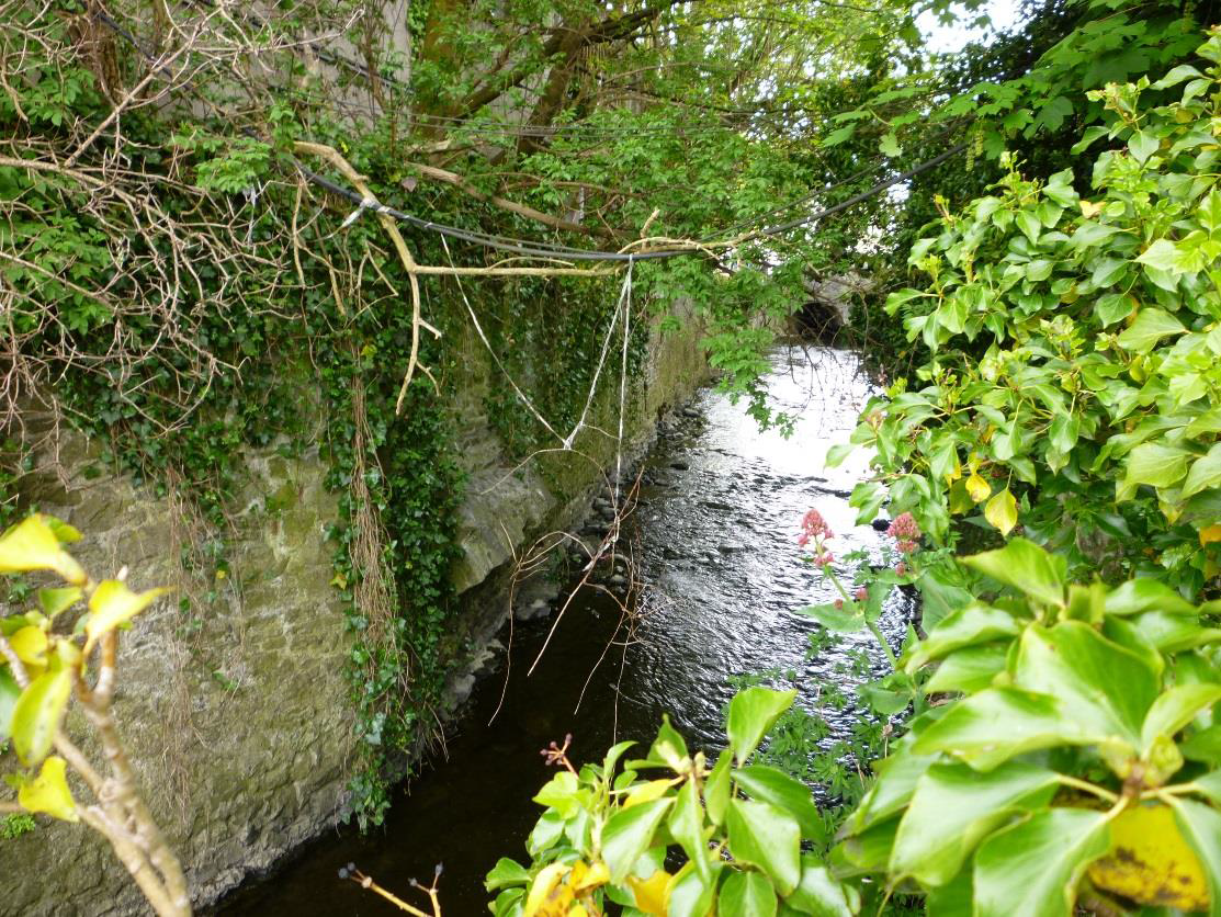
Plate 76 City Wall to the rear of the Mayfair Building taken from the west (Watergate)
4.2.12 The Mill
Plate 77 and 78 View to the mills taken from the eastern bank of the River Nore
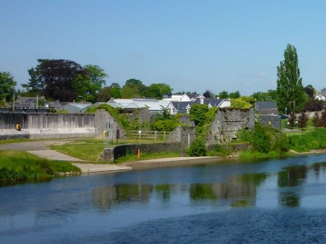
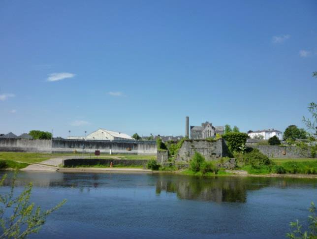
The ruined Mill building is placed on the western banks of the River Nore with a slipway present to the south of the structure. The setting of the site has altered recently with the development of the KCAS. Indeed for the purpose of this report the ruin could not be accessed for a detailed assessment as hoarding has been placed around the protected structure in order to protect it from ongoing construction works.
In recent years, the structure formed part of the public realm with public access around the exterior of the structure, however no access was provided to the interior with a low wooden fence preventing entry. At a cursory inspection the remaining masonry appears to be in a reasonable condition however it is heavily overgrown with vegetation.
4.2.13 Other Structures
Other structures within the former brewery site, both north and south of the River Breagagh are modern industrial features and without any historic or cultural recommendations. They are all scheduled for removal as part of the demolition works that are taking place in advance of Kilkenny County Council taking ownership of the site. The structures are a variety of large warehouses and mechanical stores, concrete and steel famed in construction and consist of the:
Plate 79 Truck Wash Garage
Plate 80 Bottling Store
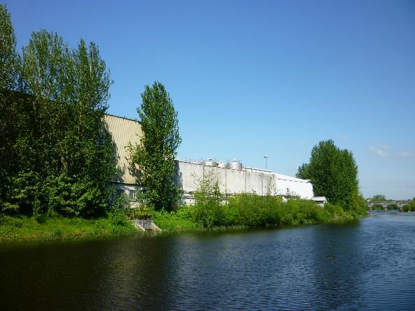
Plate 81 Hop Store
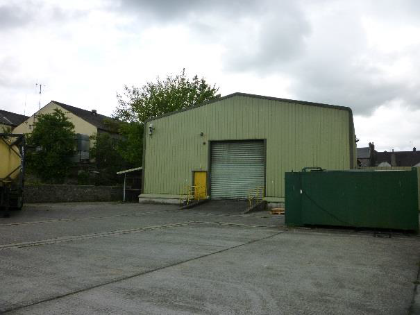
Plate 82 Kegging Store
The removal of these features will enhance the overall redevelopment of the Masterplan area and provide the space required for the creation of the linear park along the River Nore. The removal of the Hop store has the potential to open up the northern bank of the River Breagagh and provide a viewing opportunity to the City Wall.